


 6th Jan 2024, 07:24 - Wikipost
|
|||
|
|||

Which Aerodrome Mk IV

flyuav.co
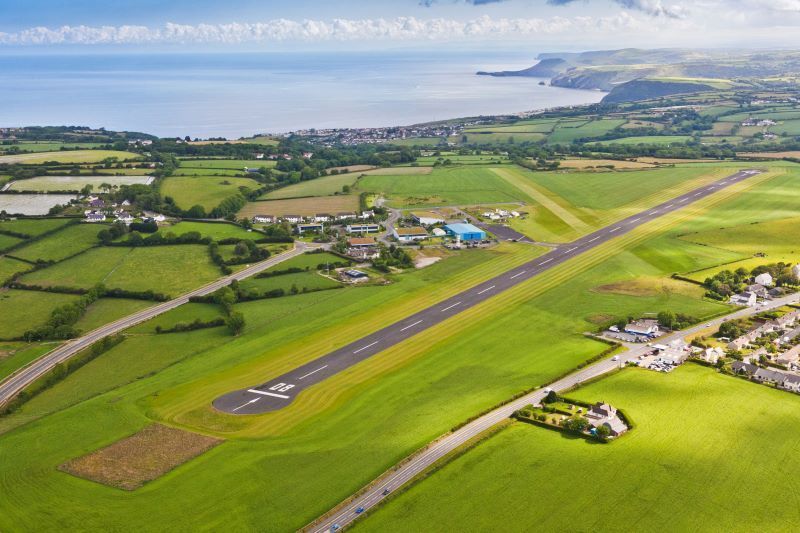
Well done chevvron - dunno how you got it.... were you detached there at some stage ? Aberporth Airfield or West Wales Airport it is.
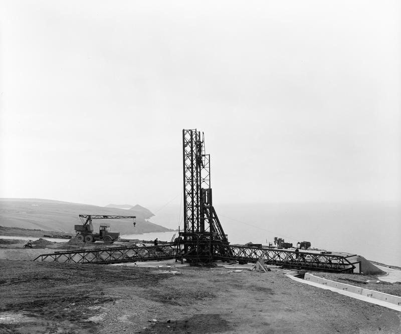
Previous images include Launch Pad for the Skylark Rocket programme which commenced in 1957. We sometimes had our Summer Holiday at Aberporth. I remember Old Railway Carriage Homes along the cliffs. Also Barrage Balloons not sure what function they had.
You have control chevvron.....................
"dunno how you got it...."
probably the blazing sunshine in the first picture...................
probably the blazing sunshine in the first picture...................
Open House
It was featured on a site called www.atchistory.wordpress.com about a year ago but seems to have disappeared. The occasion was a flypast by the Herc and the Air Cadets were there to salute it.
No I never got detached there, closest I ever got was about 2nm and 2000ft as we flew past in Farnborough's BAC 1-11; the range was separate from the airfield and the airfield itself was originally RAE and operated by a single controller supplemented by a FISO from Farnborough whenever the controller went on leave.
Further details www.rafaberporth.org.uk
Last edited by chevvron; 30th Dec 2023 at 10:01.
They`re called `Smokewinders`,same as on many display aircraft..
And in 2001 we were looking for a replacement.
Americas?
N America (Canada & the USA) ?
As I remember from my school days, North America includes Mexico; however, even with that correction, it's not North America.
More narrowing needed.
Note: In the spirit of the festive season and good will to all men (and women and the rest of the alphabet) I resisted the strong urge to place a full stop after "Mexico" and hit "Submit Reply".
Gne
More narrowing needed.
Note: In the spirit of the festive season and good will to all men (and women and the rest of the alphabet) I resisted the strong urge to place a full stop after "Mexico" and hit "Submit Reply".
Gne
As I remember from my school days, North America includes Mexico; however, even with that correction, it's not North America.
I've often thought about mentioning to PPRuNe's owners the inconsistencies and overlaps in their forum naming!

We have:
Canada The great white north. A BIG country with few people and LOTS of aviation.
North America Still the busiest region for commercial aviation.
The Caribbean and Latin America Aviation has been around South America and the Caribbean since the early days. A forum for aviators from that part of the world.
As I remember from my school days, North America includes Mexico; however, even with that correction, it's not North America.
More narrowing needed.
Note: In the spirit of the festive season and good will to all men (and women and the rest of the alphabet) I resisted the strong urge to place a full stop after "Mexico" and hit "Submit Reply".
Gne
More narrowing needed.
Note: In the spirit of the festive season and good will to all men (and women and the rest of the alphabet) I resisted the strong urge to place a full stop after "Mexico" and hit "Submit Reply".
Gne
Back to the challenge -
Are we in Continental S America ?
Are we in Continental S America ?
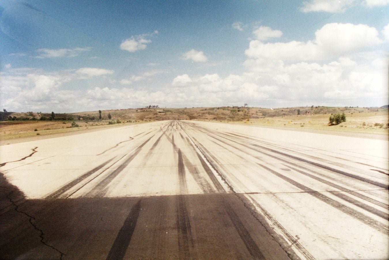
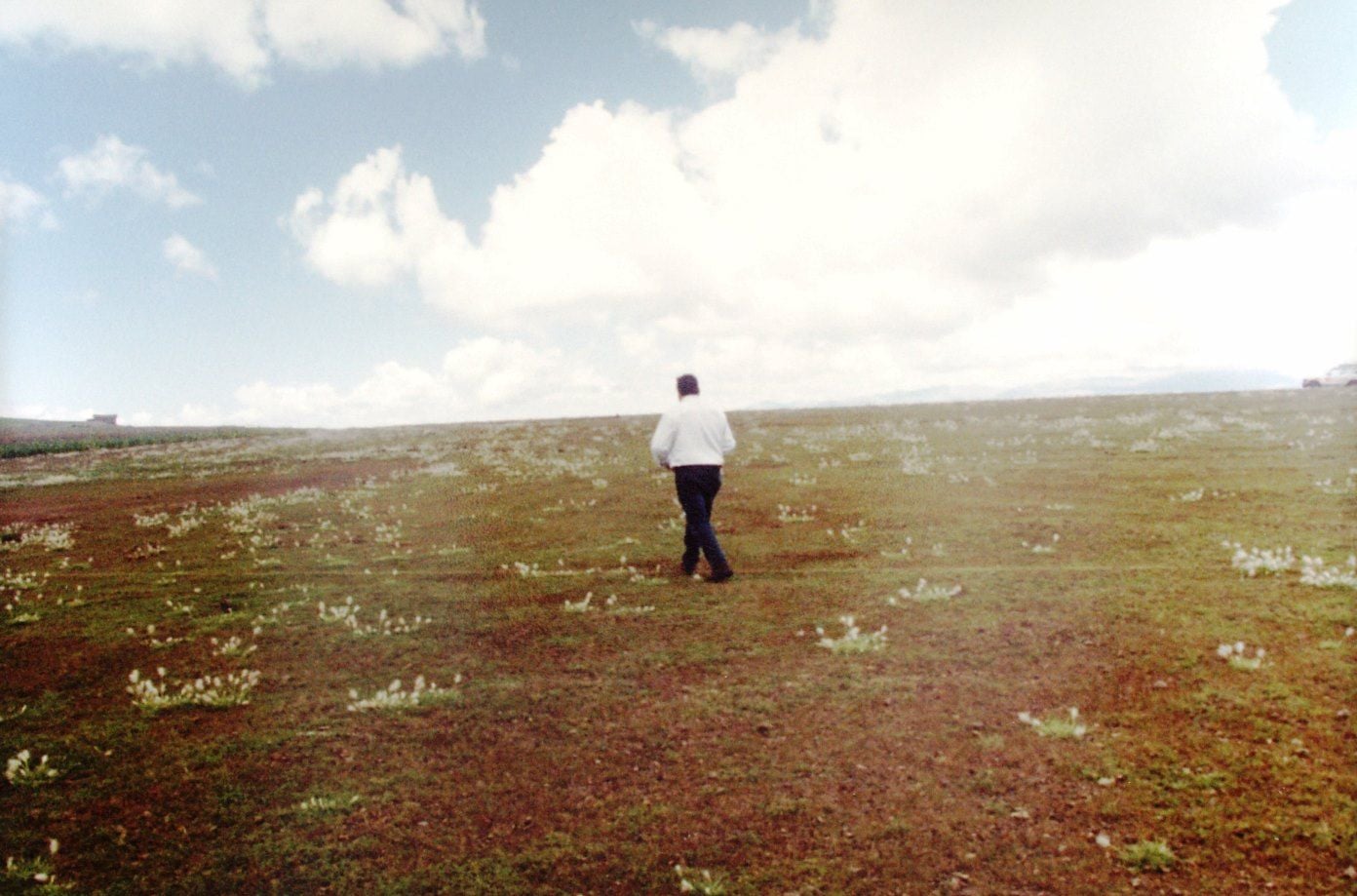
I was weary after the journey but, as I remember, I was in South America when I took both pictures. I'm currently digitizing my pictures from that era and I'll see if I can find one with a shed or two or a couple of recognizable lamp posts.
I do remember there being some confusion about the status of the city in the hierarchy of government.
Gne
I do remember there being some confusion about the status of the city in the hierarchy of government.
Gne
Another picture from the first visit with two clues for the observant.
Still looking for one with sheds and/or lamp posts.
Still looking for one with sheds and/or lamp posts.
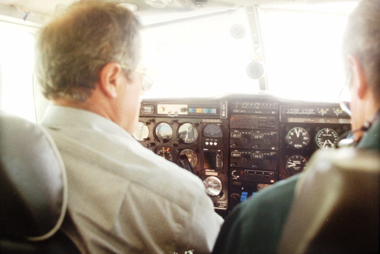
Ah! Blowing up the picture it looks as if the aircraft is at an altitude of circa 9600ft AMSL?
Since you are an officer and a gentleman we assume that this is important - so we guess that the aircraft is on the ground....................
and then check wiki for "S American airports over 9000ft" - we get a short list .
Amongst them is Juana Azurduy de Padila in Sucre Bolivia. at 95208 ft - formerly the main airport but replaced by Alcantari and closed in 2016
Wiki also tells us that " Sucre is Bolivia's constitutional (de jure) capital city," whereas "La Paz is the de facto capital"
an image search then gives us

where the hill at the end looks somewhat similar to the challenge photo....................... especially the trees!
Since you are an officer and a gentleman we assume that this is important - so we guess that the aircraft is on the ground....................
and then check wiki for "S American airports over 9000ft" - we get a short list .
Amongst them is Juana Azurduy de Padila in Sucre Bolivia. at 95208 ft - formerly the main airport but replaced by Alcantari and closed in 2016
Wiki also tells us that " Sucre is Bolivia's constitutional (de jure) capital city," whereas "La Paz is the de facto capital"
an image search then gives us
where the hill at the end looks somewhat similar to the challenge photo....................... especially the trees!
Last edited by Asturias56; 31st Dec 2023 at 08:27.