


Mag, Grid & True North Align

I42
WGS-84 actually treats the Earth as an ellipsoid (a body of rotation defined by an ellipse rotated about its minor axis). A more accurate model flattens the South pole end rather more, and makes the North pole end a bit pointier (hence, 'everything has gone pear shaped') but that make the spherical trig calculations far too difficult and the ellipsoid is good enough for government work.
As PAXboy noted the earth is an oblate spheroid - but only just. 
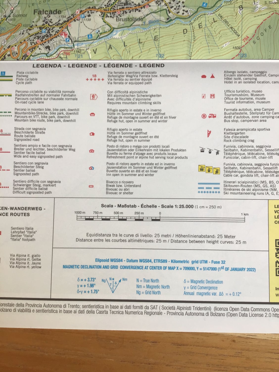
WGS-84, used as the default spheroid by GPS, has an equatorial diameter of 12,756 km. The polar diameter is 43 km less - a difference of 0.3%.
WGS-84, used as the default spheroid by GPS, has an equatorial diameter of 12,756 km. The polar diameter is 43 km less - a difference of 0.3%.

Ecce Homo! Loquitur...
Thread Starter
To just elucidate a bit further, WGS-84 is a gravity model, so the density of the different components (mantle, core etc)
is modelled rather than just the shape.
Then, of course, the Barycentre has to be taken into account..
is modelled rather than just the shape.
Then, of course, the Barycentre has to be taken into account..

In the days of Flight Systems training at Cosford, we taught the basic theory of inertial navigation. All examples involved ac flying E or N or even NE. Any other direction involved negative numbers which the would-be techies, being products of the then educational system, had trouble coping with.
Join Date: Jul 2014
Location: Hong Kong
Posts: 433
Likes: 0
Received 0 Likes
on
0 Posts
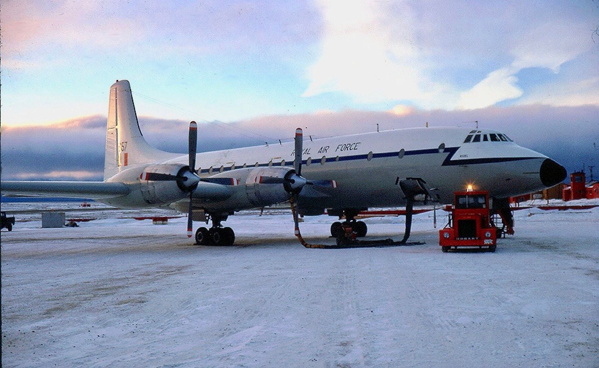
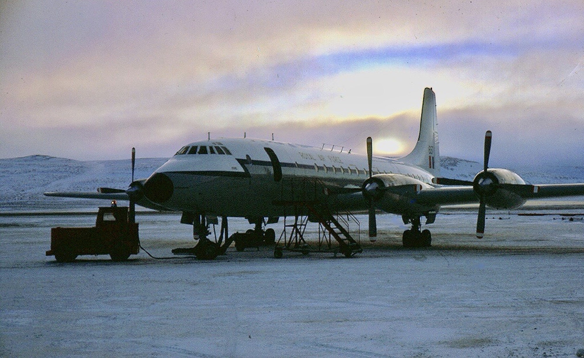
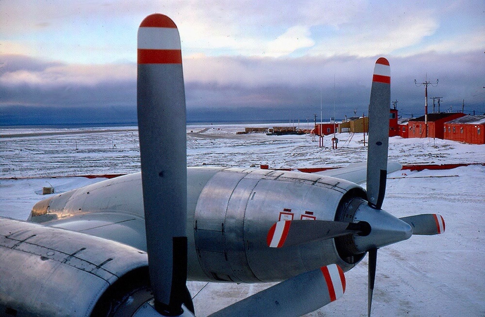
I took an RAF Britannia into Resolute Bay, Northern Canada in 1972 when the Magnetic North Pole was only 30 NM northwest of the airfield. I remember the compasses were all over the place on the ILS/visual approach!
Last edited by brakedwell; 8th Nov 2022 at 08:43.
I remember the compasses were all over the place!
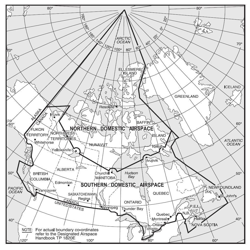
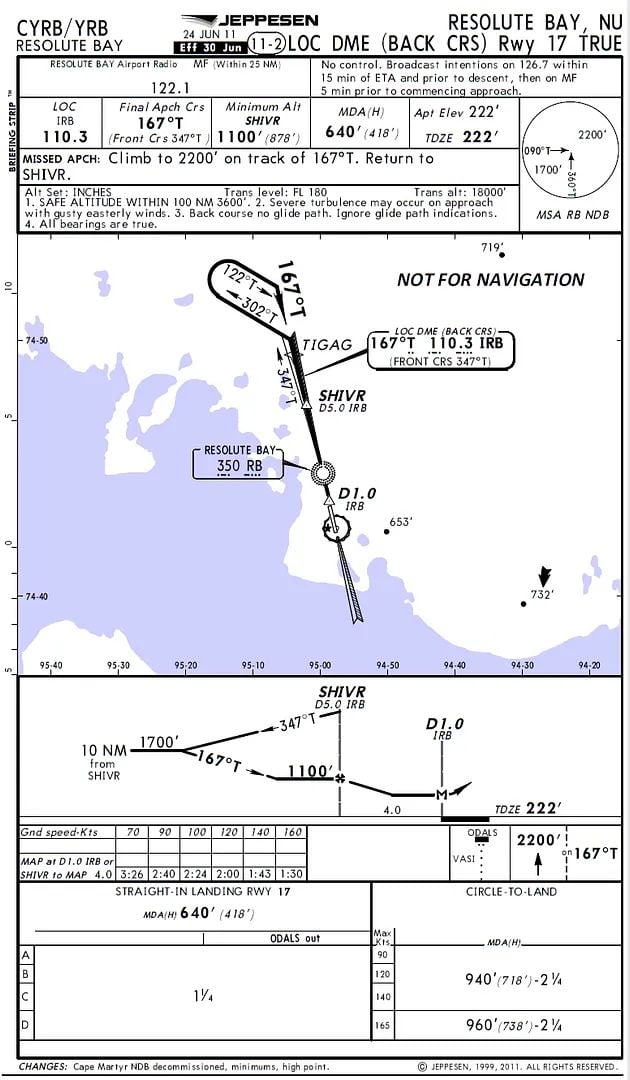
As a consequence of that, headings on airways and approach plates in the Canadian Arctic (the "Area of Compass Unreliability" - shown on charts as the Northern Domestic Airspace) are True bearings.
India Four Two, we did the approach and landing on what was Rwy 35. I am sure we used an ILS with broken cloud giving some contact with Resolute and the Smiths Flight System compasses were showing almost 90 degrees out. The runway was packed ice and snow. Being October it was also very cold!
Last edited by brakedwell; 8th Nov 2022 at 10:40.
Resolute Bay
https://skybrary.aero/bookshelf/acci...da-20-aug-2011
A sad example of the confusion that can come from high declination values.
A sad example of the confusion that can come from high declination values.
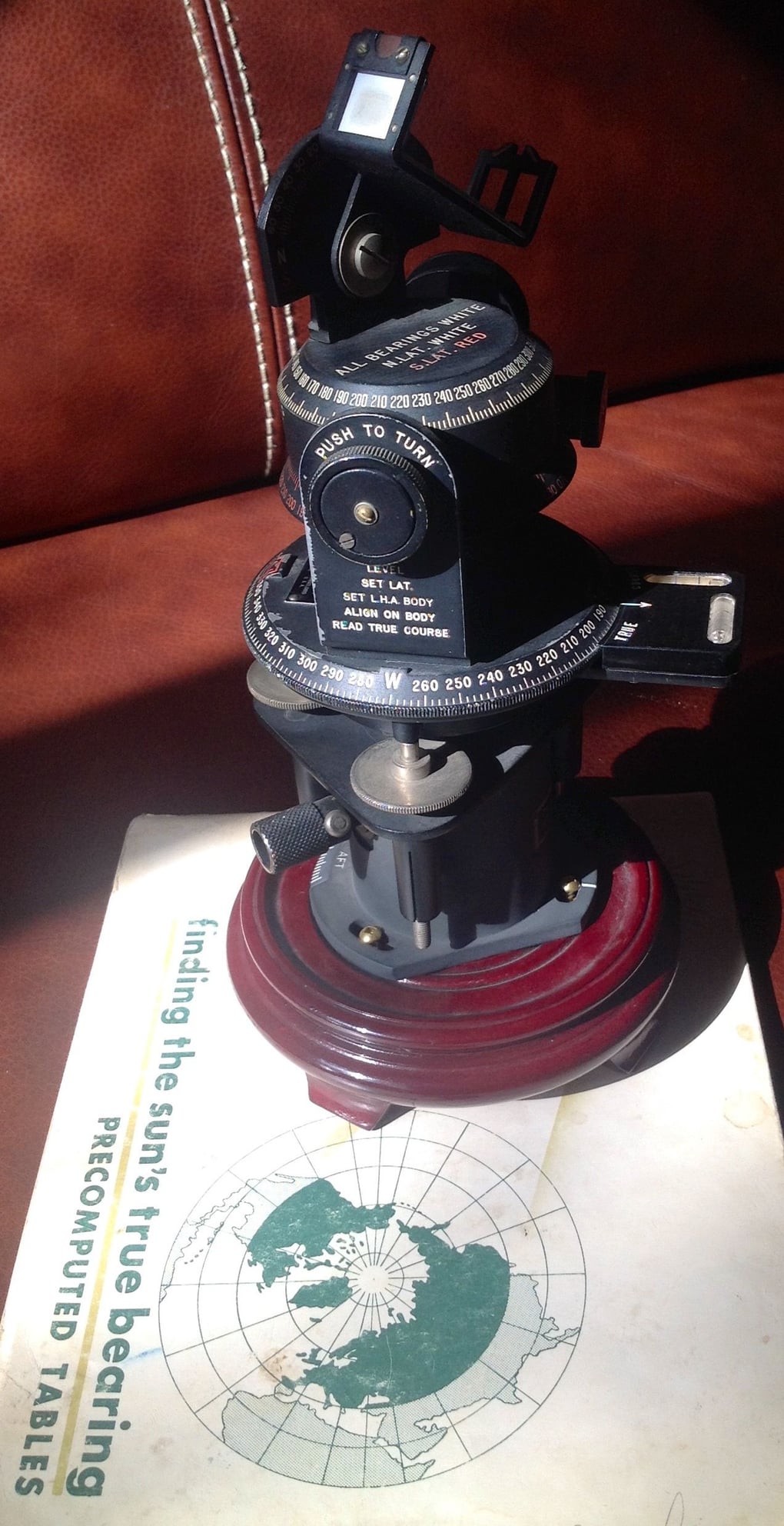
I agree, we used to carry navigators with sextants on the RAF Britannias. I did a polar trainer in 1971, with SpecN navs at the end of their Manby Course and a Litton 51 on board. We flew from Thule to the North Pole, orbited for about 20 minutes while checking compasses etc then set off for Brize Norton and landed 9 hours later.. One thing that came out well was the Smiths Flight System and our magnetic compass.
