


TAS from RAS, Altitude and Temperature.

Just looking at some aircraft on ADS-B,over the N Sea and looking at `details`,at FL s340-390,with IAS between 245-300 kts,,details show TAT/OAT,with a split usually between 25-30 degrees less on the TAT..Did the WW2 Navs have a `correction chart `,for the difference between TAT/OAT,lower IASs,as well as the `density/ISA correction...if you get my `drift`...?
I have seen OAT probes reading 0* when iced-up,when the actual OAT was totally different...
I have seen OAT probes reading 0* when iced-up,when the actual OAT was totally different...

my speculation is that the folk on opposite sides of the pond developed slightly different analogue models which would account for differences in calibration as suggested in Bennett's document
Moderator
details show TAT/OAT
Temperature rise is mach dependent. At low MN, characteristic of many of the WW2 bombers, it wasn't really a major concern. If it were, the equations were known and the answers could be obtained easily via the prayer wheel assuming a mod to model the particular equation. For example, on the CR, you have the temperature rise in one of the Huber scales. Alternatively, it would have been easy enough to provide some paper tables to achieve the same end.
Current jet traffic is well and truly fast enough for the rise to be noticeable.
Moderator
I suppose you all know that there is an app for TAS in the Apple world.
(shakes head)
The humble nav computer has been doing it for 80-odd years and it costs nickels and dimes compared to the Apple kit .....
(shakes head)
The humble nav computer has been doing it for 80-odd years and it costs nickels and dimes compared to the Apple kit .....

I believe "Course" and "Heading" meant the same thing in Commonwealth countries (eg the instruction "take up a course of 340" meant turn onto a heading of 340). We tend these days to not use the term Course (at least I don't), rather refer to Tracks and Headings (and Tracks Made Good, Track Errors etc).
In the US I believe that what we call "Track" is referred to as "Course". I think this has confused more than one person early in their training when they read the US instructions on whizz wheels. Well at least one person... not mentioning any names of course

My navigation and altimetry (where not provided by electronic gee-whizzery) is typically done by approximate rules of thumb so I wouldn't take what I say as gospel on any of that though!

Thread Starter
Join Date: Feb 2011
Location: Lions Bay
Age: 67
Posts: 9
Likes: 0
Received 0 Likes
on
0 Posts
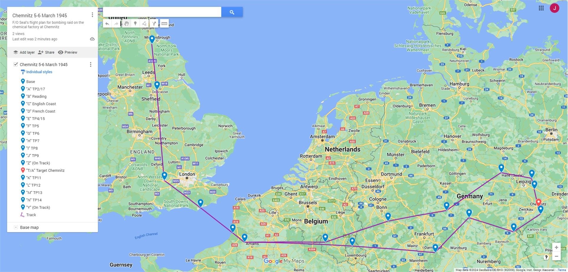
Thanks Topgas. I have these plotted for all of dad's routes, by importing KMLs into Google Maps. I have also georeferenced a clean 1:1,000,000 Navigator Flight Chart and can plot the routes on that as well, which is nice to have. I will post this when finalized.
EXDAC: Apologies for the incorrect terminology. My background is in marine navigation, and I think sloppiness in the correct terminology creeps in when corrections for drift are automatically compensated for by GPS. I think my main point is I can come close to Seale's calculations for most cases.
Finally, I guess to emphasize why I am using a spreadsheet rather than a Wizz Wheel. I think it's just more efficient for me to use a spreadsheet, if I am looking at multiple Flying Plans. These could amount to several thousand or more entries.
Jim
Jim
Last edited by JDCAVE; 28th Feb 2024 at 20:59.
