


Malaysian Airlines MH370 contact lost

Join Date: Jan 2008
Location: The foot of Mt. Belzoni.
Posts: 2,001
Likes: 0
Received 0 Likes
on
0 Posts
Although I appreciate it has been dismissed, does anyone know the location and types of PSR/SSR covering IVAO? Interestingly, the MSA at VRMT is 1500'.
Last edited by ZOOKER; 19th Mar 2014 at 21:44.

Join Date: Apr 2008
Location: Durham
Age: 62
Posts: 187
Likes: 0
Received 0 Likes
on
0 Posts
TDK
You posted
"How about a massive electrical failure caused by electromagnetic radiation from an external source. "
That means an EMP. That cannot be generated so that only one single aircraft was disabled. It would have been widespread and many aircraft, ships and almost anything that had electronic components would have had fried circuits. Its simply not possible.
Join Date: Jun 2009
Location: paradise,bc
Age: 82
Posts: 22
Likes: 0
Received 0 Likes
on
0 Posts
doppler / pinging
doppler would be proportional to the speed of approach or departure by the craft relative to the bird's position. Given the height of the bird, and the very small angle subtended by the beam relative to that height, doppler will be very small, and probably with very high error extents. Velocity times sine of the angle from perpendicular @ beam center to the craft. Doppler might be unmeasurably small, relative to frequency accuracy at bird and craft.
Freight God
Join Date: Sep 2000
Location: LS-R54A
Posts: 307
Likes: 0
Received 0 Likes
on
0 Posts
The transponder was deselected, -not abruptly de-powered.
The ACARS was logged out of, which takes a number of rarely used menu selections to achieve, -it was not abruptly de-powered.
Please explain how these devices were smoothly shutdown, (with appropriate ACARS reporting) by a cb tripping or a wire loom short circuiting?
Malaysian spokeman at press confirmed these devices were de-selected.
I question the wisdom of the spokesperson. How do you know the transponder was de-selected? Because if does not reply to a request is not a valid answer. That just means that for whatever reason the transponder does not respond.
How do we know ACARS was logged out? Same as with the transponder.
If the malaysian spokesperson can tell me HOW he KNOWS that these devices were deliberately stopped from transmitting, then I may believe his statement. The statements I remember were carefully worded and left room for uncertainty.
I don't own this space under my name. I should have leased it while I still could
I don't know the airway structure here but an early map showed a possible route passing through or near a number of reporting points. It was said, I believe that these did not represent an airway but a flight along the FIR boundary.
I am guessing that the RPs were on the boundary for traffic crossing the boundary not flying along it.
If one wants to confuse then flight along an FIR boundary is a good way of doing it as authorities might assume the aircraft was in contact with the opposite agency.
Join Date: Jul 2004
Location: Found in Toronto
Posts: 615
Likes: 0
Received 0 Likes
on
0 Posts
Why did someone in the cockpit enter a new waypoint into the FMS but subsequently fail to mention this during their conversation with ATC?!?!?
I just saw on the television news that the Malaysian Authorities are saying that they believe the waypoints must have been pre-programmed because the turn observed on radar was very gradual and looked like it must have been done using the FMC and A/P.
If that's what they are suggesting then this investigation has been doomed from the very beginning.
Join Date: Nov 2000
Location: Sol, sector ZZ9 plural Z alpha
Posts: 80
Likes: 0
Received 0 Likes
on
0 Posts
Hunter58 I completely agree with you. It seems people are far too eager to believe any old BS they hear about this incident. So far all we actually know is that an aircraft has gone missing. That's actually it.
One can also accept the radio message, since it was on a public channel, which adds to the known situation that "an aircraft has gone missing following a seemingly normal handover".
Everything else is just niff-naff until the remains are found and some forensic analysis can begin. Even the "pings".
One can also accept the radio message, since it was on a public channel, which adds to the known situation that "an aircraft has gone missing following a seemingly normal handover".
Everything else is just niff-naff until the remains are found and some forensic analysis can begin. Even the "pings".
Join Date: Mar 2014
Location: Melbourne
Posts: 5
Likes: 0
Received 0 Likes
on
0 Posts
@Jilted
That hasn't stopped Fox and other mainstream media from stating it as a fact for 2 days.
Meanwhile, the Malaysian officials seem to be backing away from it, saying they've moved on to more relevant stuff... sweeping the pilots under the bus, as MSM asserts that they are almost certainly responsible.
It's a disgrace, from the media and the authorities.
I wouldn't mind betting that these satellite paths are bogus too. If they'd produced circles for various pings, it might be believable.
FWIW: I've seen no retraction by FOX after their breaking news / scoop about the plane heading west at the time of last communication was put in the bin at the presser.
There is absolutely no evidence that a new waypoint was entered other than journalist speculation.
Meanwhile, the Malaysian officials seem to be backing away from it, saying they've moved on to more relevant stuff... sweeping the pilots under the bus, as MSM asserts that they are almost certainly responsible.
It's a disgrace, from the media and the authorities.
I wouldn't mind betting that these satellite paths are bogus too. If they'd produced circles for various pings, it might be believable.
FWIW: I've seen no retraction by FOX after their breaking news / scoop about the plane heading west at the time of last communication was put in the bin at the presser.
Join Date: Aug 2007
Location: Hong Kong
Posts: 33
Likes: 0
Received 0 Likes
on
0 Posts
To clarify incorrect information that leads to the wrong scenarios and assumptions:
- I have asked pilot friends and between us we have over 100,000 commercial hours. None of us know how to turn the Acars off in the flight deck. Cannot be done.
- the Acars does report events such as off and on blocks but not any flight plan info. CPDLC does but that is different. Singapore has CPDLC connections KL and Vietnam do not so they would not be logged on and so no one can know what was programed into their FMC flight plan. No one has any information as to how the aircraft was operated as the aircraft does not report any to the ground unless through CPDLC or the transponder. Ignore "BBC or CNN has learned" as the only way the conduct of the flight will be understood will be through finding the black box data.
I believe most probable is the theory of smoke and a turn back and all overcome or exploding oxygen bottles (google Qantas exploding oxygen bottles and images). If this occurred then the pilots may have had time to action a return but also become unconscious and the plane flies on.
Last edited by Interested_Party; 19th Mar 2014 at 22:14.
Join Date: Mar 2014
Location: USA
Age: 46
Posts: 62
Likes: 0
Received 0 Likes
on
0 Posts
Jilted said
They have been told by "officials" the WP change was included in the last ACARS transmission.
Other news organizations do not re-report the same afterwards unless they themselves could find an offical to confirm it to them (or the report runs with something like "BBC reports, we can not confirm" thereby eliminating the possibility the re-reporting organization can ever be sued out of existence)
You can only "report" what the experts involved tell you; that is what they are trying to do. Do not confuse "report" and "commentate" though, as those are two drastically different things
There is absolutely no evidence that a new waypoint was entered other than journalist speculation.
Other news organizations do not re-report the same afterwards unless they themselves could find an offical to confirm it to them (or the report runs with something like "BBC reports, we can not confirm" thereby eliminating the possibility the re-reporting organization can ever be sued out of existence)
You can only "report" what the experts involved tell you; that is what they are trying to do. Do not confuse "report" and "commentate" though, as those are two drastically different things
Join Date: Dec 2000
Location: Warks
Posts: 274
Likes: 0
Received 0 Likes
on
0 Posts
@Pontius Navigator
As far as I can tell there is no single airway joining up IGARI and VAMPI. The aircraft would have to fly IGARI-VKB-VPB-GUNIP-VAMPI. 4 separate airways!
Then from VAMPI to GIVAL, you can only fly DCT. If hugging the edge of the FIRs was the aim, it would make much more sense to fly VPB-GIVAL, which are connected by an airway, rather than go via GUNIP and VAMPI which is a dogleg!
I don't know the airway structure here but an early map showed a possible route passing through or near a number of reporting points. It was said, I believe that these did not represent an airway but a flight along the FIR boundary.
Then from VAMPI to GIVAL, you can only fly DCT. If hugging the edge of the FIRs was the aim, it would make much more sense to fly VPB-GIVAL, which are connected by an airway, rather than go via GUNIP and VAMPI which is a dogleg!
Join Date: Mar 2014
Location: USA
Age: 46
Posts: 62
Likes: 0
Received 0 Likes
on
0 Posts
Pontius Navigator,
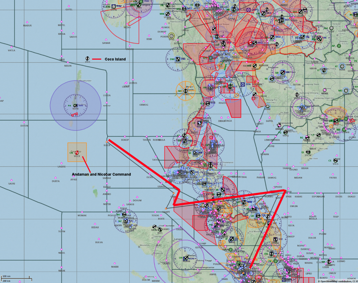
I am not saying these are fir lines, as they do not match said lines from what people can tell.
But they indicate something, obviously, as they are clearly marked on this map. (I will search my history later and see if I can find the article I first grabbed the image from - although, I know for a fact it was in another language so not sure how helpful it will be even if I do manage to locate the article)
Join Date: Jan 2009
Location: Earth
Posts: 74
Likes: 0
Received 0 Likes
on
0 Posts
Originally Posted by Clear Prop
Quote:
That hasn't stopped Fox and other mainstream media from stating it as a fact for 2 days.
That hasn't stopped Fox and other mainstream media from stating it as a fact for 2 days.
Their latest tidbit is that the turn meant there was a waypoint entered into the FMS because some pilot (Robert Goyer) says so. "The almost certain explanation would be that these waypoints were programmed into the flight management system of the 777-200, a task that would have been beyond the abilities of anyone but a professional pilot."
I guess Mr. Goyer has no respect for the folks who actually build and program the FMS. Does he think the engineers are not smart enough to program a waypoint into an FMS, even if they are not pilots? Or anyone else who works with, simulates, or repairs avionics....
This is what is passing for "news." This is CNN. I don't mean to rag on just CNN, because nearly all of the major outlets worldwide are doing similar.
Why is aviation reporting so challenging for the media?
Join Date: Jun 2003
Location: LSZH, oder in der N�he
Posts: 348
Likes: 0
Received 0 Likes
on
0 Posts
Originally Posted by D.S.:8388698
Jilted said
They have been told by "officials" the WP change was included in the last ACARS transmission.
Other news organizations do not re-report the same afterwards unless they themselves could find an offical to confirm it to them (or the report runs with something like "BBC reports, we can not confirm" thereby eliminating the possibility the re-reporting organization can ever be sued out of existence)
You can only "report" what the experts involved tell you; that is what they are trying to do. Do not confuse "report" and "commentate" though, as those are two drastically different things
There is absolutely no evidence that a new waypoint was entered other than journalist speculation.
Other news organizations do not re-report the same afterwards unless they themselves could find an offical to confirm it to them (or the report runs with something like "BBC reports, we can not confirm" thereby eliminating the possibility the re-reporting organization can ever be sued out of existence)
You can only "report" what the experts involved tell you; that is what they are trying to do. Do not confuse "report" and "commentate" though, as those are two drastically different things
ROFPML
Despite the (presumably?) unintended irony from the poster, it's sad days for aviation and PPRUNE when this is the "quality" of post that one can and does expect.
Many thanks to the tenacious, informed folk with the patience of Job who keep trying to keep this thread somewhere in the correct universe.
Join Date: Aug 2005
Location: london
Posts: 45
Likes: 0
Received 0 Likes
on
0 Posts
For anyone wishing to explore exactly where the inmarsat "arcs" are located.
This is a detailed description of how to use Google Earth to do it.
No speculation, no hypotheses. Just instructions, and a table I have calculated to take into account the distance of the satellite.
____________________________________________________________ _
Detailed Instructions:
We can't know how accurate the 40 degree ring is. Its probably been rounded, measurement accuracy is uncertain, final position of MH370 may be an uncertain distance away.
But it seems to be the solidest thing we have, and the Aussies seem to believe in it, as their new search area is bang on.
Using Google Earth, you too can explore exactly where such Inmarsat "arcs" go, using the "ruler" in "tools" at the top.
Proceed thus:
Search for the point directly below the IOR satellite, by entering "0N 64E"
Now open the little ruler window. Do this by finding "Tools" at the very top, and clicking "Ruler"'
In the little ruler window, choose "Line" at the top, and set units to "nautical miles"
Go back to the map…you'll see a bigger squarish cursor.
Click on the point 0N 64E, which should be in the middle, this sets the start of the ruler line.
Now zoom out (mouse wheel) to see up to (say) asia. Drag the cursor (say) North, making a line. Make it 2600nm long. This point is on the 40 degree arc.
You can still zoom and scroll the map normally, the ruler line will stick to your cursor.
Now feel free to explore where the line ends, keeping its length about 2600nm long.
And of course you can drag down south to explore the southern arc. Just remember 2600 nautical miles.
Clicking will freeze the line, so you can scroll about etc, but it can still be picked up and moved more by clicking its end point (a hand appears). The "save" button will make the line permanent (and unchangeable). Any other click deletes it. After saving, you can draw another line.
Now you can estimate for yourself how far MH370 might have deviated away from the given final 40deg ping arc, and factor in your own uncertainty, by increasing or decreasing the 2600 value..
You could even explore your theories of likely distance travelled, by doing a similar thing from whatever start point you like, using "path" instead of "line. This will not delete your previous line to the arc.
So why 2600 nautical miles? Not 3000, as another poster suggested?
I have corrected for the distance to the satellite, instead of assuming it infinitely high.
Here is a table of distances for other arcs.
Angle Distance (nm)
10 4284
20 3708
30 3147
35 2871
39 2653
40 2599
41 2545
45 2330
50 2064
60 1539
70 1021
80 509
PM me if you would like to check the formula I have derived. My qualifications to do so include both science and maths degrees - though in fact schoolboy trig is all that is required.
All this does assume that the satellite is truly stationary above the earth. Orbital variations are I think unlikely to introduce an error of more than 60 nautical miles.
Last edited by fg32; 19th Mar 2014 at 22:32. Reason: Add bolding, and correct a typo.
Join Date: Mar 2014
Location: Oceania
Posts: 7
Likes: 0
Received 0 Likes
on
0 Posts
Hi Feathered- Indeed, why is accurately reporting about ANYTHING so challenging for the media? In this case it is just more noticeable because actual pilots will immediately pick up on the BS... but I am sure we are served just as many lazy, poorly researched reports about Crimea, the Pistorius trial, or any other issue!
More duff gen
[QUOTE][/To clarify incorrect information that leads to the wrong scenarios and assumptions:
- I have asked pilot friends and between us we have over 100,000 commercial hours. None of us know how to turn the Acars off in the flight deck. Cannot be done.
- the Acars does report events such as off and on blocks but not any flight plan info. CPDLC does but that is different. Singapore has CPDLC connections KL and Vietnam do not so they would not be logged on and so no one can know what was programed into their FMC flight plan. No one has any information as to how the aircraft was operated as the aircraft does not report any to the ground unless through CPDLC or the transponder. Ignore "BBC or CNN has learned" as the only way the conduct of the flight will be understood will be through finding the black box data.
[QUOTE]
100,000 hours and you post that?
Controller pilot data link communication= CPDLC
That is the way ATC TALKS to aircraft via satellite
AUtomatic Dependent Surveillance = ADS and is the way ATC tracks a plane. Within VHF LOS it is ADC-b as I explained about 300 pages ago
ADS-C is used in conjunction with CPDLC when out of VHF range
Join Date: Mar 2014
Location: Georgia
Age: 65
Posts: 2
Likes: 0
Received 0 Likes
on
0 Posts
Does anyone know what size the 'large metal container', no doubt filled with early mangosteens, is likely to be, in this quote from the Telegraph?
"One of the positions on the plane that would be filled with a large metal cargo container is unaccounted for on the manifest.."
@DS if you get any information about the schedule for loading cargo into the aircraft, would you be so kind as to add it to your timeline of events?
"One of the positions on the plane that would be filled with a large metal cargo container is unaccounted for on the manifest.."
@DS if you get any information about the schedule for loading cargo into the aircraft, would you be so kind as to add it to your timeline of events?

