


Why are handheld GPS not certified for IFR

Thread Starter
Joined: Feb 2006
Posts: 376
Likes: 0
From: A long way from home
Why are handheld GPS not certified for IFR
There are plenty of GPS units on the market, for instance the Garmin ones. Some of the panel mount ones are certified for IFR approaches. The handeld ones usually have virtually identical hardware and software, but NONE do IFR. Can some Legal Eagle tell me why not?
Cheers
Cheers


Joined: Sep 2007
Posts: 11
Likes: 0
From: BRU
Dear Friends,
The answer is just one movie away!
YouTube - Close call with terrain
Watch and learn how NOT to be the "pseudo IFR"hero of the day
Rob
The answer is just one movie away!
YouTube - Close call with terrain
Watch and learn how NOT to be the "pseudo IFR"hero of the day
Rob
"Mildly" Eccentric Stardriver

Joined: Jan 2000
Aviation Qualifications: ATP+Mil
Posts: 4,331
Likes: 486
From: England
At a guess, because the CAA can exercise control over the standard of a panel-fitted unit, but not over what you care to bring aboard in your flight bag.
Thread Starter
Joined: Feb 2006
Posts: 376
Likes: 0
From: A long way from home
Jaff,
I have just one word to say about that flight: MSA
Herod,
You may have a point, but if the handheld unit hasn't been tampered with and the panel mount one is just "screwed in", I still can't see a practical difference - If the hardware is manufactured to the same standards.
I have just one word to say about that flight: MSA
Herod,
You may have a point, but if the handheld unit hasn't been tampered with and the panel mount one is just "screwed in", I still can't see a practical difference - If the hardware is manufactured to the same standards.
Fleet Manager
Joined: Apr 2001
Aviation Qualifications: ATPL
Posts: 7,447
Likes: 310
From: various places .....
It comes down to what the certification basis is for the unit.
If it gets the required ticks in the boxes and is operated and maintained per OEM direction then you can use it for specified activities .. otherwise not.
However, considering that the reasonably expected life of a handheld is more likely going to be somewhat shorter and rougher than a TSO'd unit, why would the OEM bother putting a LOT more money into the design and certification efforts principally to reduce market penetration due to the resulting higher selling cost ?
Joined: Apr 2006
Posts: 359
Likes: 0
From: UK
I would assume that because a panel such as the G1000 is a self contained avionics kit, not just a GPS, it has the ability to make an accurate approach due to the information that it is able to generate... information that is displayed on the PFD/MFD. Handhelds, I guess, just don't have the same features within to be able to be offered as an alternative that is just as accurate.
Joined: Mar 2000
Posts: 8,571
Likes: 3
From: Arizona USA
Three words...Technical Standard Order... TSO.
Comply..a done deal.
If not...whistling in the wind.
And yes, I have a TSO compliant GPS in my private airplane, and it works to perfection.
Pay the price, expect certificated results.
Next question?
Comply..a done deal.
If not...whistling in the wind.
And yes, I have a TSO compliant GPS in my private airplane, and it works to perfection.
Pay the price, expect certificated results.
Next question?
Thread Starter
Joined: Feb 2006
Posts: 376
Likes: 0
From: A long way from home
Have been reading through TSO docs. It seems that the main reason is that the maps aren't kept up to date enough and usually don't include all the instrument procedures, which have to be in the database for IFR.
Joined: Mar 2002
Posts: 2,814
Likes: 0
From: Euroland
Lets clear up one important issue. Handheld GPS units are not certified for anything.
That means that they are not certified for VFR and not certified for IFR. So these units are not to be used as "the sole source of navigation information".
Handheld GPS units are never going to be certified. It is impossible.
It has nothing to do with the capabilities of the unit or the maps or the database.
Some issues that can not be quantified in a certification process;
1. Antenna positioning. - internal antenna can be subject to screening and with no defined position for the antenna the effect of screening can not be determined. Where a sucker is stuck on the window may not be the same for everyone and every aircraft. Using an external antenna does not get round all of this issue because the connection is made and broken every time the unit is used.
2. Battery life remaining. How long are those AA's going to last from the start of the flight?
3. RF Interference. No problem in aircraft A but aircraft B with a different comm radio uses an internal frequency that interferes with the GPS signal
4. The drop test. Dropping the unit can cause internal damage. Do the same with the aircraft and it will be obvious that there is damamge.
5 Position of unit in cockpit with regard to compass, pilot vision and ease of use.
Finally and this is the one that everyone seems to forgett when they use a handheld GPS for VFR (or IFR) back=up information ;
The unit when placed in the cockpit and it's attachment must comply with the certification requirments regarding G loadings and not become a missile during all manoeuvres within the envelope as well as the accelerations that are required to be allowed for by the certification requirements (accident situation).
Not many people know that it is against the rules to place a handheld GPS on top of the instrument pannel. If due to a sudden movement of the aircraft the GPS unit departs through the windscreen, the first question going to be asked is why did it's attachment not comply with the required standards!!
Check the FAR/EASA standards for the restraint requirements.
Joined: Jul 2007
Posts: 153
Likes: 57
From: Switzerland
Even if the handhelds would have the same features as certified ifr gps and even if they would comply with TSO (which is highly unlikely), there are still some unanswered questions:
- How do you interface them to the autopilot? (and other avionics)
- How do you integrate a handheld gps into your instrument scan?
- How long can you afford to play with a handheld between your knees in IMC and turbulence before your attitude goes to pieces?
- Would you like to be passenger in a airplane in solid rocking IMC where the single pilot relies on a device that stops working when a loose cable becomes unplugged (antenna for instance)?
Joined: Mar 2008
Posts: 160
Likes: 0
From: Above the Transition Level
To be approved for IFR approaches they have to be installed, certified and checked by avionics engineers.
Sure the handheld Garmins would probably work but it would be far from legal to initiate a GPS approach with one.
I'm sure differences such as dual GPS antennae is a key difference amongst other backups.
Sure the handheld Garmins would probably work but it would be far from legal to initiate a GPS approach with one.
I'm sure differences such as dual GPS antennae is a key difference amongst other backups.
Joined: Jul 2006
Posts: 204
Likes: 0
From: 'tween posts
triateration and mapping
correct me if I am wrong.
the satellites perform "triateration" (is the term used when using distances as against bearing when it is triangulation) to fix the position of the receiver in space.(distance from the center of the earth to be exact)this is only half the job because now we need to reference it to the surface of the earth or at a height above the surface of the earth.so it boils down to which earth model is used.At the moment WGS84 is the aviation standard.I am not sure if the handheld units use the same.
the satellites perform "triateration" (is the term used when using distances as against bearing when it is triangulation) to fix the position of the receiver in space.(distance from the center of the earth to be exact)this is only half the job because now we need to reference it to the surface of the earth or at a height above the surface of the earth.so it boils down to which earth model is used.At the moment WGS84 is the aviation standard.I am not sure if the handheld units use the same.

Joined: Aug 2004
Posts: 20
Likes: 0
From: Houston, TX USA
RAIM
Don't forget the hand held units (at least the ones I know of) do not have the ability to do RAIM (Remote Autonomous Intergrity Monitoring) .. simply stated, a reality check that there is sufficient satellite geometry to ensure the required level of positional accuracy.
To fly an approach, one of the conditions for the GPS to switch to Approach Mode (+/- 0.3 NM CDI deviation), is adequate RAIM. That is required by the FAA TSO c129.
To fly an approach, one of the conditions for the GPS to switch to Approach Mode (+/- 0.3 NM CDI deviation), is adequate RAIM. That is required by the FAA TSO c129.
Joined: Jan 2006
Posts: 107
Likes: 0
From: USA
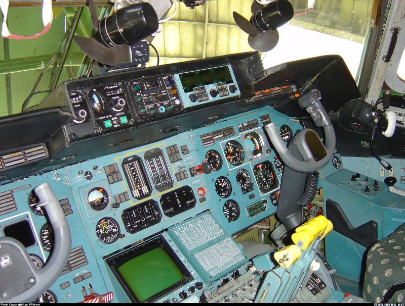
Well I just watched the video on youtube that jafflyer posted, I really don't see how the GPS had anything to do with this moron hitting the ground, I have thousands of hours using a GPS similar to the one sitting in this AN225 (!!!!!!!!!!!!!!).
One must use a little bit of common sense, like verifying accuracy with a known object, a technique most Airbus pilots are familiar with. I'm not advocating anyone using one of these devices illegally, but in some parts of the world, there are no IFR approaches. Be safe.
One must use a little bit of common sense, like verifying accuracy with a known object, a technique most Airbus pilots are familiar with. I'm not advocating anyone using one of these devices illegally, but in some parts of the world, there are no IFR approaches. Be safe.
Joined: Jul 2001
Posts: 4,960
Likes: 17
From: Australia
Folks,
1.3Vso is the one getting really close.
After Garmin, there are only a handful of GPS receiver chip manufactureres, (12 channel) Rockwell is probably the most common. They will be found in handhelds, panel mounts TSOd or otherwise for IFR, boats, cars, you name it.
It is the circuit board design that the GPS receiver chip/module/engine/wotever is attached to, which is where it all really happens, with RAIM capability close to the top of the list in importance, if it is to be IFR certified.
The RAIM handling by the C146/146 systems, compared to C129/129A is significantly different, and the change is much to be desired. If you are looking for a TSOd GPS for an aircraft, don't even thing about C-129, unless it is only feeding and IRS/FMCS.
Handhelds are great devices for VFR navigation ---- but that's all, folks!!
Tootle pip!!
