UK Notam Question

Thread Starter
Guest

Joined: Jul 2017
Aviation Qualifications: Spotter
Posts: 840
Likes: 236
From: UK
UK Notam Question
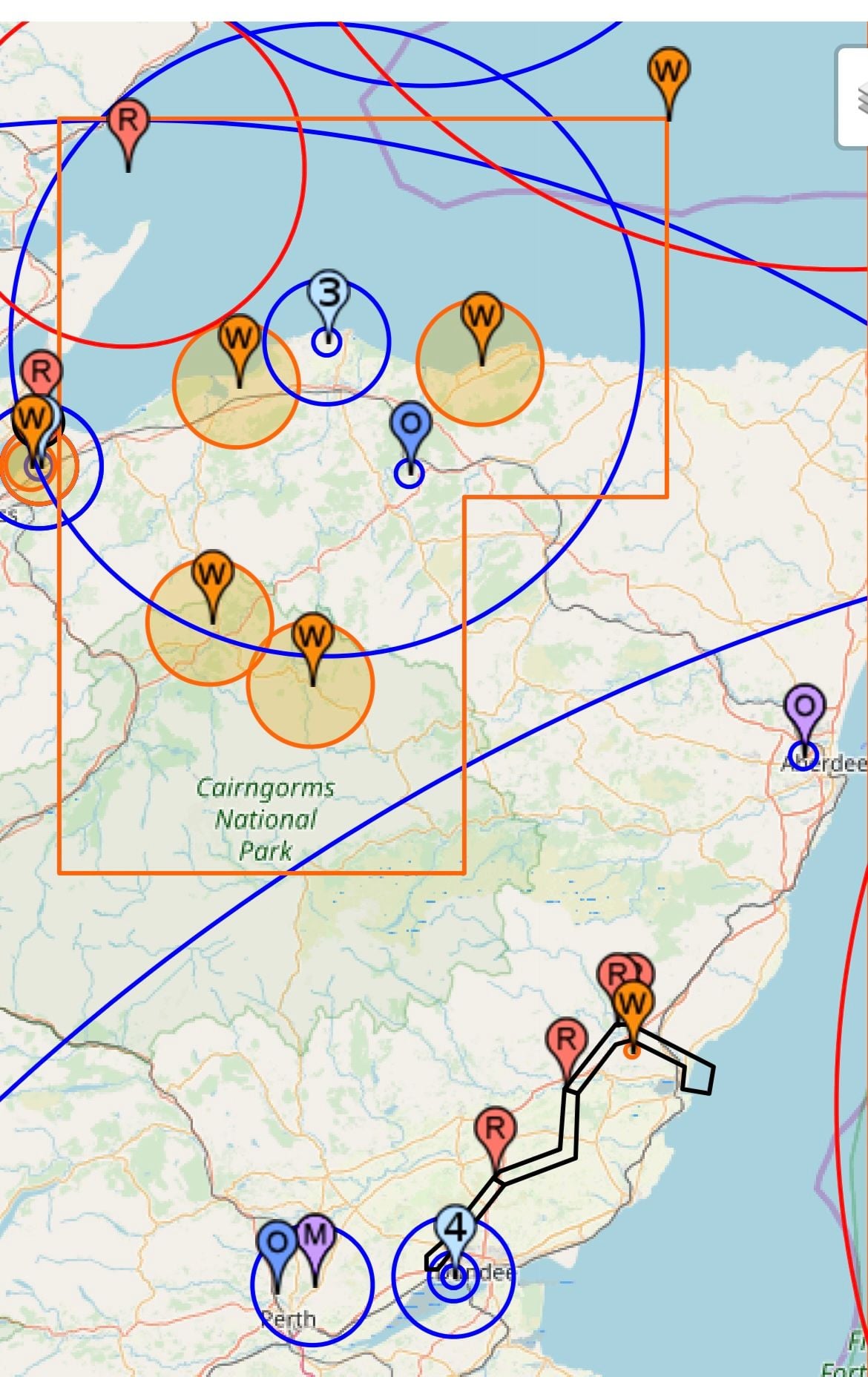
I have used SkyDemon and https://notaminfo.com/ukmap to get NOTAMS for a few years..I thought I would try to go back to the official NATS website to get NOTAMS.
The NATS website STILL seems to only list NOTAMs in raw text format
Does anyone know if there is anyway to get the NATS site to plot them on a map?
I know we are all supposed to know lat and long, but do NATs/CAA seriously expect us to plot these restrictions on a chart? It seems rather cumbersome/time consuming these days, and surely this will put people off doing this?


Joined: Dec 2007
Posts: 595
Likes: 58
From: UK
I have used SkyDemon and https://notaminfo.com/ukmap to get NOTAMS for a few years..I thought I would try to go back to the official NATS website to get NOTAMS.
The NATS website STILL seems to only list NOTAMs in raw text format
Does anyone know if there is anyway to get the NATS site to plot them on a map?
I know we are all supposed to know lat and long, but do NATs/CAA seriously expect us to plot these restrictions on a chart? It seems rather cumbersome/time consuming these days, and surely this will put people off doing this?
The NATS website STILL seems to only list NOTAMs in raw text format
Does anyone know if there is anyway to get the NATS site to plot them on a map?
I know we are all supposed to know lat and long, but do NATs/CAA seriously expect us to plot these restrictions on a chart? It seems rather cumbersome/time consuming these days, and surely this will put people off doing this?


Joined: May 2002
Aviation Qualifications: ATP+Mil
Posts: 18,633
Likes: 1,072
From: Downeast
A comparison.....
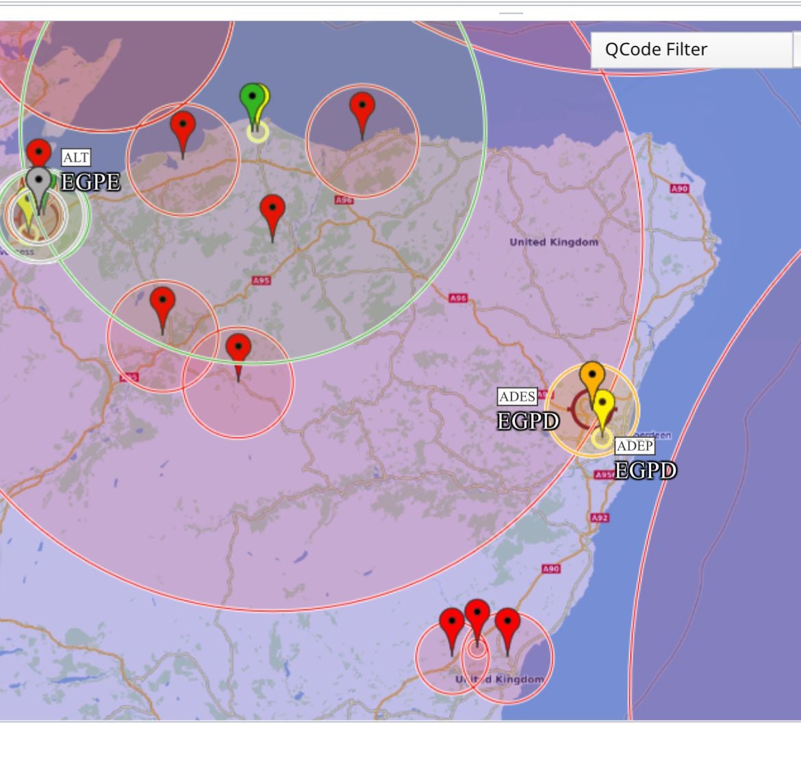
I went to the US FAA Notam Service....entered the identifier for Aberdeen and immediately received a response....and after a couple of key clicks wound up with a map and list of what appears to be Notams data.
https://notams.aim.faa.gov/notamSear....html#/results.
I went to the US FAA Notam Service....entered the identifier for Aberdeen and immediately received a response....and after a couple of key clicks wound up with a map and list of what appears to be Notams data.
https://notams.aim.faa.gov/notamSear....html#/results.


Thread Starter
Guest
Joined: Jul 2017
Aviation Qualifications: Spotter
Posts: 840
Likes: 236
From: UK
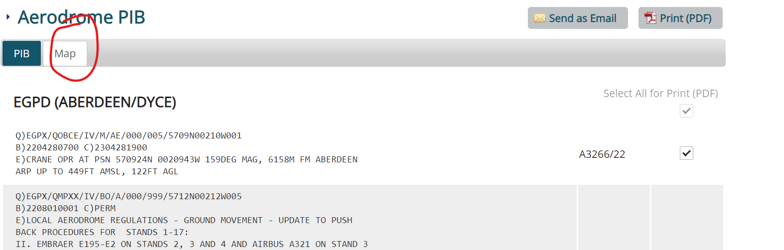
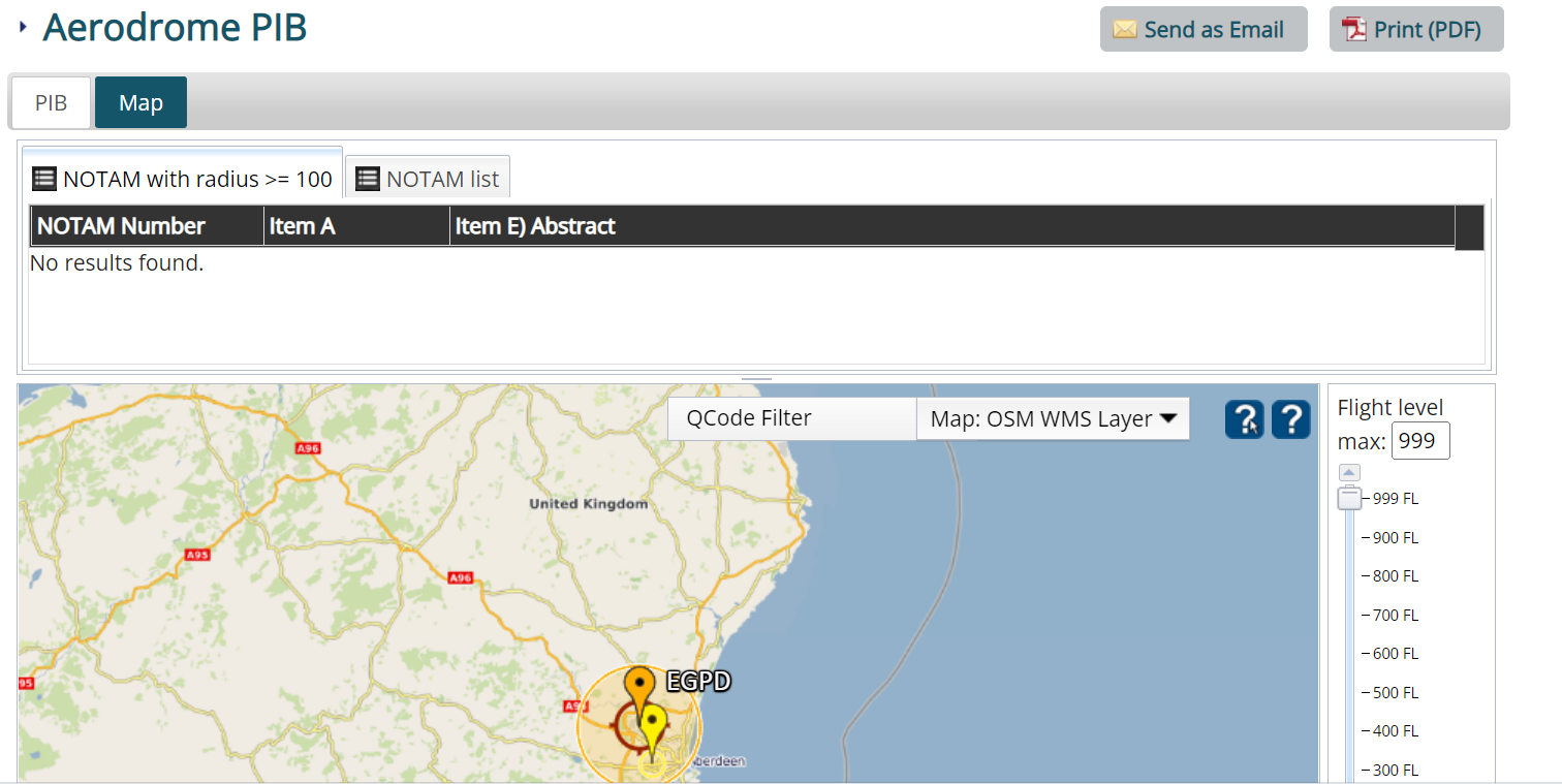
Ah yes, I see some of the NATS website NOTAM searches offer the "map" option (but not all), although it's rather clunky and of course the login doesn't always work.
I think I will continue with skydemon and notaminfo
thanks all
I think I will continue with skydemon and notaminfo
thanks all
Joined: Sep 2007
Posts: 12
Likes: 0
From: UK
Joined: Aug 2004
Posts: 2,105
Likes: 50
From: Aberdeen
The trouble is that Notaminfo, SkyDemon and the like tend to just plot a big circle around the centre of some NOTAMed activity, even if the Notam itself contains multiple Co-ordinates to define the exact shape and size. So really, IMO there is no substitute for reading the actual Notam and, if it’s one of those with multiple Co-ordinates, plotting it out.

Joined: Aug 2000
Posts: 497
Likes: 31
From: A very long way North
The trouble is that Notaminfo, SkyDemon and the like tend to just plot a big circle around the centre of some NOTAMed activity, even if the Notam itself contains multiple Co-ordinates to define the exact shape and size. So really, IMO there is no substitute for reading the actual Notam and, if it�s one of those with multiple Co-ordinates, plotting it out.