


Why do the RAF still use QFE?

Join Date: Sep 2006
Location: 23, Railway Cuttings, East Cheam
Age: 68
Posts: 3,115
Likes: 0
Received 0 Likes
on
0 Posts
TA of course, I stand corrected by your correction sir. Any idea how high it's proposed to be? I've heard mutterings of 6,000 but surely you would run into the same problem in the mountainy bits of Europe? I believe in the US it's 18,000 which seems to make more sense.

CAA docs here, relating to UK initially, but it is being looked at for Europe.
Consultation - Transition Altitude | Consultations and Responses | About the CAA
Consultation - Transition Altitude | Consultations and Responses | About the CAA
Join Date: Mar 2005
Location: Holly Beach, Louisiana
Posts: 916
Likes: 0
Received 0 Likes
on
0 Posts
Clinging to the QFE Altimeter setting is so....well Wellington like. Then add in all this Transition Height, Regional QNH, and the like. You folks should simply join the real World and go to a single Altimeter setting using QNH below the one Altitude such as the US FAA does.
It makes sense.
It makes things far more simpler and SAFER.
But then whenever did KISS hold sway with the CAA or RAF?
It makes sense.
It makes things far more simpler and SAFER.
But then whenever did KISS hold sway with the CAA or RAF?
Join Date: Jun 2005
Location: Over the hill (and far away)
Posts: 396
Likes: 0
Received 0 Likes
on
0 Posts
Or who use metres for vertical measurement, or another reference for altimeter setting, or crossing an area where there is steep pressure gradient and a great range of high ground...
Mister B
Mister B
Join Date: May 2010
Location: the earth
Posts: 86
Likes: 0
Received 0 Likes
on
0 Posts
Boudreaux Bob,
Im sure this has already been said but the whole reason why the UK mil use QFE is to keep it simple. High altitude on 1013, then move across to QFE when switched to either Director or Tower and cleared to a 'height'. How is that complicated? What bit of the KISS principle does that infringe?
Mil ac, particularly FJ and Rotary, fly a lot of visual arrivals (via VRPs) and visual ccts as they save fuel and time. In my experience its far easier to have initials at 1500' and fly a cct at 1000', then at say 2265' and 1765'. It also has the advantage of being the same for every airfield you go to. The alternative is to use the radalt, but this has problems when your airfield is surrounded by hills.
Simple.
Join Date: Mar 2005
Location: Holly Beach, Louisiana
Posts: 916
Likes: 0
Received 0 Likes
on
0 Posts
Yet you still have to use QNH in addition to the QFE don't you?
Of course there is the local QNH, Region QNH, along with the Standard Setting of 1013 for Flight Levels.
We have found it easy enough to do the mental gymnastics you describe and at the same time be able to use a common reference for Terrain and Obstacles which are all based upon MSL which is a nice fit when using QNH Altimeter settings. All of our charts show AGL Heights for Obstacles thus doing the math for you.
Our rules have us using the most up to date QNH Settings within a 100 NM's at a Minimum while Enroute although good practice is to use one from close by and when operating to an airfield or location close by, the setting for that particular Airfield.
It is all what One is used too in a lot of ways.
I have done both the UK and American method and very much find the UK procedures far too complicated and subject to finding the wrong setting showing up.
If you recall that wonderful Memo about Altimeter Settings and the manipulations required for an IF Approach with a Go Around with the attendant shift of controls then you can agree it can get tedious at times using UK Rules. (The Memo was a spoof on BA's system if you recall.)
If FJ's have problem doing Maths perhaps bringing back NAV's might be a good idea you think?
An example of why a QFE Setting might have some flaws:
Join Date: May 2010
Location: the earth
Posts: 86
Likes: 0
Received 0 Likes
on
0 Posts
Never used both QNH and QFE. I would agree that it starts to get complicated at that stage. As I mentioned; the decent is flown on 1013 until you are cleared below TL and then you fly a height rather then an altitude. Its still only one altimeter change. Same for the climb.
And the BA spoof was about the monitored approach. Not sure what it had to do with altimeter settings?
And the BA spoof was about the monitored approach. Not sure what it had to do with altimeter settings?

Join Date: May 2010
Location: the earth
Posts: 86
Likes: 0
Received 0 Likes
on
0 Posts
UK Mil app plates have the step heights based on QFE, so it's no different to flying a QNH app.
Im not really that fussed about QFE or QNH. Ive done both. Both work. Im just a touch surprised by some of the comments on here that flying QFE is this crazy, un-safe procedure.
Im not really that fussed about QFE or QNH. Ive done both. Both work. Im just a touch surprised by some of the comments on here that flying QFE is this crazy, un-safe procedure.
Two points...
1. Shotone. QFE is no better or worse than QNH at giving you your height above terrain. One tells you your height above sea level the other above runway threshold. If I have Valley QFE set (for example) it is not going to stop me flying into Snowdon any more than the Holyhead QNH if I am stupid enough to be tooling around at low level with low SA. Since there are no airfields in the UK below sea level the worst that could happen, if I accidentally left QFE set, is that I would be higher than I think I am whilst blundering around in Snowdonia.
2. Boudreaux Bob. I hear your argument but let's use the example of a display pilot flying an aerobatic routine over an airfield. Would you rather know your height above sea level or your height above the runway? Clearly my thoughts are influenced by a well known example at Mountain Home (where QFE would not have been practical) but in the UK it would work very nicely. Landing in poor weather has similar connotations and I like knowing my height above the runway whilst having SA on surrounding terrain.
For the record I currently fly in Canada where QFE is not utilised or practical (the highest airfield I have been to recently was Rocky Mountain Municipal in Boulder and QFE sure as hell wouldn't work there) but I have flown a lot in the UK. I can cope fine with either system and I really don't care one way or another but I really can't work out why some people think QFE is unsafe.
I guess it depends what you've grown up with. Everyone in this country drives on the wrong side of the road but I've managed to adapt. Mostly.
BV

Join Date: Apr 1999
Location: Manchester, UK
Posts: 1,958
Likes: 0
Received 0 Likes
on
0 Posts
Bob, well I'm not especially fussed if this is what the RAF want to do but I completely disagree with your point 1. In a mountainous area QFE gives no information relative to terrain heights/spot heights in any given place.
You appear to concede this point in your final para. Agreed, it doesn't matter much either way for most UK RAF bases but why rely on a system which "sure as hell wouldn't work" in many places?
You appear to concede this point in your final para. Agreed, it doesn't matter much either way for most UK RAF bases but why rely on a system which "sure as hell wouldn't work" in many places?
Join Date: Mar 2005
Location: Holly Beach, Louisiana
Posts: 916
Likes: 0
Received 0 Likes
on
0 Posts
I am not suggesting it is "Unsafe" per se.
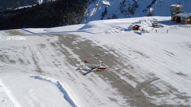
What I am suggesting is that QFE has some built in issues as it pertains to the runway elevation at the approach end. (Unless my memory fails me.) and as in the photo I posted we can see that might not apply to the entire runway as there could be quite some difference in some locales.
Determining a Circuit Height at an airfield would be easier using QFE but then I am used to doing all that higher math(s) required to do the exact same thing using QNH.
The advantage i see is in determining safe Altitudes in the surrounds of the airfield as there are MSA posted on Maps and Approach Plates which are in MSL rather than absolute heights.
If you guys want too use QFE and are happy doing so.....have at it.
I just happen to see it as being less utilitarian than using a QNH setting.
If the RAF were to suddenly have a change of heart I am sure it would tip some Worlds upside down and require lots of changes to Approach Charts, Maps, and SOP's which itself could present a Safety Issue as any major change does.
That very few places in the entire World use QFE should be some hint but then it would defy the Wellington Rule mandate. Other than the UK or RAF Bases....are there any that use QFE as standard procedure?
In the United States, it is impossible to use QFE in a great part of the country as our terrain is just way too high.
By our standards the UK is all flat land with just a few hills. Some are rather steep but none are really very high.
In Death Valley while setting at a Below Sea Level elevation one can look up at a 13,000 plus foot high Mountain which demonstrates the kind of terrain differences we have.
I guess a question is begged. What changes to procedures does the RAF make when using a QFE altimeter setting is impossible?
Last edited by Boudreaux Bob; 9th Jul 2014 at 23:57.
Join Date: Mar 2011
Location: Did I Tell You I Was A Harrier Pilot
Posts: 79
Likes: 0
Received 1 Like
on
1 Post
I think QFE appeals to the CFS old-school nibber types who like circuits to be flown at a whole number on an analogue altimeter. No ugly 46 ft etc to look at, and rounding up or down by a few feet is.... well.... imprecise! Baaaa!
Just think.... Approach plates with only one set of numbers on them and a training mindset that prepares you to fly into non-UK mil and any civilian airfield in the world. That's crazy talk!
Just think.... Approach plates with only one set of numbers on them and a training mindset that prepares you to fly into non-UK mil and any civilian airfield in the world. That's crazy talk!
Join Date: May 2010
Location: the earth
Posts: 86
Likes: 0
Received 0 Likes
on
0 Posts
Not sure how flying a QFE approach fails to train you for flying around the world or into non-mil airfields. Its the same procedures for QFE and QNH, its just the datum that has changed.
Join Date: Sep 2006
Location: 23, Railway Cuttings, East Cheam
Age: 68
Posts: 3,115
Likes: 0
Received 0 Likes
on
0 Posts
Its the same procedures for QFE and QNH, its just the datum that has changed.
Originally Posted by thing
Has the ability to fly a perfectly good circuit anywhere without an altimeter been lost?
Even at Elementary training, the ASI is covered up to see how well the student copes. Perhaps I'll try the altimeter next time too.
I don't see too many issues with the RAF flying at various places around the world. I've flown my fast jet into many airfields in the US with no issues at all. I've operated my fast jet in the mountains of northern Afghanistan, in the dark, at low level without issue.
So clearly we're doing something right.
Bored now.
Same here.
I would climb into an aircraft with dials reading knots and feet and fly around China .i.a.w metric flight levels and QFE. Then I would step into an aircraft instrumented with kilometres and metres and fly around Hong Kong using conventional flight levels and QNH.
Don't remember ever flying into anything.
 !
!