


 2nd Mar 2020, 14:35 - Wikipost
|
|||
|
|||

Which Aerodrome Mk III
Join Date: Dec 2011
Location: herts
Posts: 1,838
Likes: 0
Received 0 Likes
on
0 Posts
Part of Japan, but not Nobeoka
The "mountain" casting a shadow has (or had) the same name as a rather more famous "mountain" on another island. The documents I have has the airfield having the mountain name as part of it's name, so name that mountain
The "mountain" casting a shadow has (or had) the same name as a rather more famous "mountain" on another island. The documents I have has the airfield having the mountain name as part of it's name, so name that mountain

Join Date: Dec 2011
Location: herts
Posts: 1,838
Likes: 0
Received 0 Likes
on
0 Posts
Nope, we aren't on Fukue-Jima. You are looking at the wrong end of "Japan". In the previous image the white stuff is snow.
As an additional clue: the second part of the island you have named is part of the island name that does have the more famous mountain.
As an additional clue: the second part of the island you have named is part of the island name that does have the more famous mountain.
Is there an airport there any more...?
Confirm `N` direction ie L/R/U/D..?
Confirm `N` direction ie L/R/U/D..?
Join Date: Dec 2011
Location: herts
Posts: 1,838
Likes: 0
Received 0 Likes
on
0 Posts
In the second image, north is around 1 o'clock.
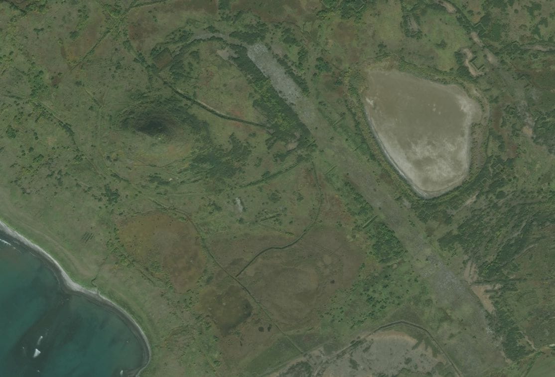
No Airport there any more. but you can still see the outline of the runway and the hangar shown dead centre of the second image.
dook - you need to read back my clue.
You know what the obvious island is, and the short version of mountain is?
Also
No Airport there any more. but you can still see the outline of the runway and the hangar shown dead centre of the second image.
dook - you need to read back my clue.
The "mountain" casting a shadow has (or had) the same name as a rather more famous "mountain" on another island. The documents I have has the airfield having the mountain name as part of it's name, so name that mountain
Also
You are looking at the wrong end of "Japan".

Join Date: Oct 2017
Location: UK
Posts: 5
Likes: 0
Received 0 Likes
on
0 Posts
So, Fukue-Jima is the wrong end of "Japan" and there is snow in you image.
We must therefore be north of Hokkaido as far as I can see.
The island of Kunashir is Russian but may not have been at the time of your images.
I'm out.
We must therefore be north of Hokkaido as far as I can see.
The island of Kunashir is Russian but may not have been at the time of your images.
I'm out.
Join Date: Dec 2011
Location: herts
Posts: 1,838
Likes: 0
Received 0 Likes
on
0 Posts
Yes, keep on going. You are correct in that it may not belong to Japan now.
One further:
Not on Google Earth though - try Bing instead
One further:
but you can still see the outline of the runway and the hangar shown dead centre of the second image.
Last edited by nvubu; 13th May 2019 at 21:09.
Join Date: Dec 2011
Location: herts
Posts: 1,838
Likes: 0
Received 0 Likes
on
0 Posts
Max Tow has it - The mountain is/was called Mount Suribachi - hence the Iwo Jima reference, and the airfield is Suribachi Bay Airfield. Originally was a fishing village, developed into an airfield, nothing there now.
Paramushiru Island has switched between Japan and Russia a number of times over the years. Was part of Japan from 1875. Japan gave up sovereignty in 1951.
Google Earth sometimes has really poor coverage compare to Bing - compare the link in Ripton's post and the screenshot I've posted above.
Open House it is