


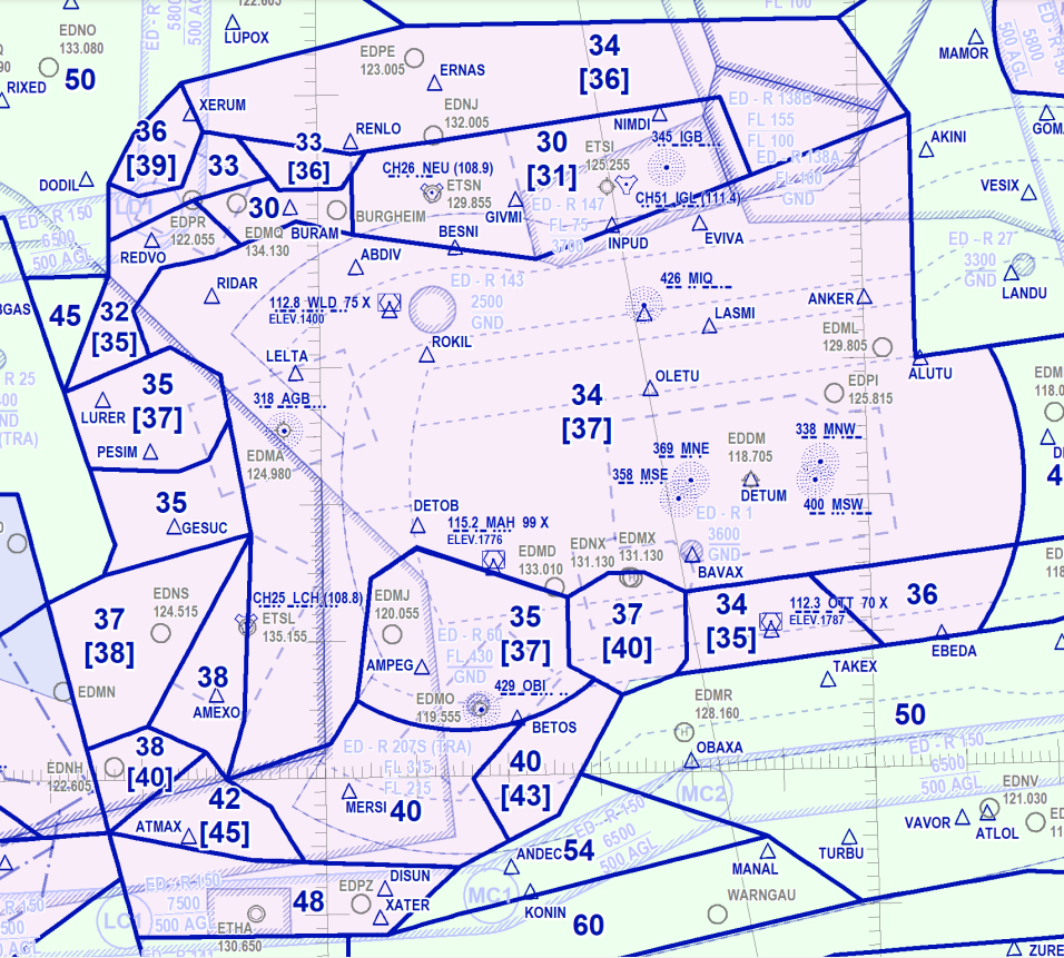
Germany Minimum Vectoring Altitude Chart

Thread Starter
Join Date: Sep 2007
Location: EU
Posts: 155
Likes: 0
Received 0 Likes
on
0 Posts
Germany Minimum Vectoring Altitude Chart
Hi All! I am looking for some info regarding MRVA for EDDS-STR and EDDM-MUC aerodromes. My company's chart provider does not publish any so I checked German AIP and found that one:
https://aip.dfs.de/BasicIFR/pages/P00DD0.html
However, the resolution of the image is low and I can't read any details. Does anyone have a better chart maybe? Appreciate your help.
https://aip.dfs.de/BasicIFR/pages/P00DD0.html
However, the resolution of the image is low and I can't read any details. Does anyone have a better chart maybe? Appreciate your help.

In the UK, charts are published for every individual IFR airfield and included in the individual AIP entries rather than a single general one; doesn't Germany have anything like that?
Called 'Surveillance Minimum Altitude Charts' (SMAC)
Called 'Surveillance Minimum Altitude Charts' (SMAC)
Thread Starter
Join Date: Sep 2007
Location: EU
Posts: 155
Likes: 0
Received 0 Likes
on
0 Posts
indeed they are charts for airports but without any MRVA info

Thread Starter
Join Date: Sep 2007
Location: EU
Posts: 155
Likes: 0
Received 0 Likes
on
0 Posts

Join Date: Feb 2016
Location: Location Location: Location
Age: 30
Posts: 23
Likes: 0
Received 0 Likes
on
0 Posts
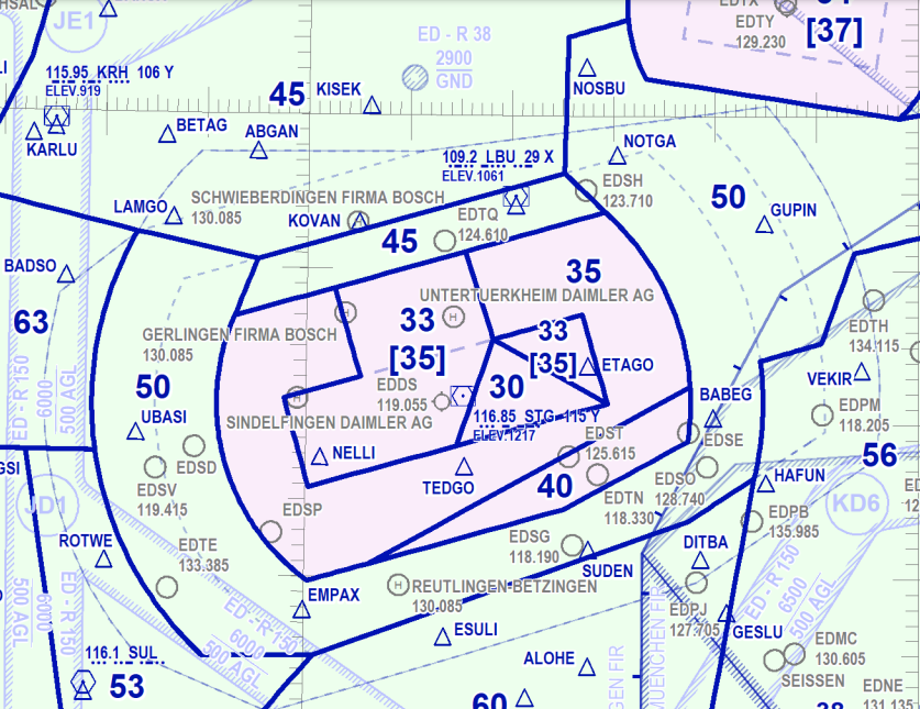
https://aip.dfs.de/basicIFR/print/EN...titude%20Chart
use the + button to then zoom in, it gets really clear.
use the + button to then zoom in, it gets really clear.
Spoiler
Spoiler
Last edited by therocketscientist; 23rd Apr 2023 at 11:57. Reason: added screenshots
Thread Starter
Join Date: Sep 2007
Location: EU
Posts: 155
Likes: 0
Received 0 Likes
on
0 Posts
https://aip.dfs.de/basicIFR/print/EN...titude%20Chart
use the + button to then zoom in, it gets really clear.
use the + button to then zoom in, it gets really clear.
Spoiler
Spoiler
