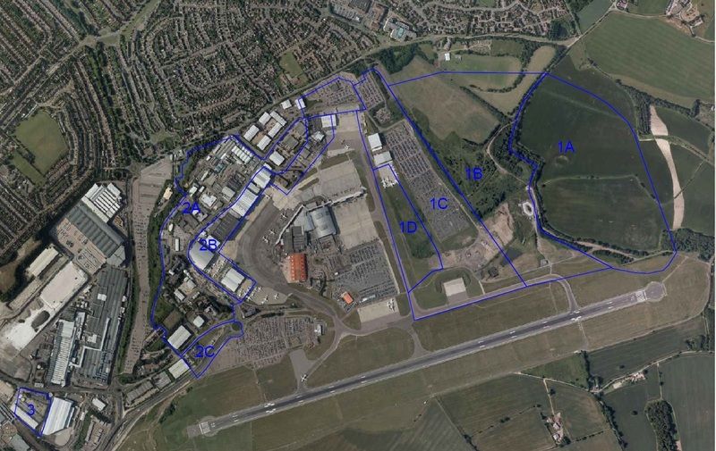
The new road basically will follow the northern blue line from the cargo centre to Zone 1A which will be Century Park. That leaves zones 1B, 1C and 1D for possible airport expansion. We know that 1D will be taxiway Foxtrot, not sure about the other 2 zones.
Questions include why does the zone end on the southern edge of taxiway Alpha and not the airport boundary? Why does it cut in towards the 26 turning circle?