Originally Posted by
EGQL1964
I don't know what the synoptic situation was, but the evolution/origin of your forecast may be of interest.
It would be great if you could have a look at what went wrong with my weather forecasts.
The ridge crest crossing took place here, from South-East to North West direction on 20th August, around 13:15 CET = 11:15 UTC:
https://goo.gl/maps/1NLvF17sadS2
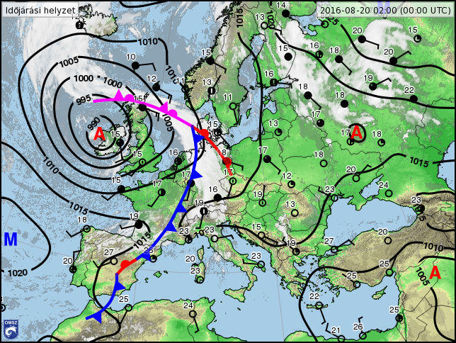
This is the synopic chart for that day (00:00 UTC) - to my inexperienced eyes, it looks like a quiet situation, being about 48 hour from an incoming cold front from the West.
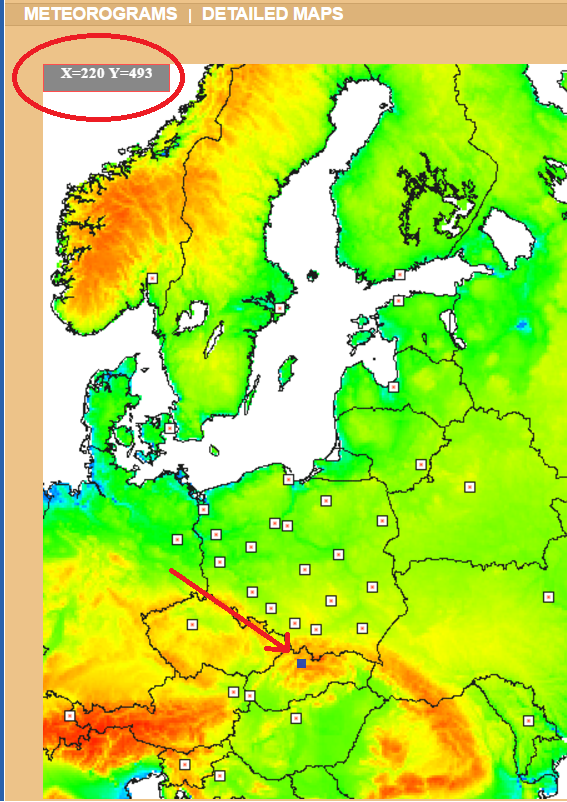
My forecast was taken from
METEO.PL, model UM, 4km grid.
The location of the forecast was the little dark rectangle marked by red arrow, the map refers to it as X=220, Y=493.
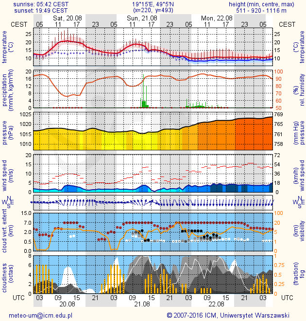
The last forecast I looked at was this - looks like a great day, high clouds only, and maximum 5-6 octas.
Last TAF from a regional airport 50 km East - this one looks great too, only few clouds, but there was also a hint of SCT clouds at 4500 feet with probability of 40%, however, no BKN or OVC clouds at all.
Code:
201608200500 TAF LZTT 200500Z 2006/2106 28004KT CAVOK
                      PROB30 TEMPO 2006/2007 6000 NSC
                      TEMPO 2007/2016 22007KT 9999 FEW050 SCT090
                       PROB40
                      TEMPO 2011/2015 SCT045 FEW060TCU=
Any thoughts what may have been overlooked, or what could have given the hint of so much cloud, i.e. a near overcast at 6000 feet over the ridge? Only the "mountain effect"?