2.2 Geometric Altitude
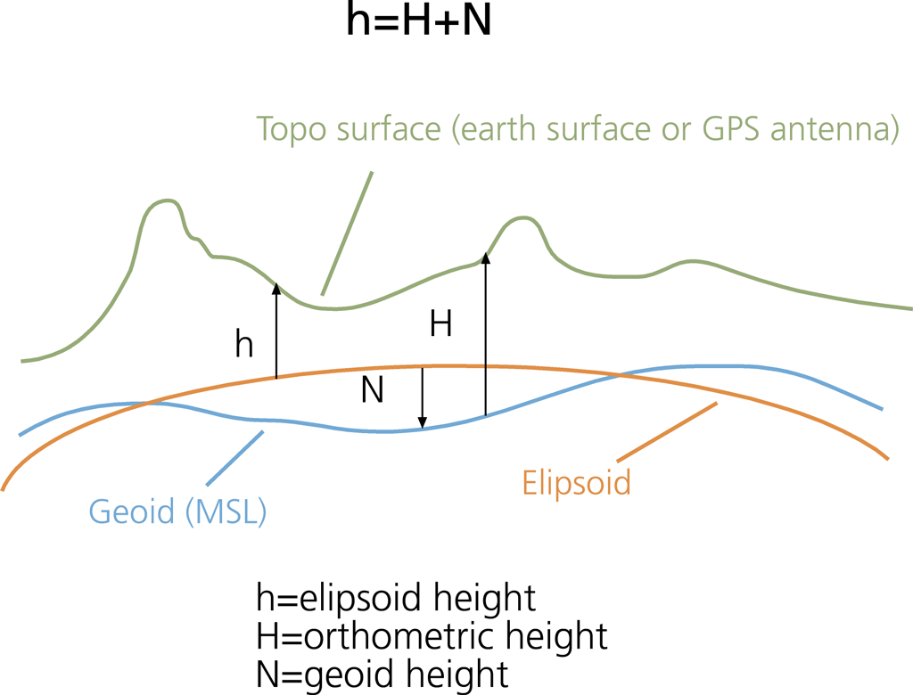
GPS geometric altitude is a measure of the vertical distance between an aircraft and the MSL. This is the height information calculated by the on-board GPS receiver based on a constellation of at least 4 GPS satellites, and is
broadcasted to ground stations via ADS-B. However, GPS uses WGS84 ellipsoid as an approximation to the MSL, which could have errors between -100m and 70m with respect to the geoid, depending on location on the globe.
The geoid is the best definition of the MSL, which is used as the reference for pressure altitude.
http://www.icao.int/APAC/Meetings/20...20Altitude.pdf
This goes back to my first post, where some ac have a lookup table, and others calc to the geoid, due to the differences in MSL vs Geiod. Some FAA and ICAO equations still use the Earth as a simple fixed diameter!
It is a good question, and there is much confusion, as the standard, and how the ac uses the informastion have been evolving...as has the understanding of the variations in MSL.