St Angelo / Lough Erne / Grosvenor
Two shots, the first taken shortly before the Wessex / Puma line moved from Angelo to Grosvenor.
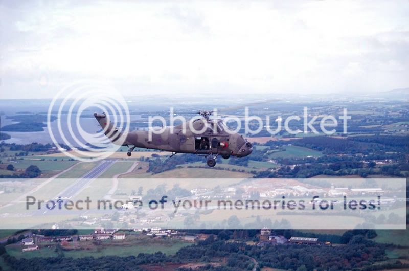
XV728 �A� on 27:08:1995 with JJ C****, Si C*********** and J****n W****y. XT607�P� is just visible on the helipad below and slightly ahead of �Alpha�s� nose, with the rest of the camp extending to the right of the frame and Ballycassidy sawmills beyond. The newly-surfaced RWY 33 of the civil airport points towards the wartime seaplane base at Castle Archdale some six miles to the north-west amongst the inlets and islands of Lower Lough Erne. Not the best Fermanagh weather for what could have been a much more scenic view. Within ten minutes the sun was shining.
Just as it was for this view of XW223 over a closed and deserted Grosvenor Barracks at Coles Hill, Enniskillen fourteen years later.
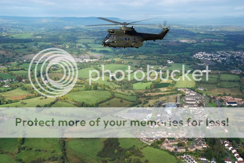
Landmarks are Rossorry Church, Drummee limestone quarry, now a landfill site, Coles Hill / Lough Shore Road housing developments, Navar Viewpoint, Lower Lough Erne and the hills of Donegal, beyond on the distant horizon. Might post a couple more from that area.
Last edited by PhamousPhotographer; 2nd May 2011 at 14:52.
Reason: Fairly Obvious!?