aterpster;
Its a small detail as the general site is known but regarding the Crash Site #'s 1 & 2, I don't think either fit when their lat/long is plotted in Google Earth.
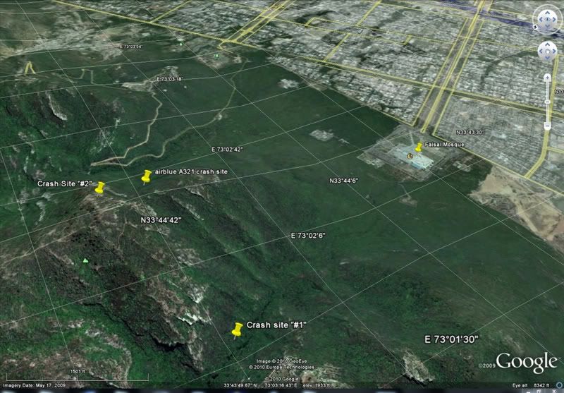
Site #1, (see second graphic below), is on the other side of the mountain and shows no road in the area so I think it is not the right location.
Site #2 is closer but is almost at the top of the peak which is contrary to crash site photographs taken from the road, which generally show the crash site against the face of the mountain and not near the top. (The tip of the yellow "push pin" of the original crash site I plotted, is visible in the first graphic.)
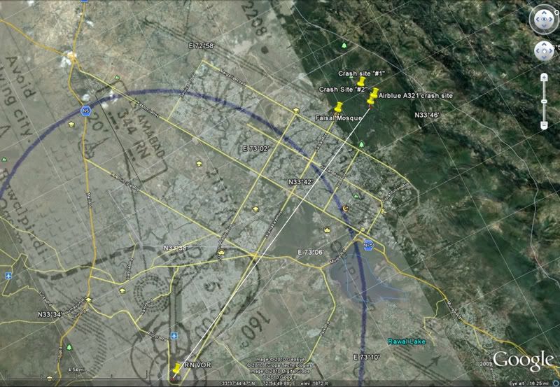
The distance from the RN VOR to the crash site plotted originally is about 9.3nm.
When I plotted the site I originally posted, (
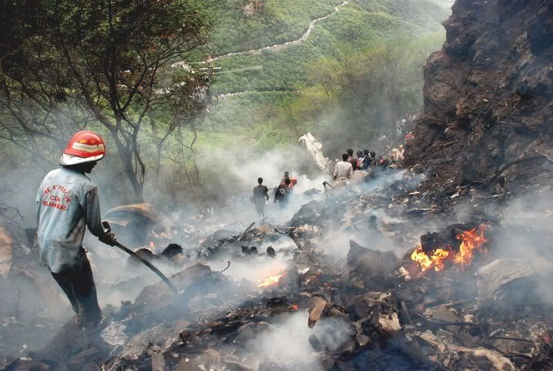
Post #124), I used crash-site photographs to examine the amount of city visible and the mountain profile - the profiles in Google Earth aren't super-accurate but they're sufficient to plot a rough location given the view of the road and how certain curves and straightaways of the winding road "line up" when comparing the photos with the Google Earth theoretical site.
==============
The following is the "view" from crash site #2 - again, the terrain profiles are only approximate in Google Earth but here, even given the slightly higher elevation that the view is taken from in GE, the entire city is visible and that is not the case in the crash-site photographs.
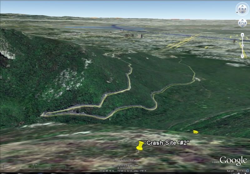
This is another photo from the crash site looking SE, showing the road, fairly close to the hair-pin turn seen in the above graphic.
This is a view of all three theoretical crash sites plus the location of the Faisal Mosque.
This is a plan view of the area, from the airport, (RN VOR), to the 3 theoretical crash sites. The map is oriented on the runway heading; the track to crash site #1 and the original one I posted is about 330deg at about 9+ nm.