Look at the chart - moderate to severe CAT is nowhere near Alberta!! (Assuming this is the correct sigwx chart)
Having grown up in England and spent many years in Calgary, it always amuses me how little knowledge people in Europe have of the sheer size of Canada.
Saying that CAT over Ontario and Quebec affected this flight, is like saying CAT over Beirut affected a London to Paris flight.
For the benefit of the geographically challenged

, I have annotated the turbulence map that GM posted. I see from ehwhatezedoing's post, that the flight was 65nm SW of Cranbrook, just south of the border in Washinton, when the incident occurred. This is just about the beginning of the higher mountains, which extend all the way to the Alberta-BC border, so if it was a CAT event, this is a likely area. This forecast was issued 8 hours after the event, but I couldn't find the previous forecast.
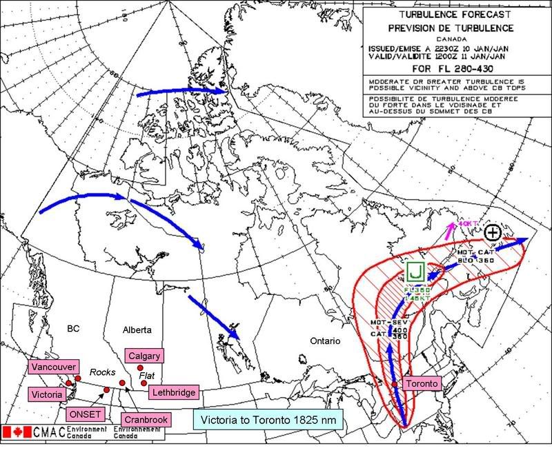
Just east of the BC border, the mountains stop abruptly, like this:
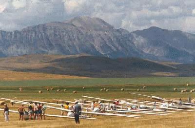
The Livingstone Range in the picture routinely generates lee waves up to at least 40,000' and you often have wave activity further west, which will be less organized than the front range waves and therefore probably more turbulent.
Note: It is not a coincidence that there are gliders in the picture (Cowley Airport).
The current data (14 hours later) shows strong westerly winds aloft and gusty surface winds from the west at Lethbridge, plus bars of cloud on the satellite images downwind of the Rockies all through Alberta and Montana, all of which point to wave activity. Can anyone find the METARs and Winds Aloft for Lethbridge and Cranbrook for 10 Jan 1200 - 1600Z?
And I've just noticed, what a suitable name for the intersection where the event occurred - ONSET.