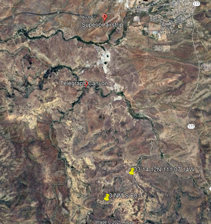
I have flown into Superior airport several times and I have used that mountain as the backdrop for sunrise photos of my aircraft.
The position coordinates in the NOTAM do not appear match the location of Telegraph Canyon. I could not find the TFR so I assume it has expired.
Is it possible the pilot did read the NOTAM but avoided the wrong place?