Out of curiosity, I was wondering how �out of the ordinary� the flight path was for PA25 compared to other flights along Route 4. I found 65 such flights in January (there are probably some I missed) and I plotted where they crossed the runway approach. Note that the altitude is binned in 25' chunks, so you should assume that all altitudes just above 200' were actually at 200'. For any aircraft above 200' I DID NOT try to determine if they received clearance from ATC (which is permitted), and you SHOULD NOT assume that they didn't. I also threw in a rough breakout between daylight and night for each crossing. For the two PAT flights well offshore, I did not investigate any special ATC clearances they had. I apologize in advance for any errors as it is a bit tricky to plot and measure these distances.
Added note: The chart shows only crossings collected with ADS-B. I threw out all MLAT collected crossing because of inherent inaccuracy.
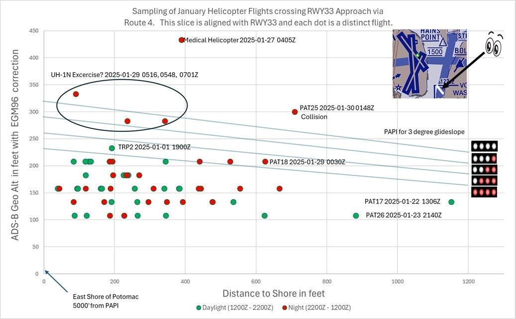 Helicopters crossing RWY 33 approach via Route 4 for January