Originally Posted by
pattern_is_full
Originally Posted by
SASless
RTFQ here folks....slow down and actually read the question.
Quote:
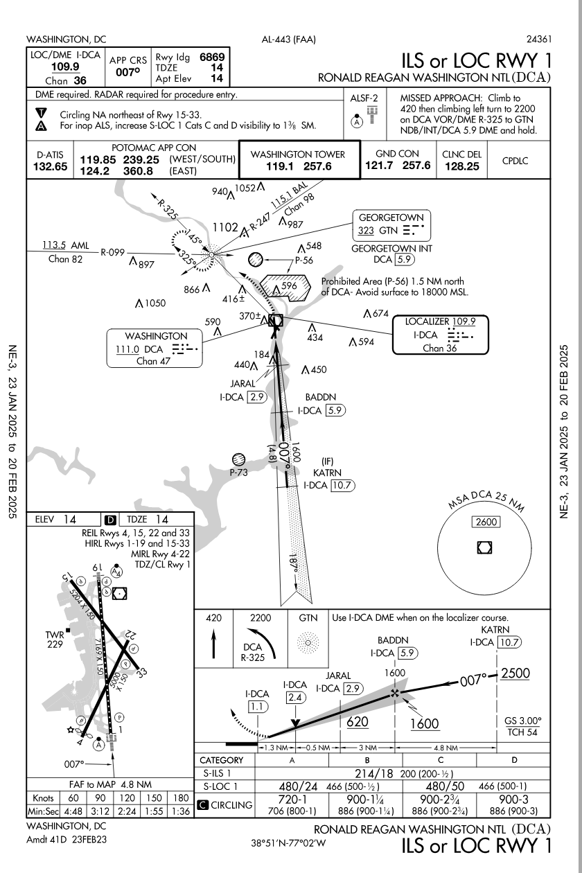
Now a test question for him.....were you flying the incident airplane doing a Visual Approach to RWY33....would you have tuned up the IAP for that RWY as an additional reference for your approach?
SOP's usually instruct Crews to use ILS data when doing Visual Approaches to runways with that kind of IAP so would that kind of thinking apply in this incident? Would that have been of any benefit considering the existing weather and terrain? Or, would that have been a distraction?
Pattern, perhaps you might review your comment.
Pattern, perhaps you might review your comment.
It really is not a difficult concept or question.
Seems easy enough to understand if the post is actually read for comprehension sakes.
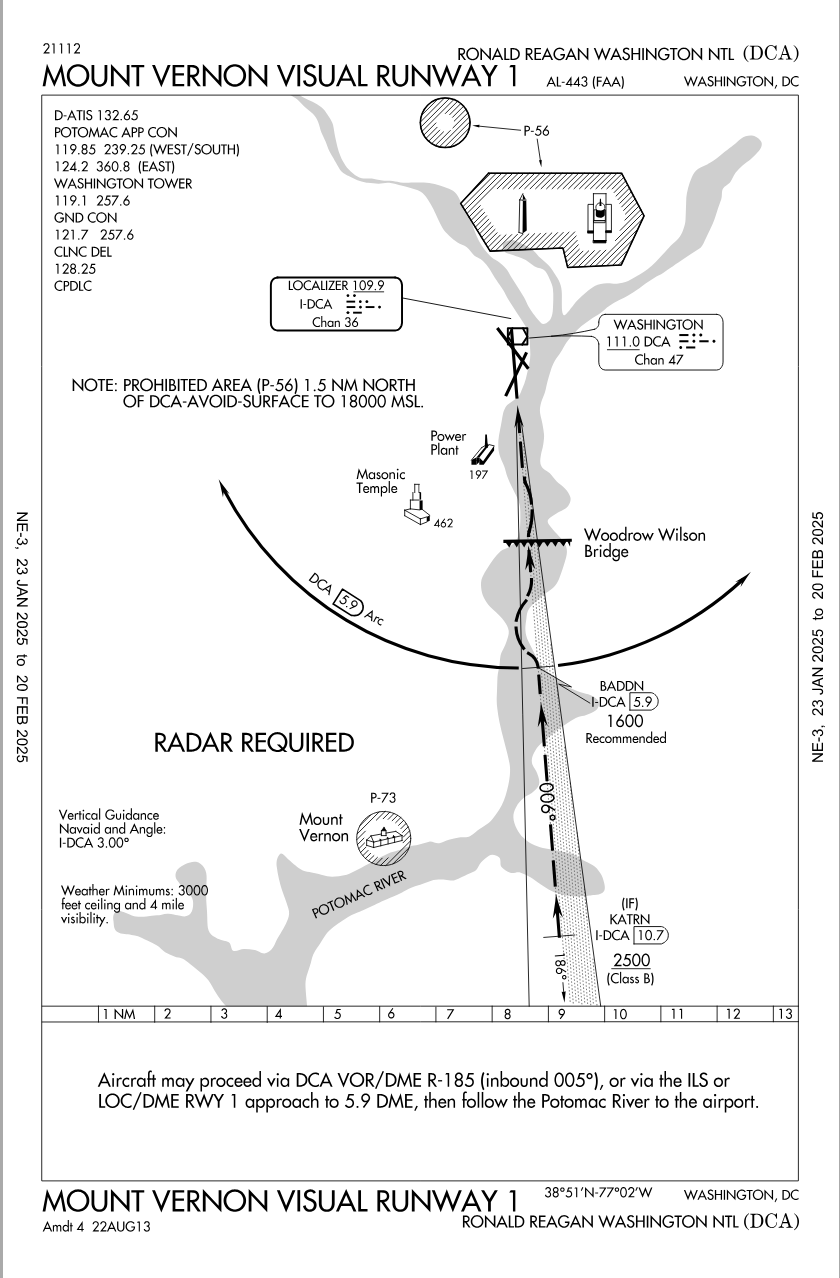
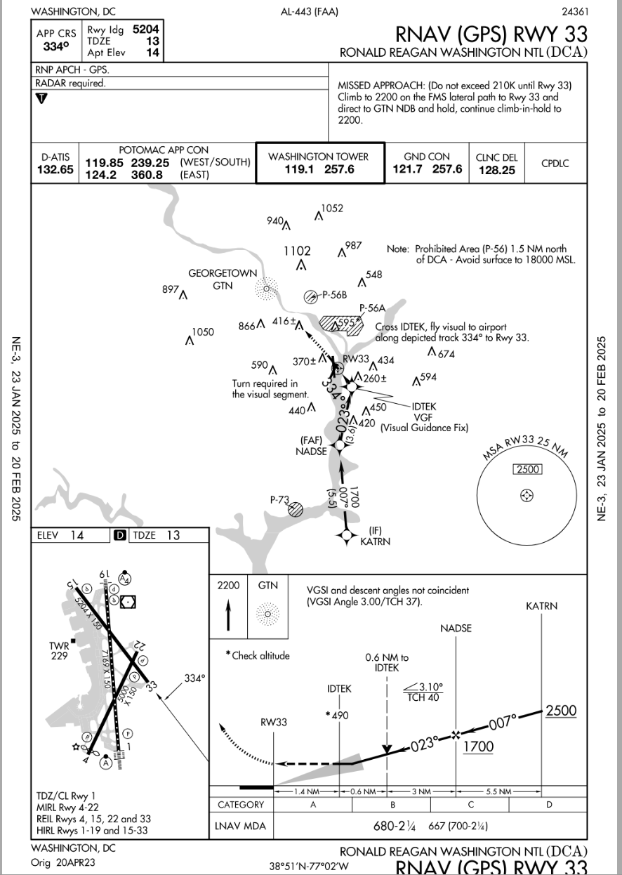
The CRJ was undertaking a CVP to RWY01, and was asked to take RWY 33 by ATC. That is kind of messy at that point, the aircraft is changed by inference from the CVP to a visual approach. There is a GPS approach that effectively overlays the CVP, and gives a reasonable intercept of the center-line of RWY33. The crew flew a track that is not far away from this, but it was not required to be followed, then again, there's a fair amount of incentive to not busting airspace in DC. Not required, helpful, but also puts a pilot head down in terminal airspace that the guys have fair landmarks to nav by visually. Whatever they did, they got to finals accurately (a dct to or by visual nav) and on a descent path that is as reqd.
About 80% of all IATA operators would be discomforted by such changes, outside of the USA visual approaches at night have a litany of requirements to adhere to for the purposes of terrain separation, vs Texas big sky rules that do work in the US. In the end, taht didn't cause the accident, it is one of those things that goes with the freedom of flight in the USA.
...