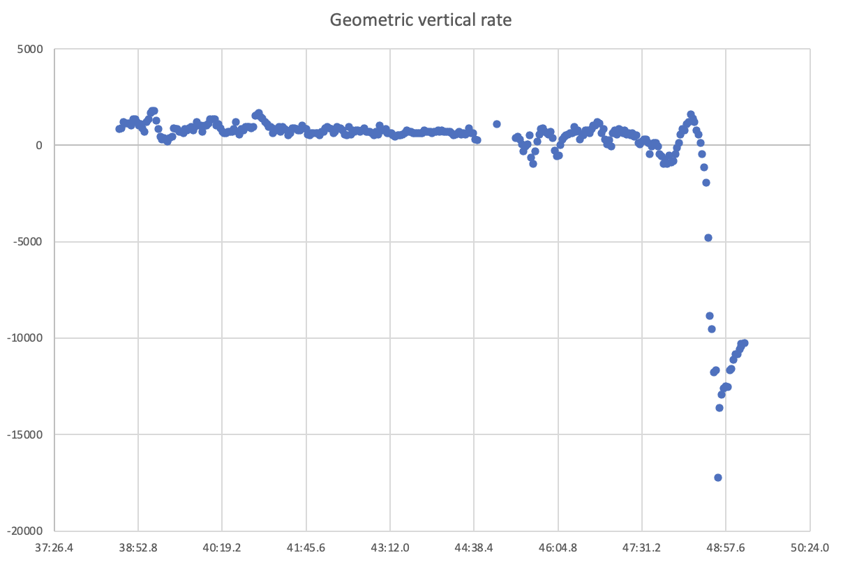
There remained an appreciable horizontal velocity component up until the highest descent rate. Both the speeds from my attachments and the other post with FR24 data is GPS derived ground speed. Lack of forward movement simply indicates the velocity vector might be pointing more downward than forward, corroborated by the peak geometric descent rate at 03:48:49 UTC of over -17,000fpm (~167 kts) and 84 kts forward speed at the same time, for a total velocity vector of (84^2 + 167^2)^0.5 = 187 kts. After that point the forward velocity reduced abruptly to around 18 kts on average until end of transmission. The vertical rate reduced to about -12,000 fpm (~118kts) for the last 15 seconds.
There's a change in geometric rate fluctuations from about 5 minutes before the event, perhaps that's when they climbed into a turbulent layer/cloud or that's where some difficulties started to evolve (pretty much from after where the data gap is in the plots). The data gap itself is from an interruption in the data feed, not from ceased transmissions by the aircraft.