Originally Posted by
Lead Balloon
RN news also said ATSB is looking into pilot history and weather conditions. (I can assist: The WX in the Appin area at the time was severe CAVOK. Pretty warm. I wasn't in the air, though.)
Another example of the utility of the WeatherCam system...Here's the two shots from the Windy.com archives either side of the accident looking southwest. The accident occurred about 2NM SSW. In this case, Wedderburn even overlay their own PWS data on the images. Short of severe turbulence causing an inflight breakup (chance of that? Buggerall...methinks) I feel we can safely discount weather as a factor.
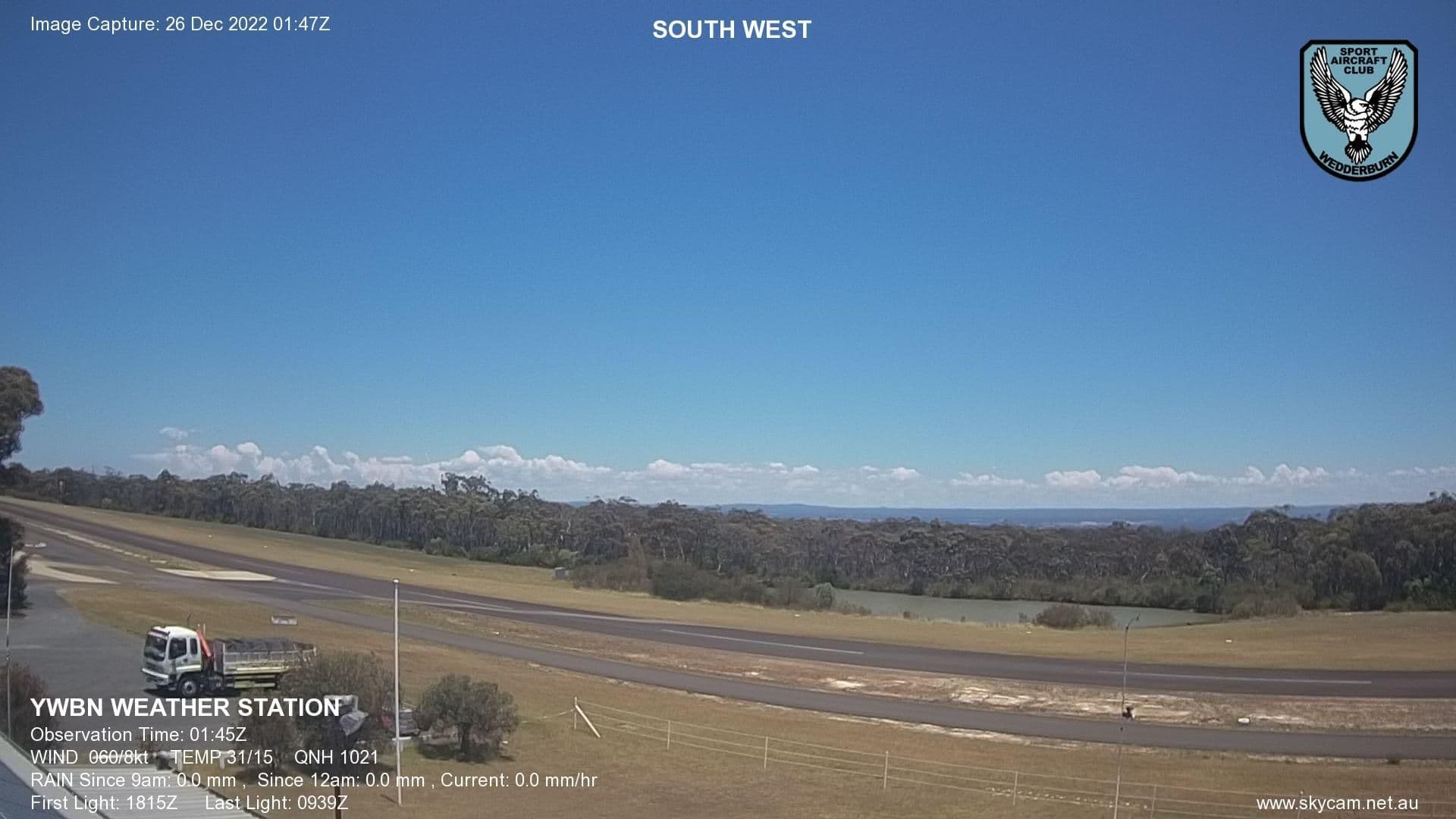 0145Z / 0245L about the time of the crash, looking Southwest towards the crash site.
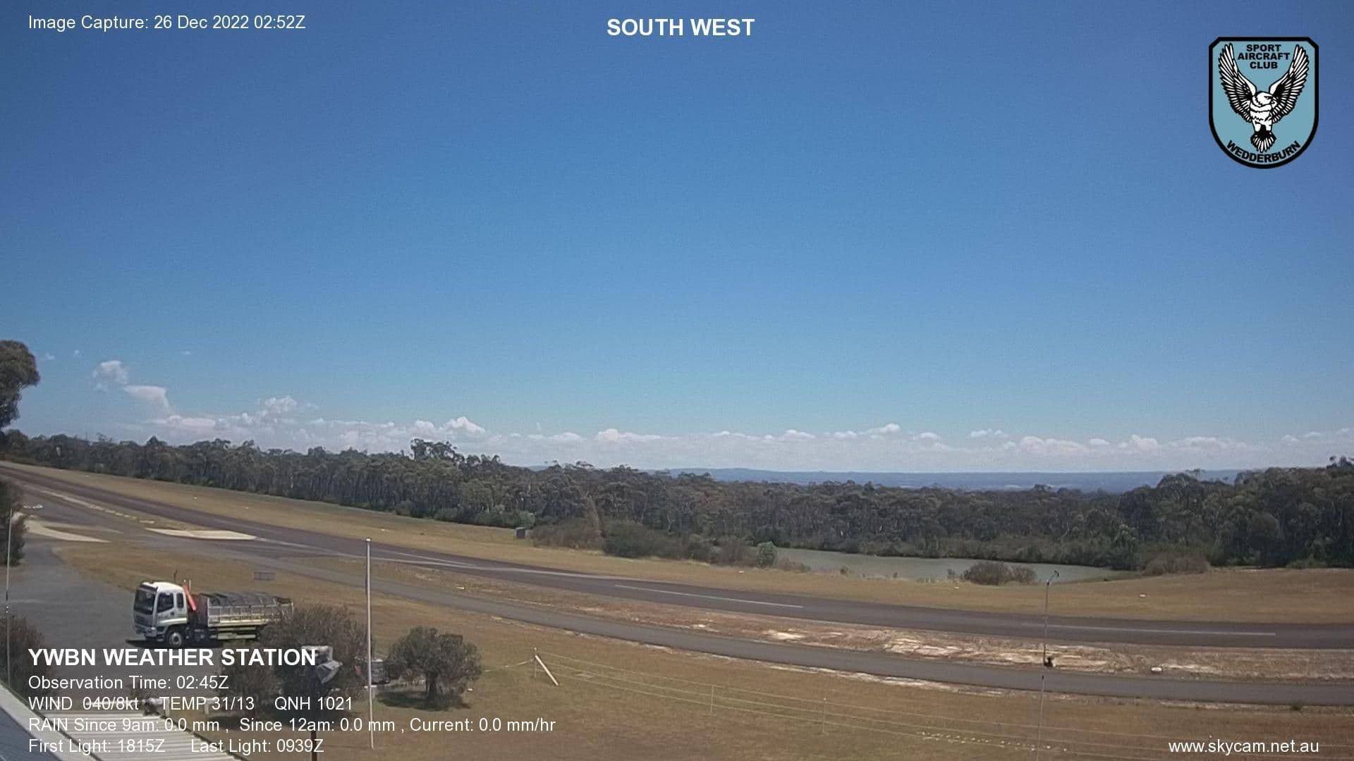 0245Z / 0345L looking Southwest, following the crash.