Geoid is theoretical mean sea level which is the vertical reference we need. It is somewhat irregular and therefore an ellipsoid can only approximate it. The GPS (not GLONASS) uses the WGS84 ellipsoid. The GUND is the local difference between the two. Modern GPS units also have the geoid data so they are able to provide altitude MSL.
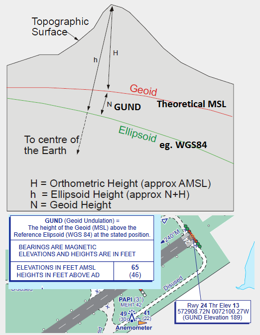
eg HKMO shows GUND -94.58Ft and elevation 199.6Ft at the threshold of Rwy 21
This tells you that the threshold is 199' above the geoid (MSL). The -94' indicates the geoid at this location happens to be lower than the ellipsoid. The pilot does not need to know this because his primary reference is the altimeter which when set to QNH is theoretically the same vertical reference as the geoid anyway. But it would be a good idea to know if your GPS is giving ellipsoidal height or altitude MSL.