Originally Posted by
MPN11
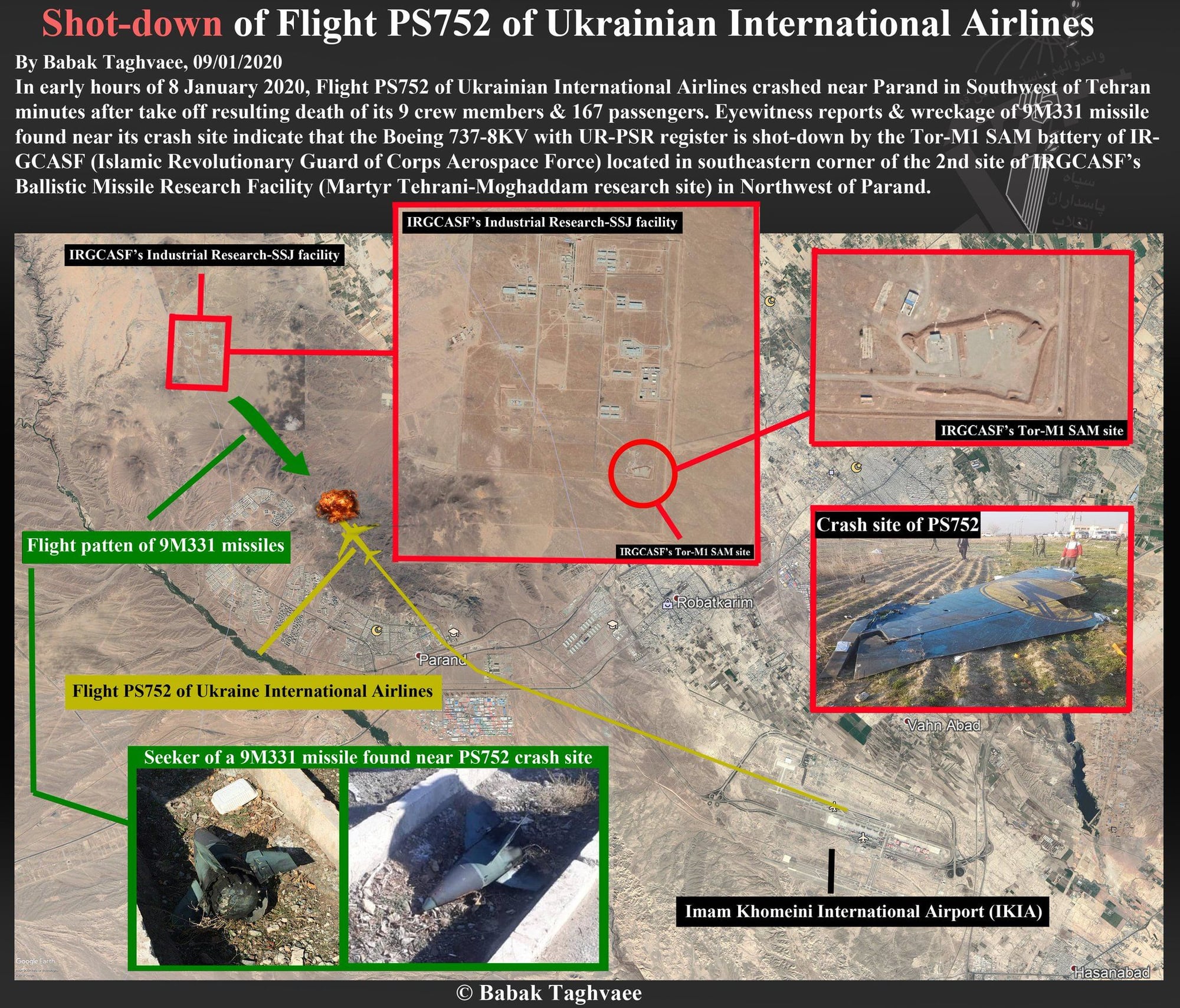
There's a 'something' 307�/13.5 nm from the rw end ... could that be the 'sensitive site'? Can't post Google Earth image, for some reason. Fairly close to the SID, though.
35�33'40.80"N 50�53'54.42"E
I think that is indeed the site of the 'missile research facility'.
Here's Babak Taghvaee's map of the points of interest from a couple of days ago. He's nailed the specifics of this crash from the gitgo from what I can see.