Originally Posted by
DaveReidUK
The FR24 trace stops with the aircraft still in the climb on the departure heading. You can't tell anything from the trace about what did or didn't happen subsequently.
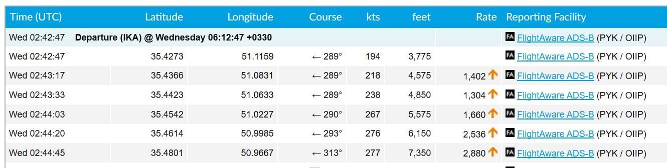
It looks to me like there is a 20 degree turn to the right before the data is lost. I think the FR24 dataset has been updated with the 'granular' data from the local ADS-B receiver(s).
Here's the FR24 plot of the .kml file plotted on Google Earth:

The standard FR24 plot:

And the FlightAware track log showing a course change in the last point: