Originally Posted by
Self loading bear
Photo below is from a book of 1931 "In de schroefwind" of KLM pilot A. Viruly.
It is a photo of two gasholders in Leeuwarden (now the Bleekhof in Leeuwarden)
The arrows point roughly North while the Leeuwarden air base is approximately 4 km in NW direction.
Did they have already have a flight pattern in place?
The history of Leeuwarden Air Base does go back to 1931, but by then there was nothing more than a plan to build an airfield near the town. This was finally approved in 1936, with a grass field bought and first used by 1937. The German occupation caused it to be enlarged into a military airfield and this sparked the development into the military base it is now.
So to go back to your photo, as there was no airfield at the town in 1931, I would suspect these markings to be nothing more than a reminder of the name of the town and a rough idea of where North is.
Edit, see here:
https://www.agl-fullstop.nl/index.php/vlb-leeuwarden Another addition from a 1919 newspaper:
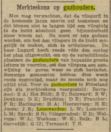
In short, even before WWI there were plans to mark gasholders with two-letter codes to enable airmen to orient themselves. This article from 1919 lists the ones as suggested for towns in Friesland.