


UK to spend Ł640m on drones. Will NPAS be given access?

Thread Starter
Joined: Nov 2012
Posts: 97
Likes: 0
From: Hy Brasil
UK MOD are going to spend Ł640m on eight Ł80m Triton Global Hawk drones to monitor the UK.
Will NPAS be given access to their pictures or tasking? Will this mean NPAS be running another course for the TFO's to fly them?
UK 'to Spend Ł600m on Spy Drones To Protect Britain From Russian Incursion'
Will NPAS be given access to their pictures or tasking? Will this mean NPAS be running another course for the TFO's to fly them?
UK 'to Spend Ł600m on Spy Drones To Protect Britain From Russian Incursion'


Joined: Feb 2005
Posts: 1,046
Likes: 28
From: Zummerset
Would like to see their CAP 722 compliance measures.....
No cleared Detect to Avoid system, no Ops outside desegregated airspace. RPAS/UAVs have enormous potential, but there are societal and technological barriers to their employment.
No cleared Detect to Avoid system, no Ops outside desegregated airspace. RPAS/UAVs have enormous potential, but there are societal and technological barriers to their employment.
Joined: Apr 2005
Posts: 1,651
Likes: 138
From: 50+ north
Evalu8ter
I share your sentiment, if they are not equipped with an approved sense and avoid system are they only going to operate for 90 days in a Temporary Danger Area, or are we to expect that we will see an ACP covering all UK off shore areas?
I share your sentiment, if they are not equipped with an approved sense and avoid system are they only going to operate for 90 days in a Temporary Danger Area, or are we to expect that we will see an ACP covering all UK off shore areas?

Purveyor of Egg Liqueur to Lucifer

Joined: Nov 2002
Aviation Qualifications: ATPL
Posts: 4,753
Likes: 65
From: Alles über die platz
NPAS and drones ..... Octocopters are just the job for footsie matches and marches, yet as they say in the onion trade, that's shallot.
Besides, don't these big boy drones deal with Lat Long coordinates? I've not yet seen an online latlong postcode converter
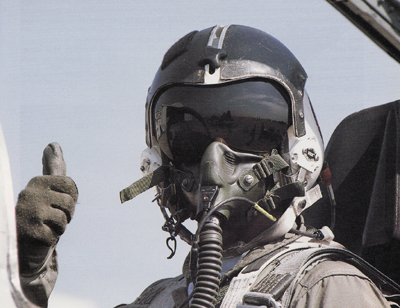
It's been a while since my last recognition lesson, but have they now moved in to pilot recognition? Must be chuffin' difficult with a helmet, mask and dark visor. So the simple countermeasure for this super camera system would be to simply blank out the helmet names ")
Besides, don't these big boy drones deal with Lat Long coordinates? I've not yet seen an online latlong postcode converter
The drones carry surveillance equipment that can detect hostile aircraft from 2,000 miles away and are fitted with powerful cameras that can zoom in on pilot's faces.
Joined: Feb 2005
Posts: 1,046
Likes: 28
From: Zummerset
Forty odd,
Not an issue when on station at altitude; you could even try to sterilise the airspace for a spiral climb up and down. The issue is the 'lost link logic' and where/how the platform gets back down, autonomously, without endangering other airspace users. It's not CAT aircraft that's the issue (TCAS will help) but those non-Xpdr equipped Users that will pose a collision risk.
Not an issue when on station at altitude; you could even try to sterilise the airspace for a spiral climb up and down. The issue is the 'lost link logic' and where/how the platform gets back down, autonomously, without endangering other airspace users. It's not CAT aircraft that's the issue (TCAS will help) but those non-Xpdr equipped Users that will pose a collision risk.


Joined: Oct 1999
Aviation Qualifications: ATPL
Posts: 7,373
Likes: 931
From: Den Haag
I've not yet seen an online latlong postcode converter

Coordinate Converter Conversions - Grid Reference - Lat/Long
Purveyor of Egg Liqueur to Lucifer
Joined: Nov 2002
Aviation Qualifications: ATPL
Posts: 4,753
Likes: 65
From: Alles über die platz
Blimey, that took longer than expected.
Well done 212, although I've found #2 on the google search list easier to use
UK Street Map Coordinate Converter
Well done 212, although I've found #2 on the google search list easier to use
UK Street Map Coordinate Converter
