


Coast to coast across America

Thread Starter
Join Date: Jul 2003
Location: Gaithersburg, MD
Posts: 622
Likes: 0
Received 0 Likes
on
0 Posts
Howdy!
Just wanted to say, "hello" to my fellow Rotorheads. I've been out on a few projects over the past couple of months and haven't been able to check PPRuNe while off-site. Nevertheless, I'm back in the saddle (and I have replied to everyone who sent a PM).
Anyway, next week I'm going to ferry an R22 from San Diego to Ft. Lauderdale. I was looking at the vertical profiles along some of my proposed waypoints... looks like some fairly steep mountains near El Paso, etc. I'll probably follow I-10 most of the way (assuming weather, TFR's, and maintenance).
Any advice?
Thanks,
R2
Welcome back, R2.
Hope you don't mind me amending your thread title - we could get some info/advice which will be valuable to others in the future.
Heliport

Join Date: Jul 2000
Location: London
Posts: 2,916
Likes: 0
Received 0 Likes
on
0 Posts
Good to see you back on the forum, Rick.
Southern California to Florida? That must be about 2300 nm, even in a straight line. You lucky guy - what a wonderful trip!
I'm not skilled to give any advice on the southern States route - my only trip across North America was from Goose Bay to Dallas - but there will be pros here who can advise you.
The only advice I can offer, based on my own regret, is: If you can, allow plenty of time to see the sites on the way across your stunning country - including beautiful San Diego before you set off.
AZ, TX, LA ( a chance to meet some GoM rotorheads if you plan it), AL and into FL? I'm envious!
Tudor
PS
Hope you take plenty of pics to post here when you get home. Not easy in an R22, I know, but that fancy camera of yours should be good for point and shoot!
Last edited by Flying Lawyer; 17th Mar 2004 at 07:34.

Thread Starter
Join Date: Jul 2003
Location: Gaithersburg, MD
Posts: 622
Likes: 0
Received 0 Likes
on
0 Posts
Ya... at least in the truck you can climb in the back for a snooze! If I take my laptop, I'll definately send PICS along the route. I planned for a few stops along the way... San Antonio to see relatives and New Orleans to have fun. Any Rotorheads in those areas?
Join Date: Jan 2003
Location: W'n. USA--full time RV
Posts: 132
Likes: 0
Received 0 Likes
on
0 Posts
If you care about fuel prices: Thermal (PSP clone) was $3.07 last month, El Centro $2.40, Yuma last week $2.19 (North Ramp, NOT the self-serv $2.80!!).
Make a pass over Imperial Dunes Rec Area (Algodones Dunes). Not far off course, spectacular little-toured seif dunes spaced 1 mi centers for 36 mi N-S. I'm toying with offering sightseeing/nature tours there next winter.
Need Rx drugs? Just finished landing R22 between showbird parking lot and gravel pit at Algodones border town (MX/AZ/CA corner) & walking across (5 min, inventory far superior to Tijuana, hundreds of dentists and doctors, too).
Ignore Border Patrol trucks & they'll ignore you. Parking lot attendant showed up wanting $10 to park, we decided to move farther away on principle, but just before startup he came back & waived the fee. Go figure. With strong north wind the base-to-final turn is real tight if you don't want to impinge on Mexican airspace; in retrospect I think next time I'll use 500' of that to make a nice smooth approach to the gravel flats.
Calexico, it is true, has airport, but pharmaceutical inventory in Mexicali is impoverished compared to Algodones.
As you'll find on preflight, heat wave in process SW USA, 99 degrees forecast for Yuma today. But hey, high DA means higher TAS, right?
Won't injure tender sensibilities of this group with locations of nudist colonies along your route, gotta keep it clean for the moderators.
Thread Starter
Join Date: Jul 2003
Location: Gaithersburg, MD
Posts: 622
Likes: 0
Received 0 Likes
on
0 Posts
Looks like my route has suddenly changed. Now going from San Diego to the Kent Island (Eastern Shore in Maryland). I'll take the same route, except I'll go NE through the Carolinas. Thanks in advance for your input.
Join Date: Nov 2001
Location: San Jose, CA
Posts: 116
Likes: 0
Received 0 Likes
on
0 Posts
A writer at AOPA has done two articles about ferrying R44s across the country. I believe the first one (maybe two years ago?) was to the same general area that you're (now) going to fly to. That might be useful data.
I am pretty sure that AOPA puts all past articles on its website, accessible to AOPA members.
good luck on the trip you lucky dawg,
Dave Blevins
edit: the first article was in the Sept. 2000 issue of AOPA Pilot, by Tim McAdams. That trip was from Torrance to Baltimore, MD. I can't find the other issue, but it's been within the last three months.
Join Date: Apr 2003
Location: USA
Age: 75
Posts: 3,012
Likes: 0
Received 0 Likes
on
0 Posts
The rock spires near Needles California are beautiful, and one can even shut down there, I am told by a friend ;-)
http://www.drelocation.com/Californi...no/needles.htm

Lake Powell is simply beautiful, with alternating white and red bands on the sedimentary stone cliffs.
http://www.imagecounts.com/Gallery/lake%20powell.htm

Monument Valley Utah is where all the John Ford western movies were shot. A friend had lunch on that valley floor once.
http://doors.stanford.edu/~sr/southwest/
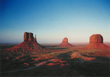
Mesa Verde National Park looks great from the air and Durango Colorado is a beautiful RON
New Orleans Lakefront airport is a nice stop over to allow a few days in the Big Easy
I have flown that route about 20 times, but I still envy you!
Good luck
http://www.drelocation.com/Californi...no/needles.htm
Lake Powell is simply beautiful, with alternating white and red bands on the sedimentary stone cliffs.
http://www.imagecounts.com/Gallery/lake%20powell.htm
Monument Valley Utah is where all the John Ford western movies were shot. A friend had lunch on that valley floor once.
http://doors.stanford.edu/~sr/southwest/
Mesa Verde National Park looks great from the air and Durango Colorado is a beautiful RON
New Orleans Lakefront airport is a nice stop over to allow a few days in the Big Easy
I have flown that route about 20 times, but I still envy you!
Good luck
Join Date: Jun 2000
Location: Hampshire, England
Posts: 56
Likes: 0
Received 0 Likes
on
0 Posts
If you are close to Brown field and there is a Blimp around speak to the pilots, they cross the States every year and obviously have problems with Altitude and Weather.
I have crossed from coast to coast a few times with SANYO, MONSTER and SNOOPY which is a great way to see the country although very slowly.
Generally we follow the I10 to Tucson then to Van Horn gap (which is the lowest pass around El Paso) after that it's pretty straight forward all the way to Maryland.
The Blimp crew's can also give you advice on accomodation en-route.
Have a good trip and take Deeper's advice about the Scenic route

Join Date: Nov 2000
Location: White Waltham, Prestwick & Calgary
Age: 72
Posts: 4,156
Likes: 0
Received 29 Likes
on
14 Posts
!
Taking a twinstar from texas to Cincinatti (did i spell that right?) only gave me thirst for more - have a nice trip, you'll find everyone really friendly. What makes the difference is that the USA is an aviation-monded country overall.
Have a good trip! tell us what happens!
Phil
Have a good trip! tell us what happens!
Phil
Thread Starter
Join Date: Jul 2003
Location: Gaithersburg, MD
Posts: 622
Likes: 0
Received 0 Likes
on
0 Posts
Well, I'm off ladies and gentleman. Thanks for the advice. We are taking a digital camera with us, so if I can find Internet access between stops we'll try and send some PICS to Heliport and give you status reports.
Thread Starter
Join Date: Jul 2003
Location: Gaithersburg, MD
Posts: 622
Likes: 0
Received 0 Likes
on
0 Posts
Greetings,
SkyFocal and I left Montgomery Field (MYF) this morning (San Diego), heading east, but as soon as we got to the mountains we had to turn around because of mountain obscurations in the weather (not forecasted). Later, we decided to travel north and through the pass along I-10 and ended up in Bermuda Dunes / UDD (slightly East of Palm Springs). This is the same route that Robinson recommends.
I'm writing this from an Internet cafe, but I forgot the USB cable for the digital camera. Pictures will have to wait a bit, which is a complete shame. The mountain terrain was quite incredible. In fact, the mountains here are the largest from base to the snow caps because the base is at sea level. It is really a fantastic voyage.
The winds were pretty strong, especially along the mountain pass. We'll post pictures of the wind farms in a few days. The R22 is a stable platform, even through moderate turbulence. It was a little dicey a couple times, but we left the cyclic alone and let her settle down most of the time.
By the time we stopped at Bermuda Springs, the winds were gusting 25-30 knotts! It would have been a great tail wind, but we decided caution was the better side of valor. So, we got a place to stay and are waiting until tomorrow morning. Only 2.1 hours today, but at least we are on the other side of the mountains (the 1st set anyway).
Stay tuned,
R2
Join Date: Apr 2003
Location: USA
Age: 75
Posts: 3,012
Likes: 0
Received 0 Likes
on
0 Posts
What brand digital camera, rD? If its a Sony, with a tiny flat end for the camera, I might have one to lend you. Here:
http://www.melrom.com/digitalacc.htm
http://www.melrom.com/digitalacc.htm
The Original Whirly
Join Date: Feb 1999
Location: Belper, Derbyshire, UK
Posts: 4,326
Likes: 0
Received 0 Likes
on
0 Posts
I am so so SO envious. Have a great trip. If you still want advice, I have a friend who's flown coast to coast seven times!!! She's not madly computer literate, but occasionally remembers to check her emails, so if you want I can send her this link and see if she replies.
Join Date: Feb 2004
Location: Home:California. Work: the lower 48
Posts: 67
Likes: 0
Received 0 Likes
on
0 Posts
I did a similar trip in 1996 from Fort Myers to Hayward, CA in a H269A. I did it in the summer so the biggest problem I had was thunderstorms coming out of Florida. Plan every leg and use the roads when you have to. You have an advantage over me, I couldn't get much above 65 kts and had a problem with the DA in west Texas and those airports with fuel become a little few and far between too in that area. Fly with the absolute minimum of clothing, take your credit cards and cash, one small airport in Texas didn't take credit cards and I had no cash, middle of nowhere, but he gave us gas any way with a promise to forward him a check!! You may not be so lucky.Take charts for the whole trip (and use them),and use a GPS. Take lots of photos. You will get to know your fuel burn very well at all power settings too. Fly low.... and enjoy it, it's a blast.
PS. Make a left at El Paso or you'll be in Mexico.
PS. Make a left at El Paso or you'll be in Mexico.
The Original Whirly
Join Date: Feb 1999
Location: Belper, Derbyshire, UK
Posts: 4,326
Likes: 0
Received 0 Likes
on
0 Posts
I wanna do it; I wanna do it!!!
If anyone ever needs a lightweight co-pilot for a trip like this, let me know, and I'll get a cheap flight to the US IMMEDIATELY!
Come to think of it, does anyone ever want an R22 ferried across Europe or similar. Anyone ever done that?
If anyone ever needs a lightweight co-pilot for a trip like this, let me know, and I'll get a cheap flight to the US IMMEDIATELY!
Come to think of it, does anyone ever want an R22 ferried across Europe or similar. Anyone ever done that?
Thread Starter
Join Date: Jul 2003
Location: Gaithersburg, MD
Posts: 622
Likes: 0
Received 0 Likes
on
0 Posts
Greetings,
DAY 2 - 7.3 hours flight time
SkyFocal is going to try and e-mail pictures to Heliport later on, but they have to be reduced in size (6.0 Megapixel professional camera produces some pretty big file sizes). We had some pretty strong tail winds on this trip, and the scenary was TOTALLY awesome. Since this isn't a ship from the factory, we didn't have to follow the same boring route that Robinson usually mandates as part of the legal agreement. Specifically, we were able to stray off the beaten path several times... at least were it made sense in terms of safety and fuel economy.
Often, we would NOT follow the highways or other major features, and we were rewarded with some fantastic sites and wildlife. We even requested special permission to overfly the "Airplane Graveyard" at Davis-Monthan Air Force Base, and we got a lot of great pictures of hundreds of old planes. Off the beaten path, there is much more wildlife to look at.
For those of you considering a similar trip "off the beaten path," you should make careful preparations. The advice concerning weight posted earlier is very important, before we left San Diego, we put everything we could think of in a box and shipped it home. Also, this time of year is perfect because it is much cooler. That said, communications and minimal safety equipment is very important for such a long trip.
At each stop, we would call FSS and get an updated briefing - filing flight plans when we knew we would be in the middle of nowhere (happened often the last few days). Also, we are using a Garmin 196 as primary, we have maps and ADF's for the entire trip, we have a SMALL emergency pack (includes PLB that is GPS capable), and a few backups (extra batteries, secondary GPS, etc).
Anyway, much of this flight was over 5000 MSL with gusts up to 20 knots. Just to keep things light, we refueled often. During the afternoon, we had incredible tail winds. At one point, we were doing 70 KIAS (indicated), but the ground speed was 103 knots!!! Although I had to work the pedals a little more, it was a nice ride. Salt lakes were great, and we were creative with our routes on occassion... mines, abandoned rail roads, the edges of wildlife reservations. We even did a few confined area landings to take pictures of some of the larger cactus in Arizona.
Finally, we ended up staying in Las Cruces, New Mexico (LRU). I have to say that this is the best airport I've ever had the pleasure of visiting. Some airports (like Bermuda Dunes) were NOT very friendly to helicopters. In contrast, Las Cruces was a real treat. The called for a hotel room, gave us a crew car (at absolutely no costs), and were extremely friendly. Plus, they had excellent facilities. If you are ever slightly west of El Paso, give them a shot.
DAY 3 - 7 hours flight time
Today, we made it past the second set of real mountains. We flew right through El Paso, and only a few hundred feet from the Mexican border. It looked like one big town, but you could definately tell the differences between the U.S. side and the Mexican side from the air. After El Paso, it gets flat and hot pretty quick, with dust storms and dust devils popping up from time to time. Taking this trip in August would NOT be recommended (heat and thunderstorms that time of year).
What can I say about West Texas?... Well, I guess not much of anything. Although we did a lot of "direct to" flying, we kept this one a little closer to the highway (within 5-8 miles). In case of an unexpected landing, at least we wouldn't have to walk far through the desert to get help. That said, the further we headed East, the greener things got. Lots of small little Mesa's in Texas, which wasn't expected. We also ran into a few more wind-mill farms. The greener it got, the more cattle and sheep we would find in the middle of nowhere, and we took some time to do a few pinnacle operations. This is why I became a helicopter pilot! What a blast!
We were enroute to Georgtown (GTU), north of Austin. Just before the sun started to set, the weather started to move in. We were beginning to get some sprinkles and could see heavy rains ahead of us, so we diverted to the north toward Mason County (T92). Right about that time, SkyFocal lost the end of his microphone... it literally broke completely off! So, here we are... only about 30 minutes of daylight, skies are getting darker because of weather, my co-pilot could NOT communicate with me or anyone else (he could hear me), and we didn't have any big towns near us.
This is where the fun starts. Since he could here me, we decided he should fly the ship and I would navigate and make radio calls. It was more important for me to be able to look at the map and give him information on what to expect ahead of us, that way he could focus on flying the ship. We made it to Mason County with no problems, and a bit of rainy weather coming in at us. The wall of dark clouds was too long, so this was our only option (couldn't go around - not enough daylight).
Once we got to the airport, there was no phone, the one (1) building was locked, and nobody was around. The information (phone number) listed in the AFD was incorrect, and the airport was about 5 miles from the small town of Mason, TX. So, we decided to start it up and fly over Mason to try and find a motel. We did a few orbits over the town (very small place), but could not see much from the air as to what the buildings were - the signs were too small to read.
So, we did a confined area landing in a field about 200 yards from an RV camp. We tied her up and talked to one of the RV campers that had been there a while. He was friendly, and offered to give us a ride to the motel (only about a 1/2 mile from where we landed). On the way, we saw a Sheriff's car, and decided it would be best to inform the local authorities about the helicopter. Well, that was a BIG mistake.
The Deputy was really cool, and he thought this was no big deal at all. However, the Sheriff was NOT enthused. He kept telling us that we should have known to dial 911 from the airport and that they would have given us a ride. (Weird to say the least). Here is the real deal... this town has a population of 274 people! That's it, and we were later informed that the Sheriff was in the middle of a close election... need I say more?
Since the airport had a beacon and the airport runway lights were lit, SkyFocal decided to fly it back to the airport. It was dark at this point, but no rain. I stayed on the ground as a safety, and it kept things light for a really good Max Perf takeoff into the night sky. The Sheriff and his Deputy (we are up to 2 police cars on the scene at this point) gave us that free ride, but we had to ride in the back of the police car! I felt a little like a criminal, but as soon as the Sheriff wasn't around the Deputies were really cool about the whole situation.
It was funny, when SkyFocal and I got to the motel, the receptionist said, "are you the pilot fellows?" When we walked over to the local restaraunt, they said, "you must be those helicopter pilots." It was hilarious... I felt like we were about to be in a scene from the movie Deliverance! Nevertheless, the Deputies showed up in the morning and gave us a ride back out to the airport... it could have been worse.
DAY 4 - 1.6 hours flight time
Since SkyFocal didn't have a fully functional headset, we kept it light today. This was a real exercise in team work. Lot's of one-way communication and hand signals, but we had a good system. One tower was 3097 MSL (1962 AGL) in height... it was a monster! Anyway, we landed at Georgetown, TX (GTU) and decided to rest. SkyFocal had relatives in town, so this worked out. He couldn't find any helicopter headsets from the local Pilot Shops, so he ordered one from Sporty's via FedEx morning delivery. We changed the oil and gave the helicopter a quick wash down to get the bugs and dust off.
Stay tuned...