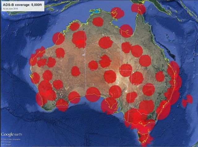
ATC data was used for the last part of the recorded flight according to a web based tracker, at an altitude of 1250 meters (4100',) however, ATC coverage may extend a lot lower than that? Somebody else might be able to provide that information. ADSB is great for providing many paramaters such as velocity, altitude, rate of climb�, and track all timestamped in high definition creating a 3 dimensional picture of what is going on. This data would be of assistance in the investigation.
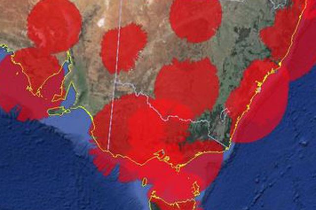
Would it be fair to suggest all check and training activities take place in a radar environment or airports that provide ADSB signal reception to ground level?
From Airservices Website