Yes
Offchocks,
I found some current information, courtesy of SkyVector. It includes links to a couple of good, recent images from short-finals on Rwys 03 and 09:
https://skyvector.com/airport/EGPT/Perth-Scone-Airport
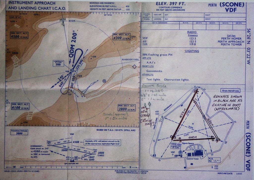
Here's the ICAO State Approach (VDF) and aerodrome chart, issued in 1965. The Tay Estuary is clearly shown as far as Dundee (Riverside Park) airfield and the Tay Bridge. The disused airfield on the way there is, of course, Errol, and those power lines are also shown.
On the Scone aerodrome chart, I've roughly superimposed the runways as configured today. Rwy 15/33 is still grass. Is that how they were in 1973? They are all significantly shorter than their grass predecessors. Judging from the Google satellite map, the perimeter road seems to have changed little since the 1960s.