Originally Posted by
Airbubba
FlightAware has a similar point in its data at 09:25:07 UTC showing an altitude of 6200 (apparently rounded to nearest 100 feet) that also plots very near the antenna farm on Mount Wilson.
EVA Air (BR) #15 ? 15-Dec-2016 ? KLAX - TPE / RCTP ? FlightAware
The EGWPS would have been screaming OBSTACLE, OBSTACLE PULL UP! and/or TERRAIN, TERRAIN PULL UP! with some hard to ignore visual cues on the PFD on the planes I've flown. I realize there are many modes, revisions and database options but I can't see how any EGWPS in a Triple would not see those hills rapidly rising.
I imagine that was happening. It seemed the voice of the EVA pilot got more serious as the mountains became closer, presuming the ATC youtube recording above has properly sync'd the flight path and the voice recording.
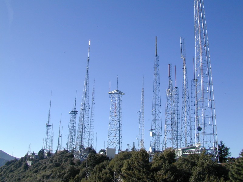
FWIW I found a pic of the Mt Wilson Antenna Farm as of 2001 and even then it was pretty impressive:
Originally Posted by
Uplinker
I have listened to the ATC tape several times and I think this entire incident was caused by EVA015. At about 1:16 they read back 'left heading 180'. Now somebody* got their left and right mixed up, but the 180 degrees direction is pretty clear, and yet they turned north. From then on, despite repeated instructions by ATC, EVA015 does virtually the opposite of what is asked, bringing it into conflict with Air Canada 788. This takes up valuable time while the controller tries to resolve that problem. The EVA015 radio pilot sounds more and more stressed and you can hear someone else in the cockpit shouting at him.
I don't think I'd go with "entire", but would say this thread seems to be fixated on radio terminology (which I can say is a pet peeve of this forum after reading it for more than a few years) and largely ignoring the fact that the crew was told to get to heading 180, and acknowledged that, and regardless of the issue regarding left turn vs right turn, flew heading 0.
Originally Posted by
End_of_Descent
I think so, too.
For a flight tracking project, I've learned how to position a camera point of view very precisely in the 3D virtual globe of Google Maps. Using the BR15 ADS-B data on FR24, I can put a camera (or cockpit) position in the Google virtual reality and simulate a cockpit view (yes, simulating! Neglecting bank angle, time of day and weather, of course).
One data point
before closest approach to Mt. Wilson would look like this:
https://www.google.de/maps/@34.21431.../data=!3m1!1e3,
using the position from the FR24 KML file, an interpolated track(turning!) of 67� (mean value between 59� and 75�) and an altitude AGL of 666 meters (FR 24 calibrated altitude 5625ft (1714m) minus Google Ground Elev of 1048 meters))
Thanks for this link and the others, they were really informative. The view out the cockpit reminded me of ones from my Pilatus B-4 glider, and not the ones I'd like to see when departing from LA on large commercial transport!