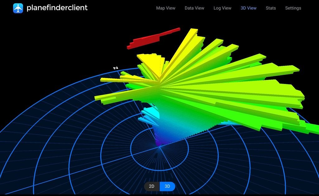
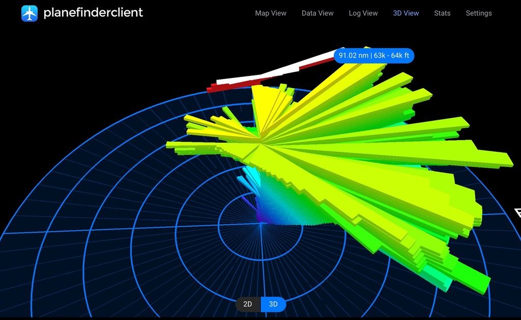
I picked up two positions within 13 nm NW of YWBL last Friday 6/5/16, roughly west east track. The step ascent in the graphic results in a minor deviation in track to the north. Each level represents 1000'. The second image highlights the level in white with altitude and distance from me. The first paint was at Portland. Great graphic.
I wonder what the risk assessment is for built up areas in the event of deflation?