We awoke in Castle Rock to find thick fog, but as we climbed eastwards out of the valley, we broke out of the fog into blue skies and sunshine. After a 50 mile drive, we reached the Visitor Center at Johnston Ridge, named after Daniel A. Johnston, a USGS geologist, who was camped here when the mountain exploded on 18 May 1980. His body was never found.
This photo shows the assymetric crater from the explosion and the new lava dome, steaming slightly. The mountain lost over 1200' in height. The energy of the initial blast was estimated at 24 megatons.
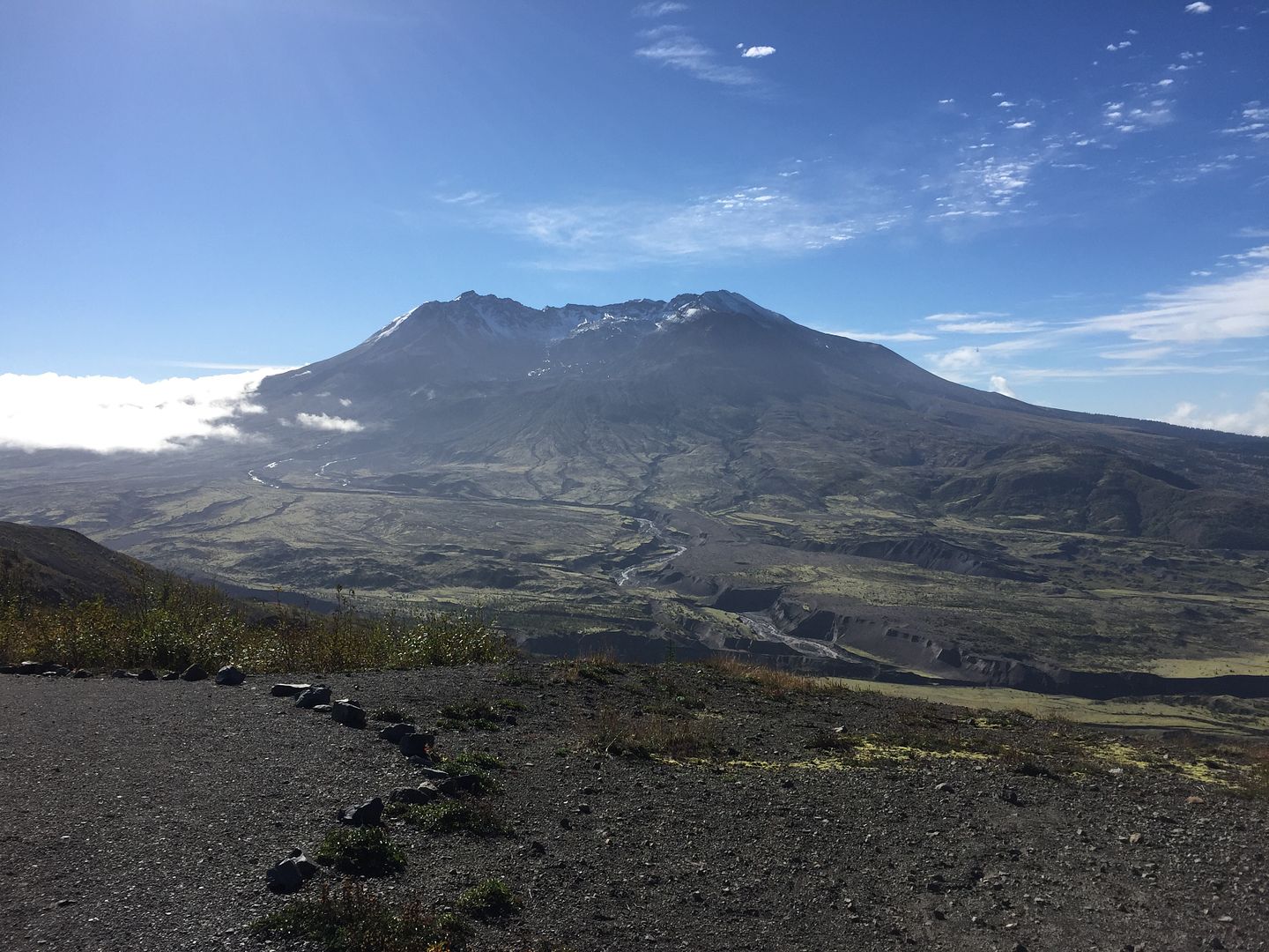
The frontal passage from the day before had left a colder airmass in the valley to the east (left) and a slight east wind was pushing the clouds over the ridge, where they subsided and evaporated in the warmer airmass in the Toutle River valley in front of us.
We then drove to Jon's home in Edmonds, just north of Seattle.
I've been using my SPOT Tracker again. You can see my route here, if interested:
http://tinyurl.com/p6ffdzl
It's currently on page 10. The earlier pages can be accessed at the bottom left of the page.