And I can't wait to get on the road again
On the road again
Goin' places that I've never been
Seein' things that I may never see again
Willie Nelson
So the plan was to leave Santa Monica on Friday morning, take a couple of photos and then drive north on I-5 to Redding, overnight there and then get up early on Saturday and drive to McMinnville to meet my friend, Jon, at the Evergreen Museum.
However, my jet lag intervened and I was awake at 2 am. After tossing and turning for a while, I decided I might as well make an early start. So after packing the car and visiting a 24 hour supermarket for some snacks, I was on the road by 3:30 am.
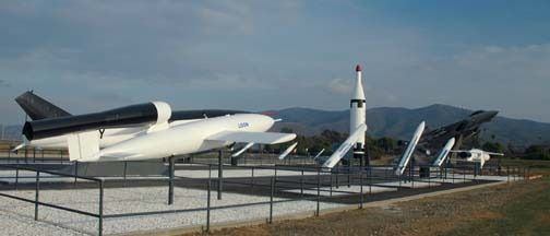
I had planned to go to the "missile park" at Pt. Mugu NAS and the San Andreas fault in the Carrizo Plain, west of Bakersfield, but since it was dark, there was no point. So here are a couple of images from the web:
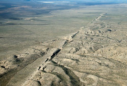
The aerial picture is probably better than any picture I could have taken on the ground. I've been there before and stood astride the fault, which is a bizarre feeling, since in a big earthquake, one side can move horizontally by several metres, relative to the other side!
The I-5 passes through the San Fernando Valley, before climbing to the Tejon pass and then descending into the Central Valley. This is a unique topographic feature, about 500 miles long and very flat and fertile. I've driven the southern half before and it is very boring - an essentially straight and flat four-lane divided highway, with fields on either side. What surprised me was the amount of traffic at this early hour - headlights and taillights as far as I could see.
I reached the San Francisco turn-off at about sunrise and started on what was for me, new countryside. Still agricultural, but with more variety and some towns and cities.
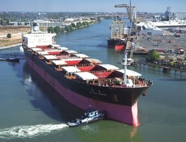
I was driving through Stockton, when I had to do a double-take. I saw two, large ocean-going freighters moored at a wharf in the river, 80 miles inland! It turns out that there is a dredged-channel through the San Joaquin delta, to allow access to this significant inland port:
Later I drove through Sacramento, the state capital and saw my first aircraft of the day - a CRJ departing the airport.
After 545 miles,I reached Redding, my erstwhile overnight stop, at 11:30am. So I had a late breakfast and decided to carry on to McMinnville. Just north of Redding, the road climbs into the hills and passes Mt. Shasta, the southernmost Cascade volcano (14,179'):
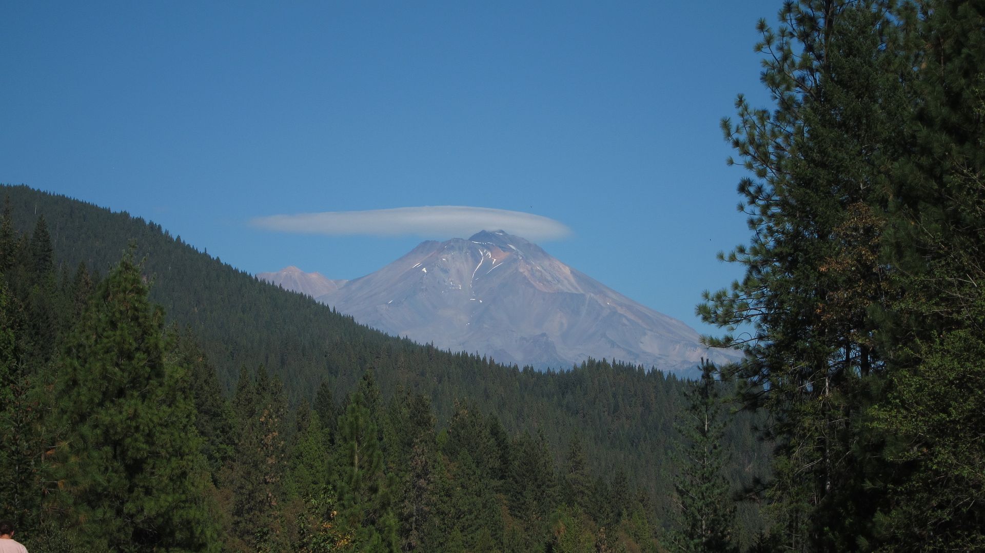
A cap cloud developed while I watched, indicative of a strong westerly flow aloft. This presaged the cold front that came through McMinnville the next day.
North of Mt. Shasta is the oddly named town of Weed, where I saw a Twin Otter and a retired Tracker water-bomber and then drove into Oregon, where there was some lovely rugged scenery, reminiscent of Scotland. I passed a sign for Umpqua Community College, which made me reflect on the recent shooting tragedy.
I eventually reached Salem, where I turned off I-5 and headed towards McMinnville. Unfortunately, by this time it was dark, Google Maps was not working and the roads were badly sign-posted. I got lost and ended up driving for an extra 20 miles or so. As a consequence of this, I came very close to clocking up 1000 miles - about 980 miles. This was an all-time one-day record for me and one that I don't intend to break in the future.
PS I was surprised at how relatively fresh I felt after that marathon effort. After making allowances for my stops, I calculated an average speed of about 70 mph!
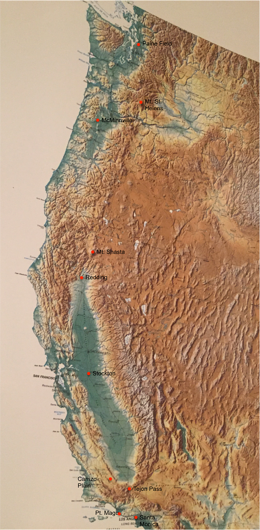
A couple of days later, I saw this very impressive hill-shaded topo map which shows the unique nature of the Central Valley: