DunePrune:
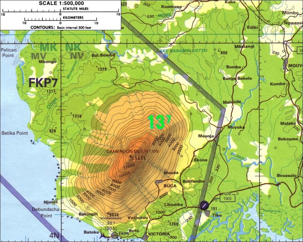
The Malabo departure feeds straight into the Douala arrival. Mt Cameroon is just outside the MSA circle of both airports, and is only obliquely referred to on the Douala chart. AF pilots fly world wide, and it is quite possible that neither pilot on the flight in question had any local knowledge.
Throw in some enormous thunderstorms with ATC that is among the world's worst and a small mistake suddenly becomes major. I feel for those pilots.
I too feel for the pilots. Perhaps a lesson to be learned by all flight operations management there are locales such as this one that need a special qualifications package and some tailored area charts with topography clearly shown.
The technology in most airliners is, in some respects, quite obsolete compared with the newer equipage sophisticated, newer business jets have. Such as topographical moving map on the MFD and synthetic vision (SV) on the PFD that is "talking" to the EGPSW.
But, the airlines will so equip only through attrition so tailored local area Jeppesen area charts would be in order.
Here is a snippet of what is apparently an aeronautical chart I found on the Internet: