Good morning all ...
OK ... This could be interesting and a bit of fun ... I hope you don't mind Brian

A new game
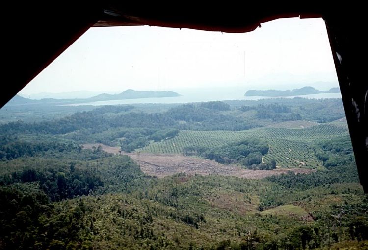
"Where's Albert" ... a sort of a cross between "Spot The Ball" and "Where's Wally" type competition.
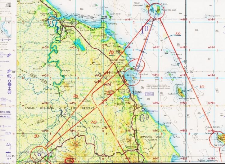
Now that we have Brian's map (dated 68/69) and AA62's pic (as yet undated). Remembering both guys were on different missions ... Brian is claiming that AA62's pic is showing the Island of P Stindan. But I'd like to suggest that perhaps the Island in AA62's pic is a little further north up the coast near Kpg T Sari (where there is another headland promontory and an island in a bay) and the other Island in the distant mist possibly being Paluau Sri Buat.
My reasoning ... the topography of the Island in AA62's pic appears more sympathetic albeit a direct track to the DZ from there would have taken Albert closer to high ground (770' BT Tanafi Abang).
Just a bit of fun ... what do others think

Best ...
Coff.