The information below was extracted from "Understanding Satellite Pings" to be found at:
TMF Associates MSS blog � Understanding ?satellite pings??
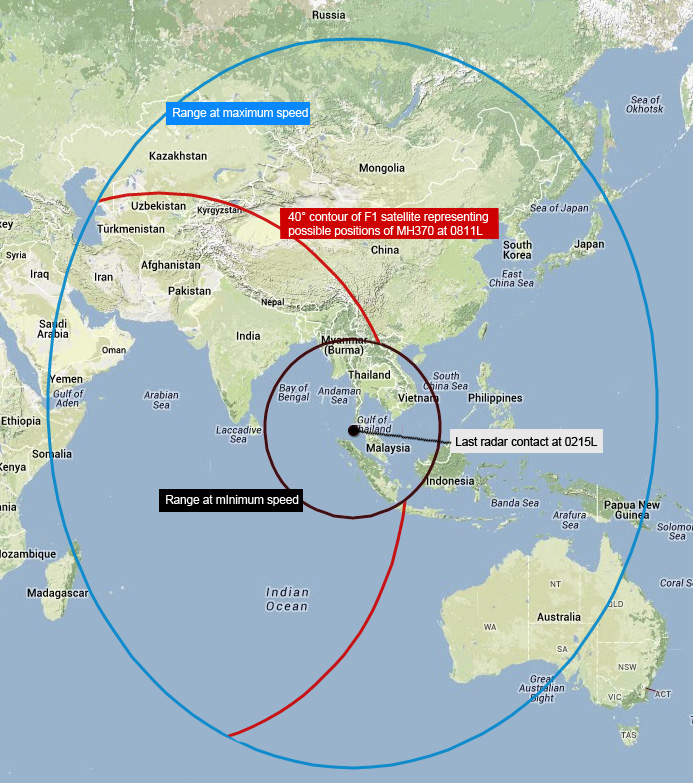
Can anyone confirm that this chart was indeed released today by the Malaysian Government ?? Or is it somebody's interpretation ?? The reference to "range at minimum speed" is perplexing.
"UPDATE (Mar 17): This picture was released by the Malaysian government today. It shows clearly that the ends of the arcs were determined based on the minimum and maximum speed of the aircraft, and were not based on the overlap of the Inmarsat satellite coverage areas."
http://tmfassociates.com/blog/wp-con...H370_Mar17.jpg