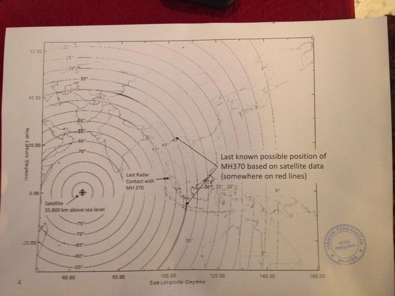
Last location reported to be somewhere on the red lines...(the 40 degree lines)
This looks more logical, but the lines appear to be angulation related stopping at 0...
The angle appears to be the angle from the ground to the satellite, so 0 the satellite would be at the horizon.
So these 40 degree arcs is what the PM was referring to? & of course they are not a track, it is just that the last received signal was on these arcs somewhere.
Would the 40 degrees be determined by received signal strength as suggested?