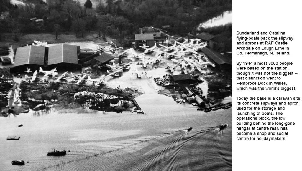
WE NOW know that the crew of Catalina Z-Zulu of 209 Sqn from Castle Archdale were guided by Enigma intelligence when they spotted the Bismarck, leading to its disablement by Swordfish torpedo-bombers of the Fleet Air Arm and its destruction by gunfire. Sadly there was no guidance on the dark December night when she flew into the mountains above Castlegregory in Co. Kerry, some 200 miles south of Lough Erne. The explosion of her depth charges was heard 20 miles away in Tralee, and a huge fireball lit the countryside for 30 seconds.
Training accidents were all too frequent, and the weather was often a factor. The magnetic compass swings wildly when disturbed by turning or turbulence, so it is linked to the direction indicator or DI -- an instrument stabilised by a spinning gyroscope, so its readings are constant. Early gyros had to be caged or locked to avoid damage as the flying-boats bounced over the waves on takeoff and landing, and released just before they became airborne.
The crew of a Catalina from the Canadian OTU at Killadeas, a few miles from Castle Archdale, omitted to uncage their DI and entered cloud at a few hundred feet. Under the torque from the engines the Catalina gently turned left, the trainee pilot failed to notice the turn on his instrument cross-check, and the aircraft disintegrated along the top of a ridge bordering Lough Erne. Alloy fragments can be found there to this day.
Later in the war the BABS system was installed at Castle Archdale, a vital aid to letdowns in Fermanagh’s winter weather of low cloud and misty hills. It did not help the crew of one returning Catalina which overflew the base and was never heard of again. The Cat and her crew rest somewhere beneath the waters of Lough Erne, their memorial a stone on the shore near Gay Island.
Sunderland ML743, which began this story, had taken off from Castle Archdale 30 minutes before crashing into the cloud-shrouded Donegal hills about 20 miles north of track, where her Pegasus engines lie to this day. Did her crew make a basic mistake in setting course? Was the wind far stronger than forecast? We’ll never know. As to the beacon at Ballyshannon, Desmond said it was low powered and besides the Cat nav gear was not very reliable.
“The old radio compass might work for weeks, then one day the cockpit acquired a whiff of burnt fish and we knew the set had gone U/s again. We always kept a detailed log and plot, using the beacons for confirmation rather than basic nav. And you’ll do the same if you know what’s good for you ...”