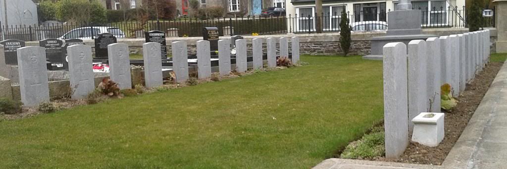
When the first fatalities occurred near Castle Archdale the congregation at Irvinestown Church, four miles away, gave the front quarter of their cemetery to be a plot for fallen Servicemen. In less than two years the plot was filled with aircrew graves, so a similarly sized plot was established at the rear. By war's end this, too, was filled with casualties from the Battle of the Atlantic. Most of these are Commonwealth airmen, UK citizens being taken home to their families.
THERE IS good reason for Ireland being green, and that�s the rainfall. It streams from our grey Atlantic skies, and the clouds shroud the granite Donegal mountains for days on end. This is why the weather took terrible toll of Coastal Command aircrew trying to find their bases after many hours patrolling the Western Approaches. The headstones above bear sad witness.
Nowadays the pocket GPS gives the walker�s position to within a few yards. But 70 years ago radio navigation was of limited use, the radio beacons were low powered with very limited range, and bearings could easily be 20 degrees out, especially at night. Radio waves can be bent as they pass along a coastline, so a bearing may be off by 10 degrees or even more.
The Germans� long-range Kuriers used an excellent system called Sonne, with one transmitter in Norway, one at Bordeaux and another in Spain. The Kurier could place himself in the triangle formed by these widely spaced beams, obtaining an accurate position to pass to the U-boat packs. The Allies adopted the system after the capture of U-505 in 1944; renamed Consol, it became invaluable for Coastal Command. After the war one of the transmitters was moved to Bushmills in Northern Ireland, where it became Bushmills Consol and was used by transatlantic flights until the 1980s.
In the early years, Allied crews had to rely on dead reckoning, in which the aircraft position is plotted by airspeed, course, and time, backed up by ground features, sun and star sights. But none of these is possible when you�re far out to sea with 20,000ft of cloud above you. During your 10-hour patrol the wind has drifted you in various directions, you may be many miles from your expected landfall, and behind the mist-shrouded coastline the mountains are waiting.