
Harry Dubinsky flew with the Canadian Navy until 1958 after which he joined Kenting Helicopters flying S-55's.
When Kenting was contracted by the US Air Force to help with the DEW (Distant Early Warning) line construction on Baffin Island, he flew in support of the construction of their radar sites.
Kenting went on to be contracted by the Canadian Army Topographic Survey to assist in mapping of the Canadian Western Arctic Islands. Dubinsky was appointed detachment commander flying S-55's. This was the first ever accurate mapping of these Arctic Islands using telerometers. They mapped Banks and Victoria Islands.
From late 1960 Dubinsky flew S-55's out of Greenland in construction support for the DEW line. Later in life, he became District Manager of the Canadian Coastguard vessels in Hayriver, North West Territories.
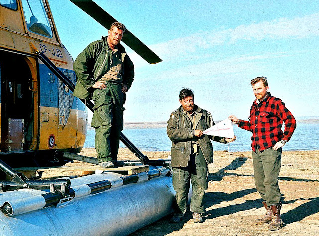 Harry Dubinsky (right) with members of the Canadian Army Topographic Survey Corps in 1962
 Harry Dubinsky with Kenting's S-55 CF-JJD in 1962
With thanks to Harry's daughter, Gale, for these images.