PPRuNe Forums - View Single Post - 737 reported down in Canada
View Single Post
Old 23rd Aug 2011, 16:57
  #81 (permalink)  
Zeffy
 
Join Date: Feb 2006
Location: USA
Posts: 487
Likes: 0
Received 0 Likes on 0 Posts
The Google map within opale4's link can be zoomed to quite a remarkable resolution -- revealing a slight offset from the icon for the VOR DME and the actual navaid.

Published elevation is 67 meters/221 feet.

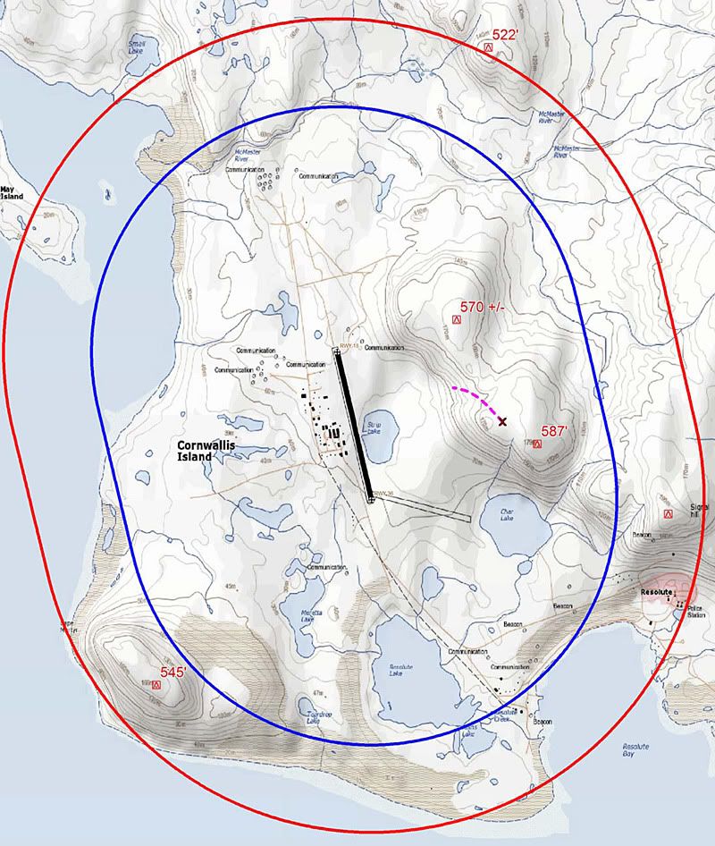
Aterpster's terrain map has a 70-meter contour line East of "Strip Lake".


Last edited by Zeffy; 23rd Aug 2011 at 17:02. Reason: aterpster's map added
Zeffy is offline