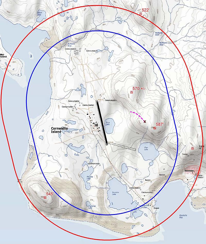
Based on info on AvHearld it appears to be a circle to land from the ILS 35 to land Runway 17.
These are the topo data with CAT C and D TERPs CTL protected airspace.
The "X" marks the approximate impact point followed by the dashed line representing the break-up path.
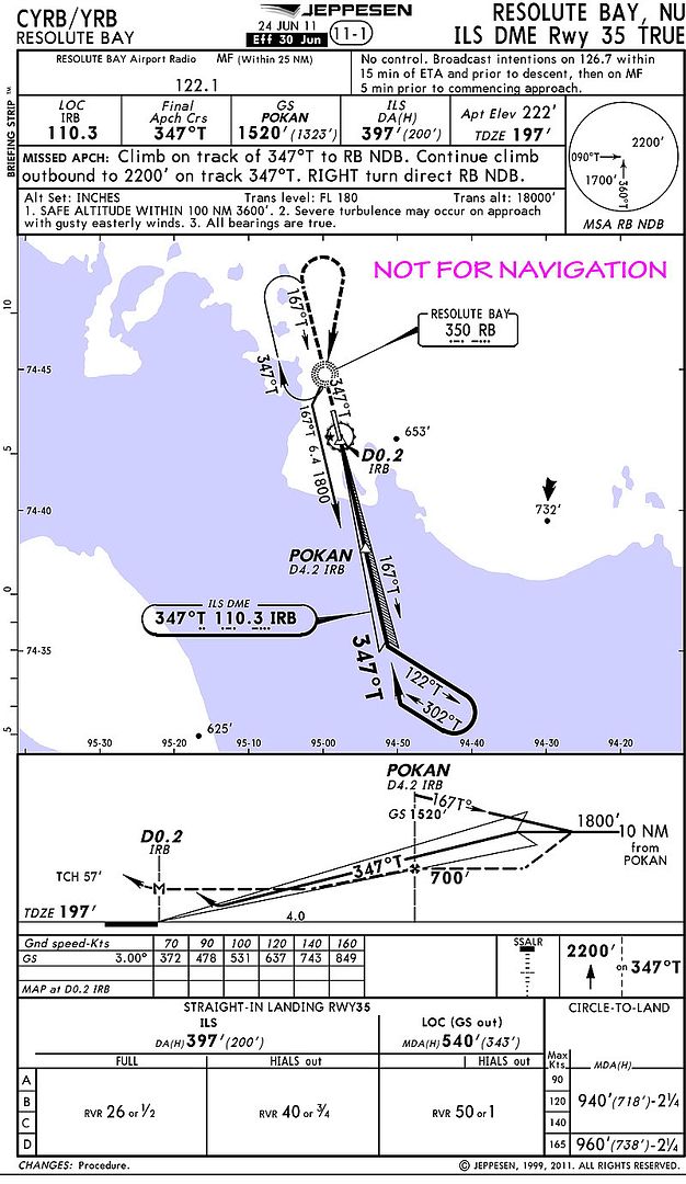
(following that graphic is the Jepp chart for the ILS 35.)