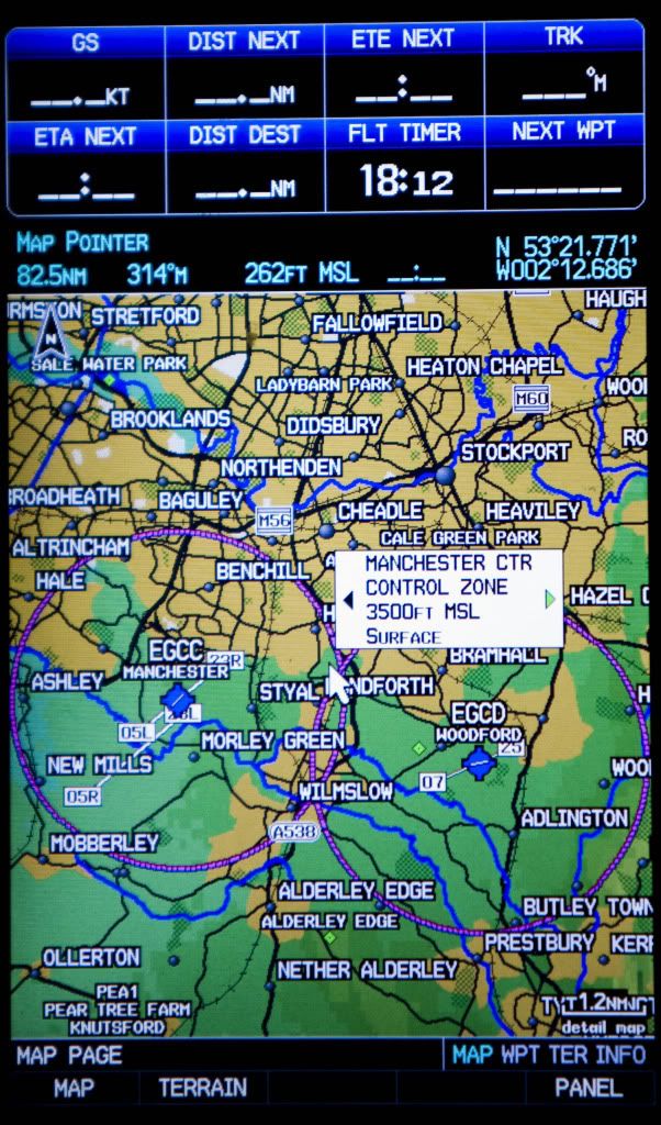
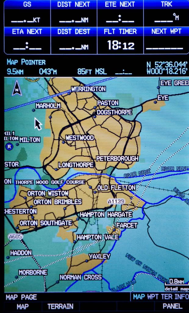
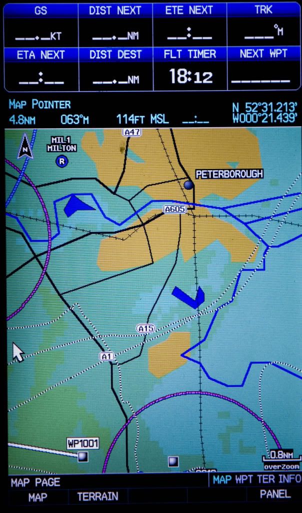
Screenshot images show Peterborough at 0.8 with and without the card in, plus EGCC at same range with card in. Notice how with the card, the breadcrumb trail in the SW corner from when I left the unit on in the car matches the path of the A1 and A605 exactly, whereas the track on the version with the basic data is a long way out and the 605 is just not in the right place at all. The 20-year-old bypass isn't on it! The rivers and railways are much smoother and better resolved. Standing at on the apron at Conington the unit as originally purchased would show me as being to the East of the railway, whereas all of the airfield is to the West - the error being in the position of the railway; GPS coords are spot on. The basic mapping just isn't very good (awaits flames).
Dick