TCraft41, Welcome to PPRuNe.
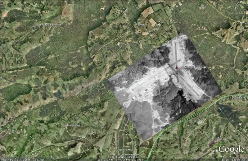
As StbdD said, it's Stoney Cross - a disused wartime airfield, which is used as a Visual Reporting Point for VFR traffic skulking round the edge of the "busy" Bournemouth zone.
IF you are interested in UK airfields, download this Google Earth 'kmz' file:
http://www.rickdavis.co.uk/home/UKAirfields.kmz
Here's the whole of the UK:

Another interesting 'kmz' file that I found recently is
http://is.gd/hAMrD
which contains old aerial photos of airfields.
Here's the one for Stoney Cross (with Ab's Grand Slam crater in the top left corner):