Hi,
Could someone confirm the interpretation I did of this exercise:
(see annexes 071-2084A below)
The inertial navigation system (INS) indicates:
Position: 71� 55.1'N 094�55.3'W
Drift: 6�L (left)
The route followed in order to return to the VOR station is the meridian of the VOR station used:
RESOLUTE BAY (74�43.6'N 094�55.3W), this VOR has North set on the local geographic meridian.
The gyro compass has just been reset to Grid North (chart used: polar stereographic chart, grid parallel to zero meridian, Grid North in the direction of geographic North Pole).
The correct representation of the RMI VOR/DME is at this moment:
(the distance DME is in the box)
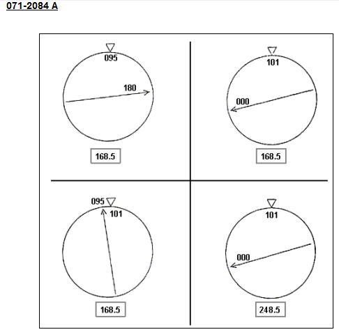
---> my interpretation is that I am flying on a True North Track with wind coming from the right. I apply a drift correction angle to the right of 6�. So the arrow of my VOR RMI is pointing towards the VOR station with an angle of 6� to the left of the nose of my aircraft. My True heading is 006� and my Grid heading is 90,27 + 6 = 96,27�
Is that right ? Do you agree ?
The Answer given by "Fly Around" is picture 2 (well,... the pictures don't have numbers) (
http://www.cours-de-math.eu/Drift-left.jpg)
Thank you very much for your help and explanation.
Emmanuel Cordier.