During a search related to the What Aerodrome thread, I was looking at Leeming on Google Earth.
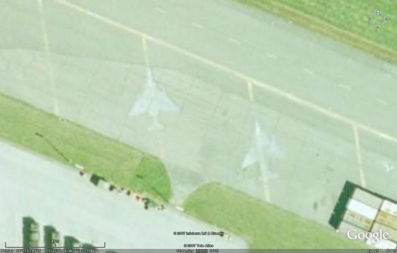
Apart from the poorly parked Hawk

, I noticed a couple of ghostly white swept-wing aircraft images just to the east. Specifically, 54�17'52.99"N, 1�31'31.59"W and 54�17'52.52"N, 1�31'30.07"W.
Can someone tell me what they are?