Originally Posted by
DaveReidUK
As already discussed, the data doesn't support that conclusion. The aircraft was around 175-200 feet AAL by that point.
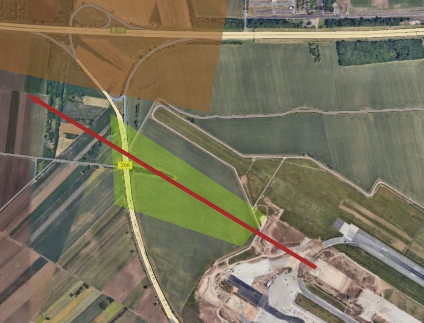
Here is the visual explanation I did. I am driving here almost every day. Green shade is the "hole" or "downslope" that starts after the runway end and goes all the way down to the access road, then the terrain starts to go up. Brown shade is highway - it is well above access road, some 10 meters. Red arrow is takeoff path. Yesterday I was able to watch normal takeoff so from that perspective it would be disaster if the road is not in ravine.