Originally Posted by
Shagpile
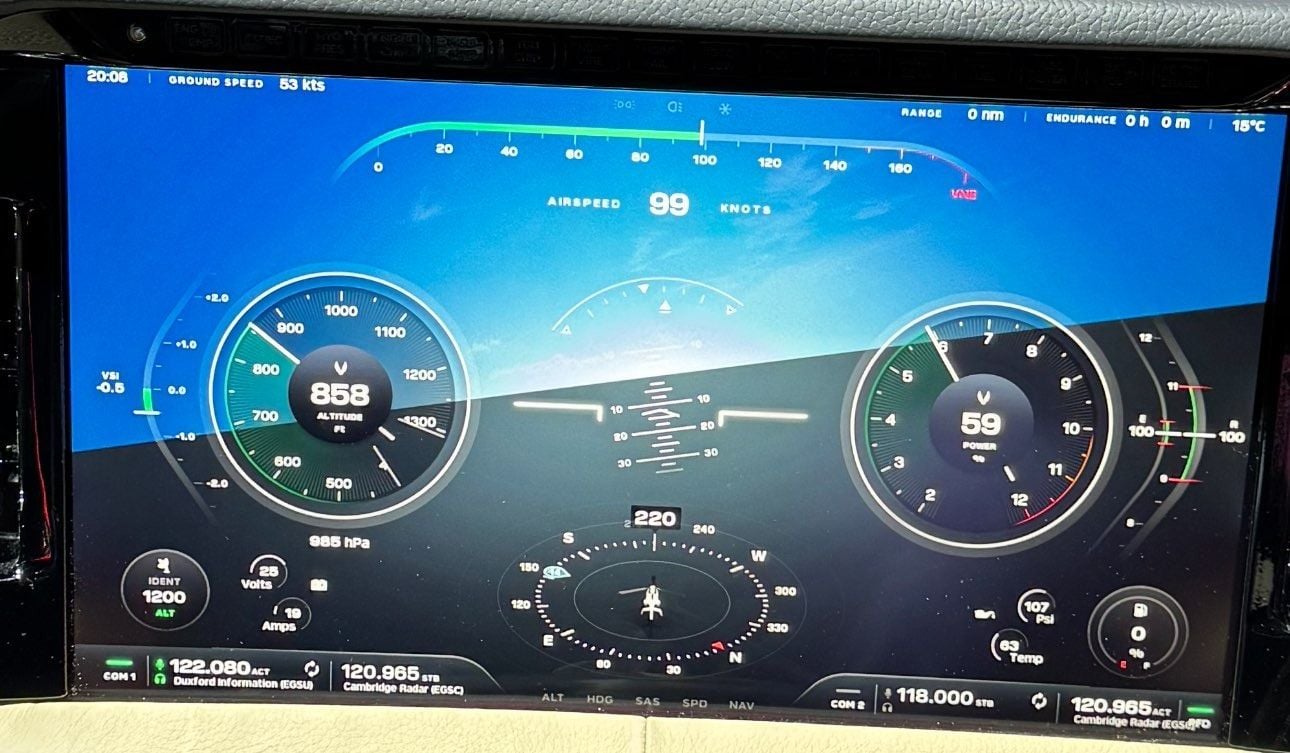
Keeping in mind this is a work in progress (e.g. see the text overrun bug bottom right, no terrain yet, ...), I think it's going quite well. Improvements I'd make are:
- Altitude readout: round to nearest 10 ft
- GPS Track pointer on HSI
- Fonts for units smaller. Capitalise NM (nm is nanometers).
- Regionalised formatting of thousands separators, e.g. 1,200 ft
- Add Wind indicator (significantly lowers workload & improves safety)
I particularly like the colour coded power and "time available" countdown. e.g. your two lots of 30 second 500hp max power every hour will be accurately presented, and 440hp takeoff power (5mins).
It's a VFR machine but I think it would be quite easy to fly in IMC, should the need arise. And I think all VFR aircraft should have some kind of "get out of trouble" instrumentation; there have been far too many IMC into terrain lately.
I’m sure you’d get used to it, but something doesn’t sit right with me about that layout. I think it’s the power gauge on the right next to the AI, to me that should be IAS. Having an IAS strip along the top when the altimeter is a circular gauge also seems a little incongruous. Perhaps I’m thinking about it from an IFR view point and the ability to maintain a scan, when that’s not really what it’s aiming at, and it actually works for a VFR only machine.
And yes, separate out the engine/tech stuff into its own area on the screen, bit of a dog’s dinner at the moment.