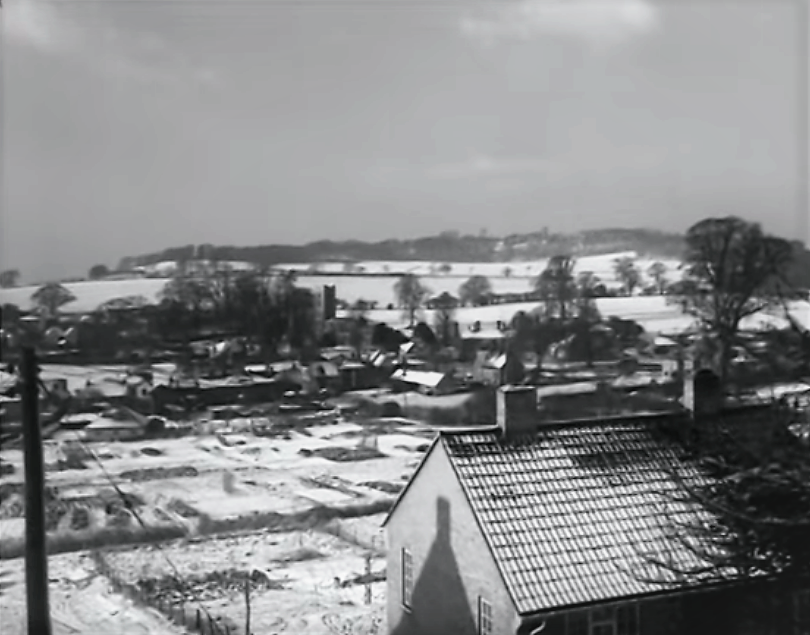
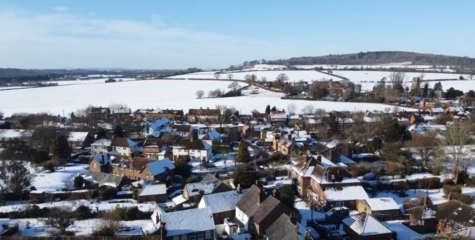
Aldbury Village. Image thought to have been taken on January 7th 1954
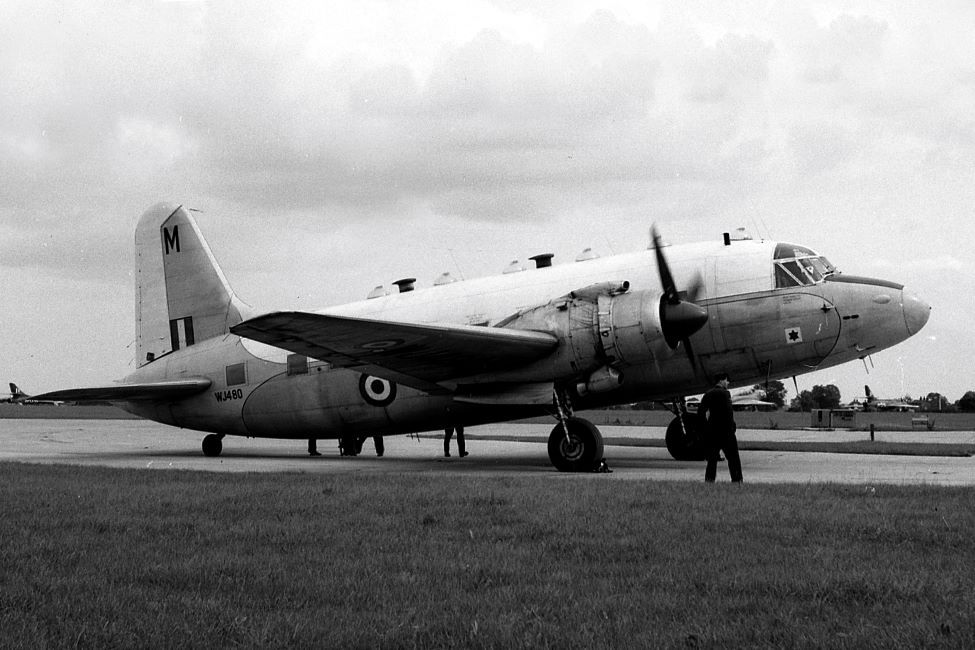
Vickers Valetta T3 of No 2 Air Navigation School Thorney Island pictured circa 1960
Valetta T3 of No 2 Air Navigation School Thorney Island (1958) Configured for 12 Students. Photo: Imperial War Museum.
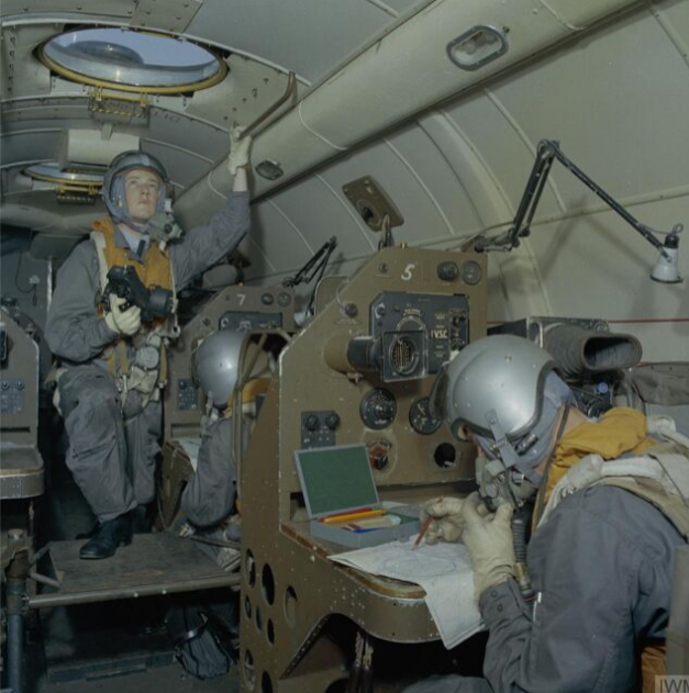
Of the victims of this accident all except the pilot Flt Sgt Ralph Marshall and Flt Lt P. Clare who hitched a lift from Bovingdon had played in the Rugby match at Halton. Fate works in mysterious ways. In 2017 Retired Wing Commander Patrick Cliff OBE related to Paul Aylott how as the junior officer he was displaced by the extra passenger and so seated himself on the main spar. He attributes his survival to this stroke of good fortune.
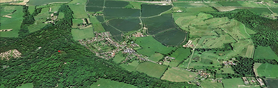
Looking south-south-west towards Aldbury Church (at 466 ft) in the middle distance with Tom's Hill highlighted. In the distance and out of sight left is Cow Roast and the start of the Bulbourne Valley.
Photo: National Trust
Aldbury looking north-west from the bottom of Tom's Hill. Tring in the distance to the left. Beyond, the Escarpment sloping down towards the Vale and Aylesbury. It would appear that the Valetta was heading for Aylesbury before turning south to route direct to Thorney Island. The High ground to the right is Aldbury Nowers (728 ft) Photo: Paul Foreman.
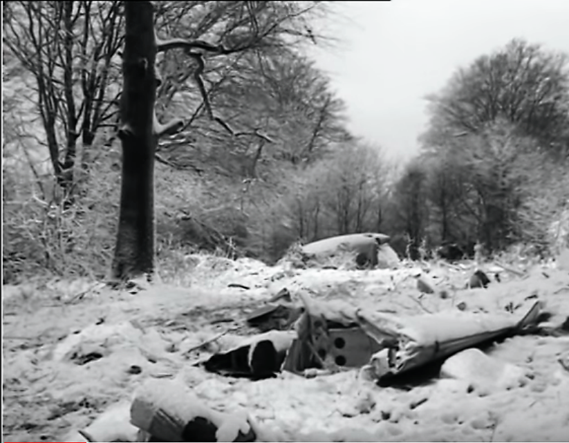
Crash Site

It is all well and good to try and paint a picture from old press reports and Hansard. The aircraft was last seen to make a gentle turn to port at about 400 feet. One assumes that this observation was made on departure by ATC at Bovingdon but we don't know for sure. If it was, that would place the Valetta at a height of approximately 950 ft amsl.
It was suggested that the Pilot then lost height in order to see the ground. I find this rather unlikely considering that the Pilot would have been Instrument Rated and that it was dark (Sunset at 1600 hrs that day) and on departure, snowing lightly. However in the unlikely event that he had decided to follow the LMS Railway Line from Berkhamsted this is roughly the direction in which he would have flown. Incidentally the Grand Union Canal runs almost in parallel with the railway and would show up better in contrast with snow on the ground. In conclusion if the pilot was attempting to follow the railway line/canal it would be reasonable to think that he would keep these features to his port side, concentrating his vision thus. But note the presence of high ground on his starboard side, typically Norcot Hill (yellow dot) 620 ft. The distance from the railway at Cow Roast (at 413 ft) to the point of impact at 680 ft (red dot) is 1.15 statute miles. Note how the railway starts to curve north-north-west for a short distance at this point. Sadly it seems the flight lasted approx 5 minutes. There is a very good image of the railway and canal posted by Warmtoast on the first page of this thread (and that's going back a bit !). Just click on 'First' at the bottom right of screen. In retrospect I think this is all rather fanciful. Perhaps the aircraft was continuing a wide gentle turn towards Aylesbury in the west when it encountered a heavy snow flurry, with the Pilot experiencing whiteout and perhaps, because of this, loosing what little height he already had thus hitting the trees?
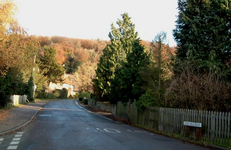
The road to Tom's Hill is narrow in places. Photo: Rob Farrow geograph
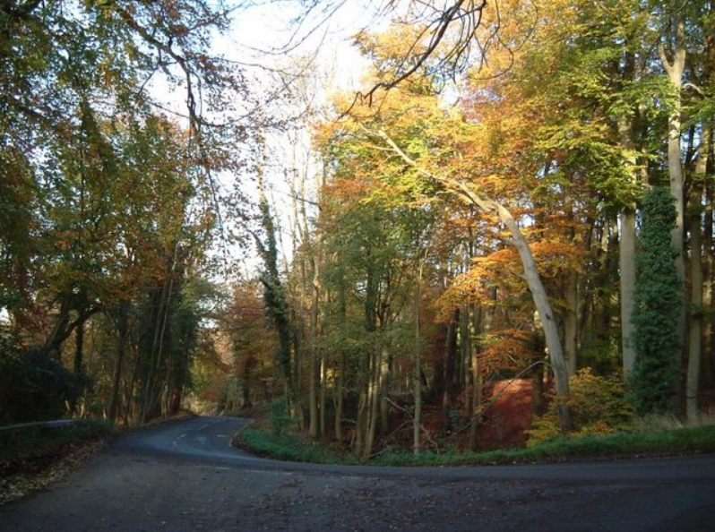
Quite steep too - I believe they have cycle time trials here these days. Photo: Rob Farrow geograph
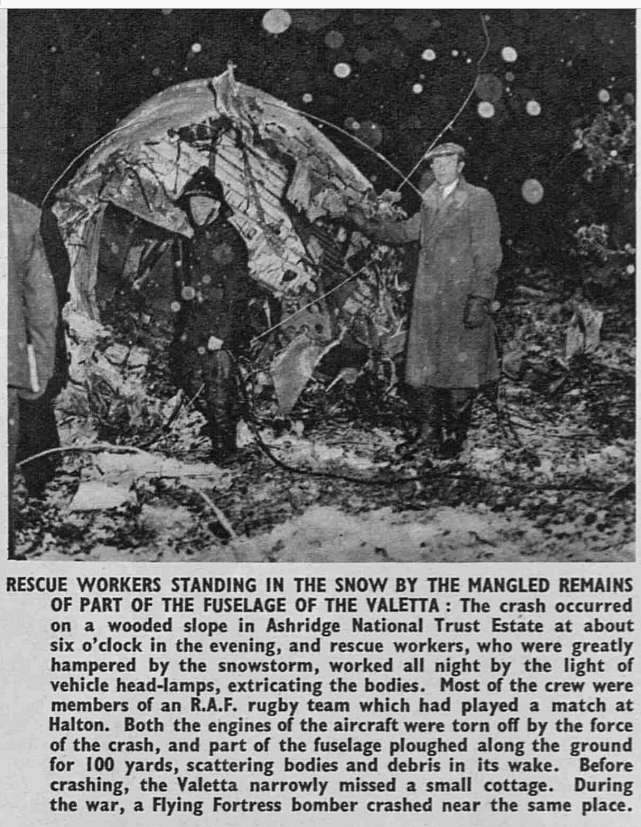
The Sphere January 16th 1954 (BNA)
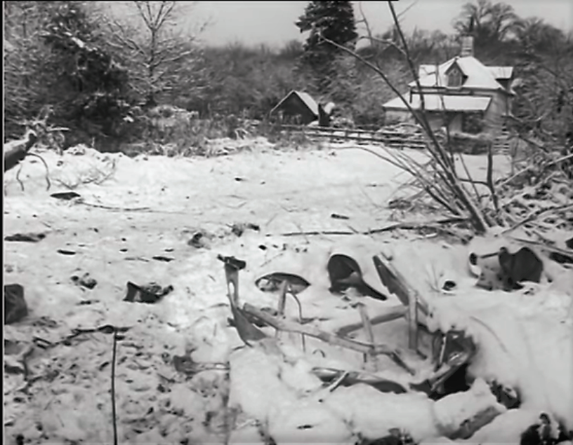
Old Copse Lodge - Looking to the north-east. Home of the Gamekeeper. The crash site was a couple of hundred yards away to the south-east.
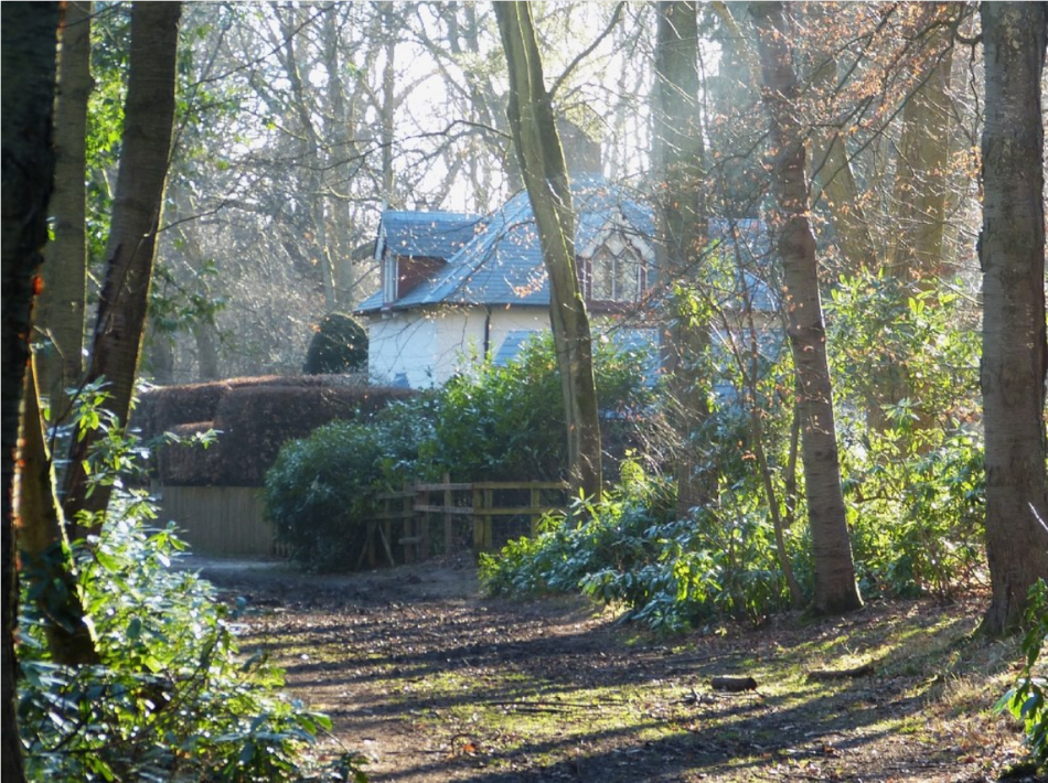
Old Copse Lodge looking to the south-west. The home of generations of Gamekeepers. Constructed in the early 19th century as a Lodge on the west side of Ashridge Park serving the road that ran from Ashridge House to Aldbury and Tring. Photo: Rob Farrow geograph
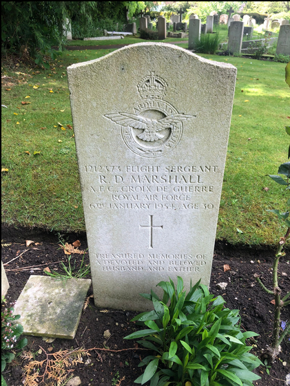
Several members of the Rugby Team, together with their pilot, are resting in the Churchyard of St Michael, Halton.
Kevin Slade
Further reading:
https://www.hertsmemories.org.uk/con...letta-accident