Originally Posted by
Si Guy
Thanks jimjim1. I am curious how the NTSB got ADSB-out data for the C152,.... Also, your link for the ADSB out data just takes us to a site giving current conditions. Are you expecting us to use that site to go back and replay from the accident date, or were you expecting your link to already take us back to that date?
.
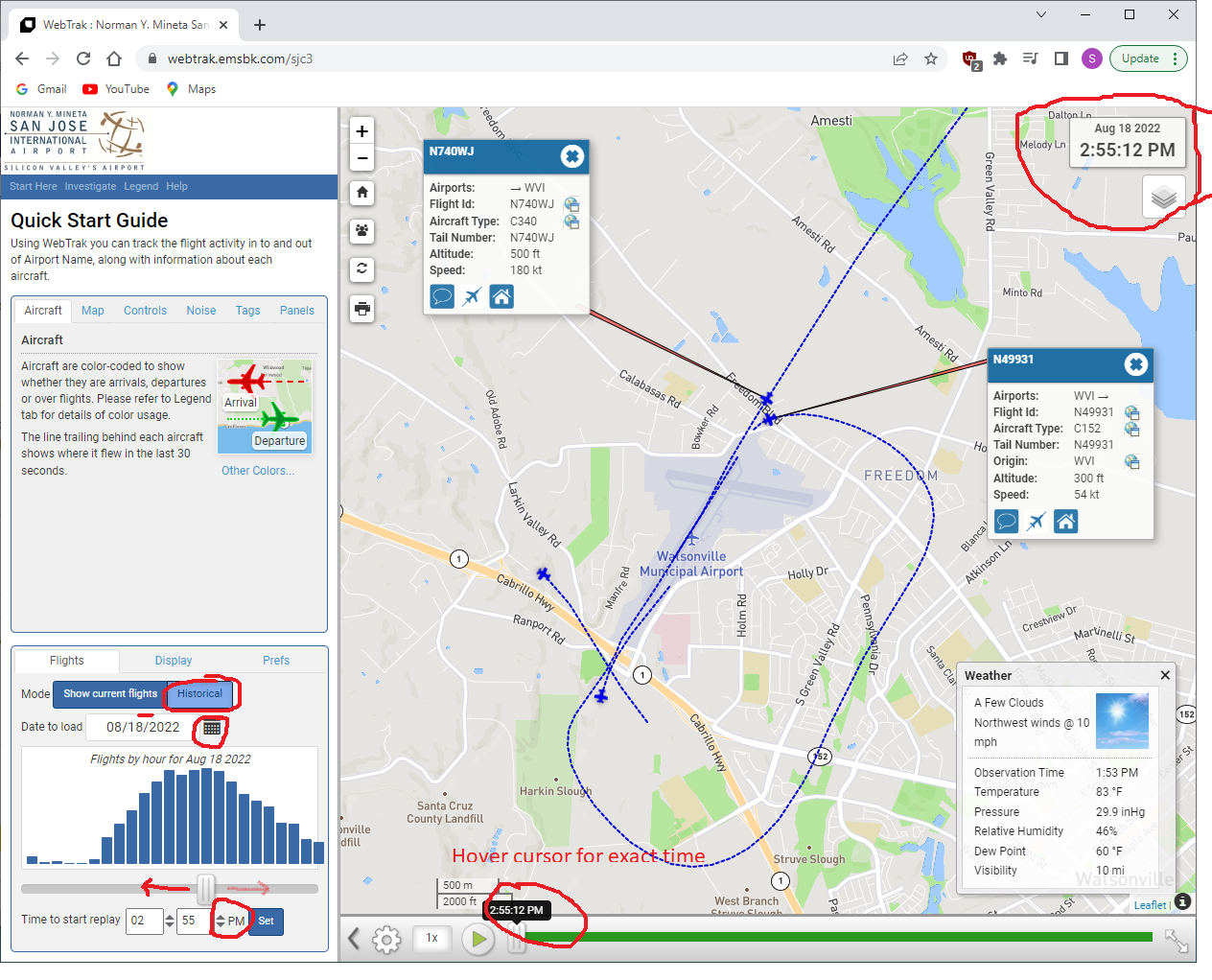
I can find no way to do a link that incorporates a start time. Choose "Historical" and put in the LOCAL time of the incident.
This accident's collision is at 2:55:10 PM local time 18 August.
NE side of Watsonville Airport.
I have no idea where they get the data. I notice that Dave mentions Radar, however other discussion groups mention a different adsb radio frequency than used by "airline" grade (let me call it:-) adsb. There is certainly accurate looking height data. I think you can get that from a radar transponder.
Someone said:- "
The C152 was pinging on 978mhz. A number of the services we commonly use like FlightAware can't see 978 signals unless the plane is closer to 1800' in the Watsonville area"