I can’t help but think the primary (out of many) causes of this horrendous incident is that it was not clear to anyone what the ‘Route APBSS (Blacksod South) actually was! I assume when the route was first produced pre 1999 it was meant as a visual low-level route (not a low-level IMC route!) for an S61 or similar, equipped with something like Decca based RNAV 1 or RNAV 2 which (as the report mentions) required an overfly of the start point (BKLMO) to confirm the navigation accuracy. I assume this would have started with an offshore let-down to a suitable height to gain visual references.
Back then, this was probably a sensible solution as there were no other real options for an instrument approach. What I can’t understand, and what to me is unforgivable, is that 18 years later, the Authorities have still not insisted that the ONLY acceptable method for general aviation helicopters (including SAR helicopters flying to/from regular use sites) to descend below MSA from IMC is via a properly designed and published instrument/PinS procedure.
From what I can see (I do not have access to the terrain or obstacle data for Ireland), you could easily have PinS approaches and departures both to/from the North East and West South/West which would have been more efficient and safer!
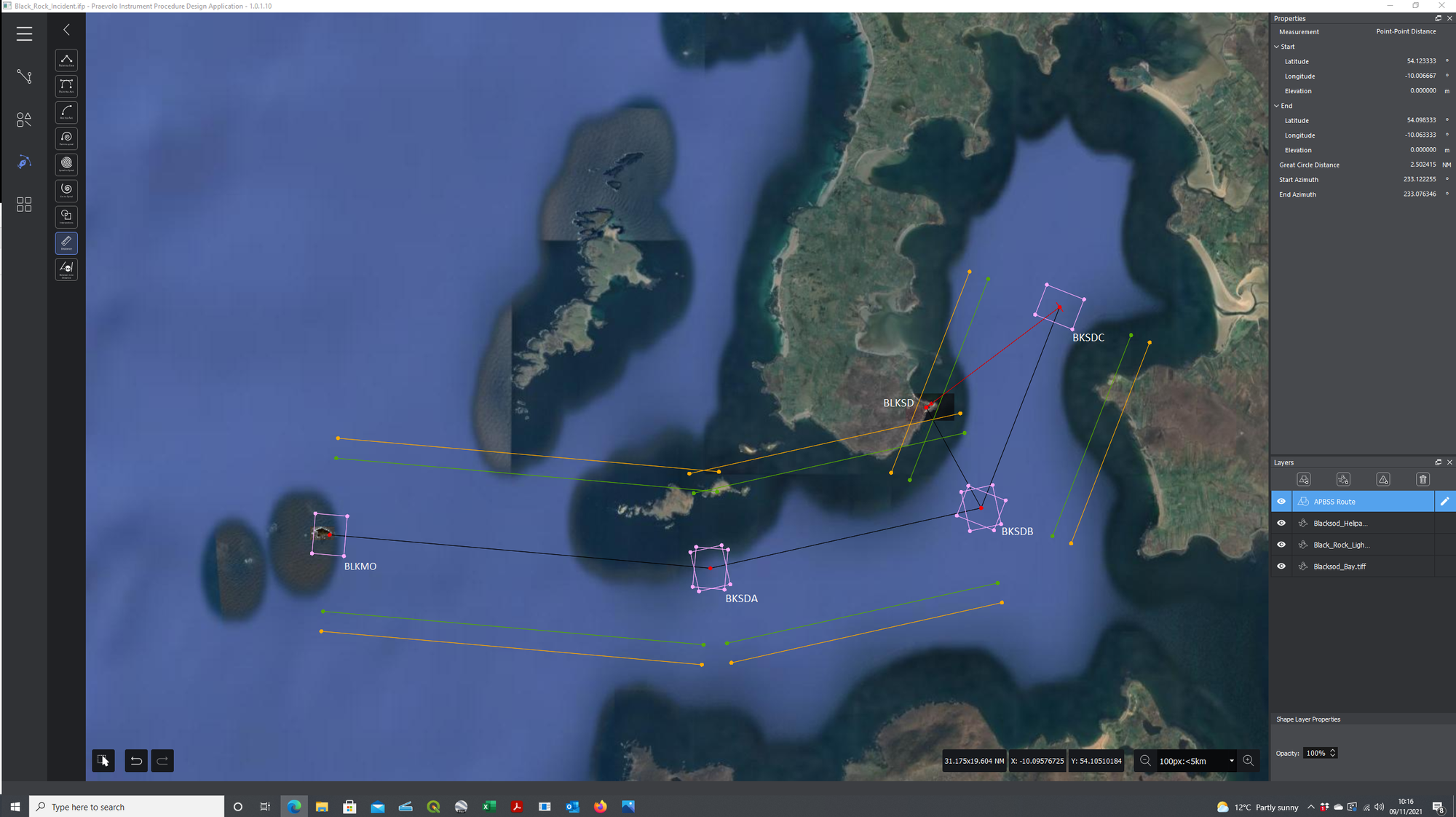
Out of interest, I drew the route on a Google Earth image (attached) with the RNP 0.3 (CAT H) waypoint fix tolerance areas (for anyone not into PBN, 0.3NM either side of track [that’s your RNP 0.3 so 95% of the time the GNSS says you are over the waypoint you should be in the pink rectangle] and 0.24NM before and after the waypoint). Also shown are the area semi-width areas in amber for a helicopter flying a route 1.45NM each side of track and in green for an aircraft on a STAR, SID, Initial Segment, Intermediate Segment or Missed Approach 1.15NM.
If drawn as a procedure, the route looks pretty flyable at MSA until BKSDB where the combination of establishing back on track after the turn and then turn anticipation for a rather interesting 148 degree turn at BKSDC is probably not doable in a distance of only 3.2NM.
Cheers
TeeS